
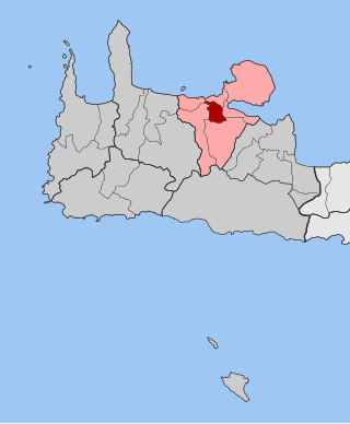
Apokoronas is a municipality and a former province (επαρχία) in the Chania regional unit, north-west Crete, Greece. It is situated on the north coast of Crete, to the east of Chania itself. The seat of the municipality is the village Vryses. The municipality has an area of 315.478 km2 (121.807 sq mi). It has a total of 75 villages.
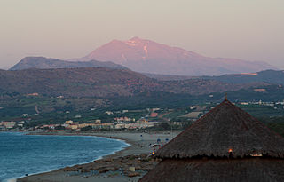
Georgioupoli is a resort village and former municipality in the Chania regional unit, Crete, Greece. Since the 2011 local government reform it is part of the municipality Apokoronas, of which it is a municipal unit. The municipal unit has an area of 53.498 km2 (20.656 sq mi). It is located 39 kilometres east of Chania, about 23 km (14 mi) west of Rethymno and about 100 km (62 mi) west of Heraklio. It was named after Prince George of Greece, high commissioner of the island in the last years of Ottoman occupation.

Platanias is a village and municipality on the Greek island of Crete. It is located about 10 km (6.2 mi) west from the city of Chania and east of Kissamos, on Chania Bay. The seat of the municipality is the village Gerani. Platanias is a popular tourism village with beaches, several hotels, restaurants, bars, nightclubs and souvenir shops. The area is especially popular with Scandinavian tourists with the season running from April to October. Not far from the coast is the island of Agioi Theodoroi.
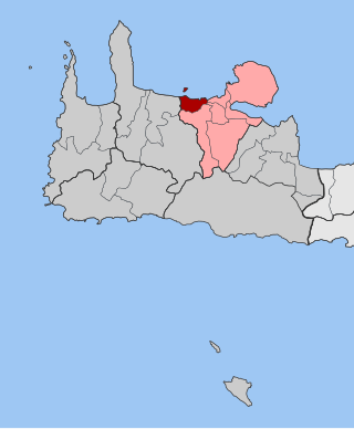
Eleftherios Venizelos is a former municipality in the Chania regional unit, Crete, Greece. Since the 2011 local government reform it is part of the municipality Chania, of which it is a municipal unit. The municipal unit has an area of 18.806 km2 (7.261 sq mi). It is centred on the town of Mournies, due south of the city of Chania. The municipality was named for the Greek statesman Eleftherios Venizelos, who was born in Mournies. Other settlements include the villages of Pasakaki, Nerokouros, Vandes and Agios Georgios. As of 2021, the population of the municipal unit was 13,018.

Asi Gonia is a mountainous village and a former community in the eastern part of the Chania regional unit in Crete, Greece. Since the 2011 local government reform it is part of the municipality Apokoronas, of which it is a municipal unit. The municipal unit has an area of 18.273 km2 (7.055 sq mi). Asi Gonia is situated east of the Lefka Ori mountain range, 20 km southwest of Rethymno. The communal office is situated in the heart of the community. In the village square there are two statues dedicated to the two Greek prime ministers Eleftherios Venizelos and Sofoklis Venizelos.

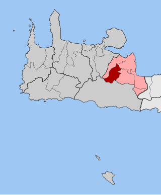
Armenoi is a village and former municipality in the Chania regional unit, Crete, Greece. Since the 2011 local government reform it is part of the municipality Apokoronas, of which it is a municipal unit. The municipal unit has an area of 55.292 km2 (21.348 sq mi). The seat of the municipality is in the village of Kalyves.

East Selino is a former municipality in the Chania regional unit, Crete, Greece. Since the 2011 local government reform it is part of the municipality Kantanos-Selino, of which it is a municipal unit. The municipal unit has an area of 136.555 km2 (52.724 sq mi). It is situated on the south-west coast of the island of Crete. It was part of the former Selino Province which covered the mountain and coastal region west of Sfakia. The seat of the municipality was Kampanos.
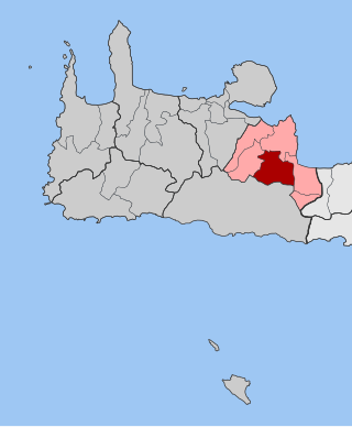
Fres is a village and former municipality in the Chania regional unit, Crete, Greece. Since the 2011 local government reform, it is part of the municipality Apokoronas, of which it is a municipal unit. The municipal unit has an area of 53.819 km2 (20.780 sq mi). The municipal unit of Fres has a population of 787 (2021). The city has a large main square surrounded by several cafés where the locals in the village meet and socialize. An archway in Fres leads through to the upper village and to the chapel of Our Lady of the Two Rocks.
Kryonerida is a former municipality in the Chania regional unit, Crete, Greece. Since the 2011 local government reform it is part of the municipality Apokoronas, of which it is a municipal unit. The municipal unit has an area of 67.561 km2 (26.085 sq mi). The seat of the municipality of Kryonerida was the large village of Vryses. Vryses became the seat of the new municipality Apokoronas. It is located in foothills of the White Mountains.
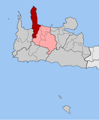
Nea Kydonia is a former municipality in the Chania regional unit, Crete, Greece. Since the 2011 local government reform it is part of the municipality Chania, of which it is a municipal unit. The municipal unit has an area of 21.457 km2 (8.285 sq mi). It is situated on the western outskirts of Chania. It saw fierce fighting during the Battle of Crete during World War II and there the main prisoner of war camp for Allied soldiers in Western Crete was in Galatas.

Pelekanos is a former municipality in the Chania regional unit, Crete, Greece. Since the 2011 local government reform it is part of the municipality Kantanos-Selino, of which it is a municipal unit. The municipal unit has an area of 166.618 km2 (64.332 sq mi). Pelekanos is in the south west corner of the island, part of the rugged and remote Selino Province. The Venetians built a castle - Kastel Selinou - at Palaiochora, giving the region its name. Palaiochora is now a growing coastal resort and the capital town of the municipality.

Kissamos is a town and a municipality in the west of the island of Crete, Greece. It is part of the Chania regional unit and of the former Kissamos Province which covers the northwest corner of the island. The town of Kissamos is also known as Kastelli Kissamou and often known simply as Kastelli after the Venetian castle that was there. It is now a port and fishing harbour, with a regular ferry from the Peloponnese via Kythira. A town museum is located in the old Venetian governor's palace and there have been important archaeological finds in the town, including fine mosaics, dating from the Roman city of Kisamos. The head town of the municipality is Kastelli-Kissamos itself.

Kandanos or Kantanos, also Candanos, is a town and former municipality in the Chania regional unit, Crete, Greece. Since the 2011 local government reform it is part of the municipality Kantanos-Selino, of which it is a municipal unit. The municipal unit has an area of 73.081 km2 (28.217 sq mi). It was part of the former Selino Province which covered the southwest of the island. The community has 590 residents.

Mousouroi is a former municipality in the Chania regional unit, Crete, Greece. Since the 2011 local government reform it is part of the municipality Platanias, of which it is a municipal unit. The municipal unit has an area of 191.744 km2 (74.033 sq mi). It was part of the former Kydonia Province. The municipal unit extends from the hinterland of the town of Chania to the mountains of south Crete. Many tourists pass through Mousouroi on their way to Omalos and the start of the Samaria Gorge walk, which is in Mousouroi. Mousouroi is bordered by Voukolies in the southwest, Platanias in the northwest, Theriso to the east and East Selino in the southwest with Sfakia in the southeast.

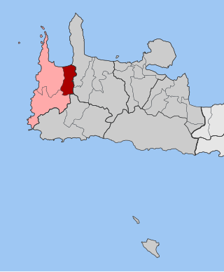
Keramia is a former municipality in the Chania regional unit, Crete, Greece. Since the 2011 local government reform it is part of the municipality Chania, of which it is a municipal unit. The municipal unit has an area of 89.722 km2 (34.642 sq mi). It is part of the former Kydonia Province.
Kolymvari, also known as Kolymbari, is a coastal town at the southeastern end of the Rodopou peninsula on the Gulf of Chania. Kolymvari was formerly a municipality in the Chania regional unit, Crete, Greece. Since the 2011 local government reform it has been a municipal unit of the municipality Platanias. It was also formerly part of the Kissamos province, which covered the northwest of Chania Prefecture. The municipal unit has an area of 149.99 km2 (57.91 sq mi), including the mostly uninhabited and barren Rodopou peninsula to the west and some villages to the south: Rodopou, Afrata, Vasilopoulo, Spilia, Kares, Episkopi, Vouves, Glossa, Panethimos, Nochia, Deliana, Drakona, Ravdouchas, Kalidonia, and Kamisiana.

Theriso is a village and former municipality in the Chania regional unit, Crete, Greece. Since the 2011 local government reform it is part of the municipality Chania, of which it is a municipal unit. The municipal unit has an area of 74.106 km2 (28.612 sq mi). It was part of the former Kydonia Province, which covered the central part of Chania Prefecture.

Voukolies is a town and former municipality in the Chania regional unit, Crete, Greece. Since the 2011 local government reform it is part of the municipality Platanias, of which it is a municipal unit. The municipal unit has an area of 75.110 km2 (29.000 sq mi). It was part of the former Kissamos province which covered the northwestern part of Chania Prefecture. Voukoulies is a large village with an important Saturday morning market. The municipal unit of Voukoulies extends from Tavronitis on the north coast to the foothills of the White Mountains. The seat of the municipality was Voukolies itself. The municipal unit also includes Tavronitis, Neriana, Kakopetros, Polemarchi, Neo Chorio, Anoskeli and Palea Roumata.
Mythimna is a former municipality in the Chania regional unit, Crete, Greece. Since the 2011 local government reform it is part of the municipality Kissamos, of which it is a municipal unit. The municipal unit has an area of 55.268 km2 (21.339 sq mi). It was part of the former Kissamos province which covered the north west of Chania Prefecture.

Kantanos-Selino is a municipality in Chania regional unit, Crete, Greece. It is numbered 4 on the map of the Chania region. The seat of the municipality is the village of Palaiochora. The municipality has an area of 376.254 km2 (145.272 sq mi). A significant number of fresco's painted by Ioannis Pagomenos are located in Selino.

