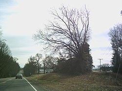
Index, Virginia | |
---|---|
Coordinates: 38°11′37″N77°4′48″W / 38.19361°N 77.08000°W | |
Country | United States |
State | Virginia |
County | King George |
Time zone | UTC−5 (Eastern (EST)) |
• Summer (DST) | UTC−4 (EDT) |
Index is an unincorporated community located in King George County, in the U. S. state of Virginia. [1] The area became known as Index after the establishment of a Post Office in 1898 by local merchant Peyton Parker who built a General Store a few years prior. The store was at the intersection of Kings Highway and Salem Church Road and the building is still there today. The store sold everything including cloths, furniture, and seed to local farmers. The Index Post Office closed in 1965 and the store a few years later. Prior to the naming of the Index Post Office, the area was known as Johnsville.
A ZIP Code is a system of postal codes used by the United States Postal Service (USPS). Introduced on July 1, 1963, the basic format consisted of five digits. In 1983, an extended ZIP+4 code was introduced; it included the five digits of the ZIP Code, followed by a hyphen and four digits that designated a more specific location.
Lake Montezuma is a census-designated place (CDP) in Yavapai County in the U.S. state of Arizona. The population was 5,111 at the 2020 census. The CDP includes the communities of Rimrock and McGuireville. Located along Interstate 17, it is 20 miles (32 km) south of Sedona and 8 miles (13 km) north of Camp Verde in central Arizona's Verde Valley.
Haysi is a town in Dickenson County, Virginia, United States. The population was 498 at the 2010 census, up from 186 at the 2000 census, over which time period the town's area tripled.
Lorton is a census-designated place (CDP) in Fairfax County, Virginia, United States. The population was 20,072 as of the 2020 census.
Elkton is an incorporated town in Rockingham County, Virginia, United States. It is included in the Harrisonburg Metropolitan Statistical Area. The population was 2,762 at the 2010 census. Elkton was named for the Elk Run stream.
Gordonsville is a town in Orange County in the Commonwealth of Virginia in the United States. Located about 19 miles northeast of Charlottesville and 65 miles northwest of Richmond, the population was 1,496 at the 2010 census.
A general merchant store is a rural or small-town store that carries a general line of merchandise. It carries a broad selection of merchandise, sometimes in a small space, where people from the town and surrounding rural areas come to purchase all their general goods. The store carries routine stock and obtains special orders from warehouses. It differs from a convenience store or corner shop in that it will be the main shop for the community rather than a convenient supplement.
Unison is an unincorporated community village in Loudoun County, Virginia. It is located approximately five miles from Middleburg in the Loudoun Valley close to the Fauquier County border.
Fork Union is an unincorporated community in southern Fluvanna County, Virginia, along U.S. Highway 15. Its ZIP code is 23055; the population within that ZIP code was 1148 according to the 2000 Census. It is known mainly as the home of Fork Union Military Academy, Fork Union Animal Clinic and formerly had one of the few surviving drive-in theatres in Virginia. Fork Union is also home to a post office, a bank, a small grocery store, an IGA, and a Dollar General. The town also includes two independently owned restaurants: Sal's Pizza and The Village Restaurant. The Village of Fork Union is the location of Fluvanna County's only Presbyterian congregation, Fork Union Presbyterian Church. The James River is just a few miles from Fork Union.
Woodwardville is an unincorporated community situated in western Anne Arundel County, Maryland, United States, containing 27 structures, 16 of which are historic and included in the Woodwardville Historic District, listed on the National Register of Historic Places in 2003. Most of the structures are located adjacent to Patuxent Road, which runs through the center of the community. On the north end of the district, a small street, 5th Avenue, runs west from Patuxent Road underneath the train tracks. Prior to the establishment of what would be later known as Fort George G. Meade in 1917, the road once continued on to Laurel. Three of the seven buildings along 5th Avenue are historic. Woodwardville's building stock consists principally of late-19th and early-20th century domestic architecture. Good examples of the Bungalow, Foursquare, Tudor Revival, and Queen Anne styles are present, as well as older traditional vernacular classifications such as the I-house. These older forms are supplemented by a handful of post-World War II era structures. Woodwardville also features several public or commercial buildings including a church, a former schoolhouse, the ruins of a store and storage or service buildings associated with the railroad. Many of Woodwardville's older buildings fell into decline following World War II, but in recent years, due to its close proximity to commuter rail service, Woodwardville has evolved into a bedroom community for persons working in Washington and Baltimore. Investment by new residents resulted in the restoration and renovation of many buildings which had formerly been in deteriorating condition. Despite the intense development a mile away in Piney Orchard, this quaint community retains its ability to communicate its historic qualities and distinct sense of place.
Wingina is an unincorporated community in Nelson County, Virginia, United States.
Mt. Lookout is a small unincorporated community in Nicholas County, West Virginia, United States, 10 miles (16 km) south of Summersville.
Mount Clifton is a Census-designated place in Shenandoah County, in the U.S. state of Virginia. As of the 2020 decennial census the village was noted as having 110 residents with 6 being Native American or Alaska Native, 1 being Asian, 0 Black or African American individuals, 7 of Hispanic or Latino descent, 0 Native Hawaiian and Pacific Islanders, 4 of Some Other Race, 8 of Two or More Races, and 91 White. It was also noted as having 54 housing units, 3 of which are noted as being vacant.
Chancellor is an unincorporated community in Spotsylvania County, in the U.S. state of Virginia. Originally named Screamersville, the community was established as a railroad whistle stop west of Fredericksburg. The name was changed to Chancellor around 1927 by agreement of the railroad and the local community.
Jodie, also known as Imboden, is an unincorporated community in Fayette County, West Virginia, United States. It is located along the Gauley River at the mouth of Rich Creek, 4 miles (6.4 km) northeast of Gauley Bridge. Due to its proximity to the county line, Jodie is part of the Nicholas County ZIP code of 26690; it had its own post office until its closure on July 23, 2005.
Callands is an unincorporated community in Pittsylvania County, in the U.S. state of Virginia. It was named after Samuel Calland, a native of Scotland that immigrated during the 18th century, whose general store became a popular fixture of the community. The area around the store served as the county seat of Pittsylvania County until the end of 1776.
Goldbond is an unincorporated community in Giles County, Virginia, United States.
Atenville is an unincorporated community in Lincoln County, West Virginia, United States. It is a residential community located in Harts Creek District and is part of the Harts census-designated place.
Hybart is an unincorporated community in Monroe County, in the U.S. state of Alabama. Hybart is located at 31°49′36″N87°22′56″W. It is located at the intersection of Alabama State Route 41 and Monroe County Road 56, in the northwestern part of Monroe County, just a short distance from its border with Wilcox County, Alabama. Hybart is the host of a locally famous Alabama turkey hunting competition called the Butterball which has appeared in Mobile Bay Magazine. The area is also known for being a good hunting spot for whitetail deer, turkey, quail, dove, and duck. Hybart is on the northwestern edge of the Red Hills region of southwestern Alabama, a hilly, wooded, and still largely undeveloped part of the state, geologically distinct from the Gulf Coastal Plain to its south, and the Black Belt region to its north. Within the Red Hills region, the Forever Wild Land Trust of Alabama owns two large tracts of land a few miles to the southeast of Hybart. Recreational opportunities in these tracts include hunting, woods road hiking/exploration, wildflower viewing, photography, and bird and wildlife watching. The Red Hills tracts are open to visitors year-round.
Munson is a hamlet in the Town of Hempstead in Nassau County, on Long Island, in New York, United States. Although often now associated as being part of Franklin Square and West Hempstead, the name lives on through the local fire department.