Office Hall, Virginia

Last updated

Office Hall, Virginia
NB US 301 at VA 3 in Office Hall, Virginia.jpg
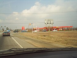
Northbound US 301 as it approaches VA 3 in Office Hall
USA Virginia location map.svg
Red pog.svg
Office Hall
Location within Virginia and the United States
Usa edcp location map.svg
Red pog.svg
Office Hall
Office Hall (the United States)
Coordinates: 38°14′20″N77°09′01″W / 38.23889°N 77.15028°W / 38.23889; -77.15028
CountryUnited States
State Virginia
County King George
Time zone UTC−5 (Eastern (EST))
  Summer (DST) UTC−4 (EDT)

Office Hall is an unincorporated community in King George County, Virginia, United States. The main roads in Office Hall are U.S. Route 301 and Virginia State Route 3. [1]

Related Research Articles

<span class="mw-page-title-main">St. Mary's County, Maryland</span> County in Maryland, United States

St. Mary's County, established in 1637, is a county located in the U.S. state of Maryland. As of the 2020 census, the population was 113,777. Its county seat is Leonardtown. The name is in honor of Mary, the mother of Jesus. St. Mary's County comprises the California-Lexington Park, Maryland Metropolitan Statistical Area, which also is included in the Washington-Baltimore-Arlington, DC-MD-VA-WV-PA Combined Statistical Area. It is part of the Southern Maryland region. The county was the home to the first Maryland Colony, and the first capital of the Colony of Maryland. Settled by English Catholics, it is considered to be the birthplace of religious freedom in North America, at a time when the British colonies were settled primarily by Protestants. The county is home to the Patuxent River Naval Air Station and St. Mary's College of Maryland. Traditionally, St. Mary's County has been known for its unique and historic culture of Chesapeake Bay tidewater farming, fishing, and crabbing communities. But with the advent of the military bases, growth of an extensive defense contractor presence, and the growth of St. Mary's College of Maryland, as well as increasing numbers of long-distance Washington, D.C. commuters, it has been undergoing a decades-long transformation which has seen the county's population double since 1970.

<span class="mw-page-title-main">Prince William County, Virginia</span> County in Virginia, United States

<span class="mw-page-title-main">James City County, Virginia</span> County in Virginia, United States

James City County is a county located in the Commonwealth of Virginia. As of the 2020 census, the population was 78,254. Although politically separate from the county, the county seat is the adjacent independent city of Williamsburg.

<span class="mw-page-title-main">Huntington, West Virginia</span> City in West Virginia, United States

Huntington is a city in Cabell and Wayne counties in the U.S. state of West Virginia. The county seat of Cabell County, the city is located at the confluence of the Ohio and Guyandotte rivers. Huntington is the second-largest city in West Virginia, with a population of 46,842 as of the 2020 census. Its metro area, the Huntington–Ashland metropolitan area, is the largest in West Virginia, spanning seven counties across three states and having a population of 359,862 at the 2020 census. During the 1900s, the city was a major hub for manufacturing, transportation, and Industrialization. After World War II, due to the shutdown of these industries, the city lost nearly 46% of its population, from a peak of 86,353 in 1950 to 54,844 in 1990. Both the city and metropolitan area declined in population from the 2010 census, a trend that has been ongoing for six decades. It is home to the Port of Huntington Tri-State, the second-busiest inland port in the United States.

<span class="mw-page-title-main">Culpeper, Virginia</span> Town in Virginia, United States

Culpeper is an incorporated town in Culpeper County, Virginia, United States. The population was 20,062 at the 2020 census, up from 16,379 at the 2010 census. It is the county seat of Culpeper County.

<span class="mw-page-title-main">Washington, Virginia</span> Town in Virginia

The town of Washington, Virginia, is a historic village located in the eastern foothills of the Blue Ridge Mountains near Shenandoah National Park. The entire town is listed on the National Register of Historic Places as a historic district, Washington Historic District. It is the county seat of Rappahannock County, Virginia.

<span class="mw-page-title-main">Martinsburg, West Virginia</span> City in West Virginia, United States

Martinsburg is a city in and the county seat of Berkeley County, West Virginia, United States. The population was 18,773 at the 2020 census, making Martinsburg the largest city in the Eastern Panhandle of West Virginia and the seventh-largest city in the state. It is a principal city of the Hagerstown–Martinsburg metropolitan area extending into Maryland, which had 293,844 residents in 2020.

<span class="mw-page-title-main">Lewisburg, West Virginia</span> City in West Virginia, United States

Lewisburg is a city in and the county seat of Greenbrier County, West Virginia, United States. The population was 3,930 at the 2020 census.

<span class="mw-page-title-main">Washington–Baltimore combined statistical area</span> CSA in the United States

The Washington–Baltimore combined statistical area is a statistical area including two overlapping metropolitan areas, Washington, D.C., and Baltimore, Maryland. The region includes Central Maryland, Northern Virginia, three counties in the Eastern Panhandle of West Virginia, and one county in South Central Pennsylvania. It is the most educated, highest-income, and third-largest combined statistical area in the United States behind New York–Newark and Los Angeles–Long Beach.

<span class="mw-page-title-main">Staunton, Virginia</span> Independent city in Virginia, United States

Staunton is an independent city in the U.S. Commonwealth of Virginia. As of the 2020 census, the population was 25,750. In Virginia, independent cities are separate jurisdictions from the counties that surround them, so the government offices of Augusta County are in Verona, which is contiguous to Staunton. Staunton is a principal city of the Staunton-Waynesboro Metropolitan Statistical Area, which had a 2010 population of 118,502. Staunton is known for being the birthplace of Woodrow Wilson, the 28th U.S. president, and as the home of Mary Baldwin University, historically a women's college. The city is also home to Stuart Hall, a private co-ed preparatory school, as well as the Virginia School for the Deaf and Blind. It was the first city in the United States with a fully defined city manager system.

<span class="mw-page-title-main">U.S. Route 250</span> Highway in the United States

U.S. Route 250 is a route of the United States Numbered Highway System, and is a spur of U.S. Route 50. It currently runs for 514 miles (827 km) from Richmond, Virginia to Sandusky, Ohio. It passes through the states of Virginia, West Virginia, and Ohio. It goes through the cities of Richmond, Charlottesville, Staunton, and Waynesboro, Virginia; and Wheeling, West Virginia. West of Pruntytown, West Virginia, US 250 intersects and forms a short overlap with its parent US 50.

Halltown is an unincorporated community on land that was originally owned by William Hall along Flowing Springs Run in Jefferson County, West Virginia. Halltown is located off U.S. Route 340 on West Virginia Route 230 between Charles Town and Bolivar. A few houses, a fork in the road, a tiny post office, and the large Halltown Paper Plant are the distinguishing features of the community.

<span class="mw-page-title-main">U.S. Route 50 in West Virginia</span>

U.S. Route 50 in West Virginia runs from the border with Ohio to Virginia, passing briefly through Garrett County, Maryland, and following the Northwestern Turnpike. Prior to the U.S. Highway System it was West Virginia Route 1 and in the 1930s, the road was not finished in Maryland. Today the section of US 50 from Clarksburg to Parkersburg on the Ohio River is part of Corridor D of the Appalachian Development Highway System.

<span class="mw-page-title-main">King George, Virginia</span> Census-designated place in Virginia, United States

King George is a census-designated place (CDP) in and the county seat of King George County, Virginia, United States. It is sometimes referred to as King George Courthouse, because it is the location of the King George County Courthouse. The population as of the 2020 census was 4,970. The Journal Press was a local weekly newspaper published in King George and serving local areas until its final issue was published on Jan 11th, 2017.

<span class="mw-page-title-main">Morven, Virginia</span> Unincorporated community in Virginia, United States

Morven is a rural unincorporated community in northwestern Amelia County just south of the Appomattox River in the U.S. state of Virginia. It is located in Leigh District at the intersection of SR 681 and SR 616, northwest of Flat Creek. A portion of the segment of U.S. Bicycle Route 1 that runs southwest from Richmond follows SR 616 through Morven.

<span class="mw-page-title-main">U.S. Route 60 in Virginia</span> Section of U.S. Numbered Highway in Virginia, United States

U.S. Route 60 (US 60) in the Commonwealth of Virginia runs 303 miles (488 km) west to east through the central part of the state, generally close to and paralleling the Interstate 64 corridor, except for the crossing of the Blue Ridge Mountains, and in the South Hampton Roads area.

<span class="mw-page-title-main">Edgehill, King George County, Virginia</span> Unincorporated community in Virginia, United States

Edgehill is an unincorporated community in King George County, Virginia, United States. The main roads in Office Hall are U.S. Route 301 and Virginia State Route 205.

Mt. Lookout is a small unincorporated community in Nicholas County, West Virginia, United States, 10 miles (16 km) south of Summersville.

<span class="mw-page-title-main">The Pentagon</span> Headquarters of the US Department of Defense in Arlington, Virginia

The Pentagon is the headquarters building of the United States Department of Defense, in Arlington County, Virginia, across the Potomac River from Washington, D.C. It was constructed on an accelerated schedule during World War II. As a symbol of the U.S. military, the phrase The Pentagon is often used as a metonym for the Department of Defense and its leadership.

Ordinary is an unincorporated community in Gloucester County, Virginia, United States. Ordinary is located along U.S. Route 17 4.5 miles (7.2 km) north of Gloucester Point. Ordinary has a post office with ZIP code 23131.

References