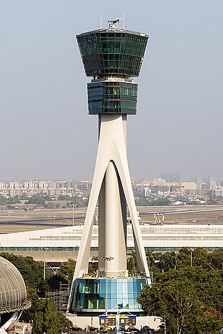
Air traffic control (ATC) is a service provided by ground-based air traffic controller who direct aircraft on the ground and through a given section of controlled airspace, and can provide advisory services to aircraft in non-controlled airspace. The primary purpose of ATC worldwide is to prevent collisions, organize and expedite the flow of air traffic, and provide information and other support for pilots.

Eastern Air Lines Flight 663 was a domestic passenger flight from Boston, Massachusetts, to Atlanta, Georgia, with scheduled stopovers at John F. Kennedy International Airport, New York; Richmond, Virginia; Charlotte, North Carolina; and Greenville, South Carolina. On the night of February 8, 1965, the aircraft serving the flight, a Douglas DC-7, crashed near Jones Beach State Park, New York, just after taking off from JFK Airport. All 79 passengers and five crew aboard perished.

Allegheny Airlines Flight 853 was a regularly scheduled Allegheny Airlines flight from Boston, Massachusetts, to St. Louis, Missouri, with stops in Baltimore, Maryland, Cincinnati, Ohio, and Indianapolis, Indiana. On September 9, 1969, the aircraft serving the flight, a McDonnell Douglas DC-9, collided in mid-air with a Piper PA-28 light aircraft near Fairland, Indiana. The DC-9 was carrying 78 passengers and 4 crew members, and the Piper was leased to a student pilot on a solo cross-country flight. All 83 occupants of both aircraft were killed in the accident and both aircraft were destroyed.
The En Route Automation Modernization (ERAM) system architecture replaces the En Route Host computer system and its backup. ERAM provides all of today's functionality and:
ATC Zero is an official term used by the U.S. Federal Aviation Administration (FAA) that means the FAA is unable to safely provide the published ATC services within the airspace managed by a specific facility. The term is always used in conjunction with a facility reference. FAA ATC facilities include Air Route Traffic Control Centers (ARTCC); Terminal Radar Control facility (TRACON), Air Traffic Control Tower (ATCT), Flight Service Stations (FSS), or the Air Traffic Control System Command Center (ATCSCC). The term is defined in FAA Order JO 1900.47, Air Traffic Control Operational Contingency Plans. It is one of three designations used by the FAA to describe degraded operations and invoke operational contingency plans.
The National Airspace System (NAS) is the airspace, navigation facilities and airports of the United States along with their associated information, services, rules, regulations, policies, procedures, personnel and equipment. It includes components shared jointly with the military. It is one of the most complex aviation systems in the world, and services air travel in the United States and over large portions of the world's oceans.

Chicago Air Route Traffic Control Center (ZAU) is one of 22 Air Route Traffic Control Centers (ARTCCs) operated by the United States Federal Aviation Administration. It is located at 619 W. New Indian Trail Rd., Aurora, Illinois.

The Air Traffic Organization (ATO) is an air navigation service provider in the United States of America. The ATO is the operational division of the Federal Aviation Administration (FAA).

Anchorage Air Route Traffic Control Center (PAZA/ZAN) is located just outside the main gate of Joint Base Elmendorf-Richardson at 700 North Boniface Parkway in Anchorage, Alaska, United States. The Anchorage ARTCC is one of 22 Air Route Traffic Control Centers in the United States.
"Denver Air Route Traffic Control Center (ZDV), is one of 22 US Area Control Centers. It is located at 2211 17th Ave, Longmont, Colorado, United States.
Jacksonville Air Route Traffic Control Center (ZJX), is one of 22 Area Control Centers in the United States. It is located at 37075 Aviation Ln, Hilliard, Florida.

Kansas City Air Route Traffic Control Center, is one of 22 Federal Aviation Administration (FAA) Area Control Centers. It is located at 250 S. Rogers Rd. Olathe, Kansas, United States.
Miami Air Route Traffic Control Center is one of 22 United States air route traffic control centers (ARTCs), or area control centers, located at 7500 N.W. 58th st, Miami-Dade County, Florida.
Memphis Air Route Traffic Control Center (ZME) is one of 22 United States Federal Aviation Administration (FAA) Area Control Centers and is located at 3229 Democrat Rd, Memphis, Tennessee 38118, United States
Minneapolis Air Route Traffic Control Center (ZMP), is one of 22 Area Control Centers. It is located at 512 Division Street in Farmington, Minnesota, United States.
Oakland Air Route Traffic Control Center (ZOA), is one of 22 Area Control Centers in the United States. It is located at 5125 Central Ave, Fremont, California, roughly 25 miles southeast of downtown Oakland in the East Bay.

Atlanta Air Route Traffic Control Center (ZTL) is one of 22 Air Route Traffic Control Centers operated by the United States Federal Aviation Administration. It is located at 299 Woolsey Rd, Hampton, Georgia, United States.

Northwest Airlines Flight 188 was a regularly scheduled flight from San Diego, California, to Minneapolis/St. Paul, Minnesota, on October 21, 2009, which landed over one hour late in Minneapolis/St Paul after overshooting its destination by more than 150 miles (240 km) because of pilot error. As a result of the incident, the Federal Aviation Administration (FAA) revoked the pilot certificates of the involved pilots and the National Transportation Safety Board (NTSB) issued recommendations for changes to air traffic control procedures and the rules for cockpit crew. The incident also caused American lawmakers to move to prevent pilots on U.S. airliners from using personal electronic devices while taxiing or flying. In 2013, changes to flight deck automation were suggested, and prototype designs that could mitigate errors leading to similar incidents were described.
The 2014 Chicago Air Route Traffic Control Center fire was an incident in the United States where arson at an air traffic control facility in Aurora, Illinois caused close to 2000 airline flights to be grounded. One employee at the facility was treated for smoke inhalation, while 15 to 30 employees were evacuated.


