This article relies largely or entirely on a single source .(January 2026) |
Interlaken District Amtsbezirk Interlaken | |
|---|---|
District | |
 Flag  Coat of arms | |
 | |
| Country | |
| Canton | |
| Capital | Interlaken |
| Area | |
• Total | 681 km2 (263 sq mi) |
| Population (2007) | |
• Total | 38,156 |
| • Density | 56.0/km2 (145/sq mi) |
| Time zone | UTC+1 (CET) |
| • Summer (DST) | UTC+2 (CEST) |
| Municipalities | 23 |
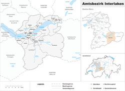
Interlaken [1] is a district of the canton of Bern.
From 1 January 2010, the district lost its administrative power while being replaced by the Interlaken-Oberhasli, whose administrative centre is Interlaken. Since 2010, it remains therefore a fully recognised district under the law and the Constitution (Art.3 al.2) of the Canton of Berne.
Its administrative capital was Interlaken. It comprises 23 municipalities with a total area of 724 km2:
- CH-3803 Beatenberg
- CH-3806 Bönigen
- CH-3855 Brienz
- CH-3856 Brienzwiler
- CH-3707 Därligen
- CH-3818 Grindelwald
- CH-3814 Gsteigwiler
- CH-3815 Gündlischwand
- CH-3804 Habkern
- CH-3858 Hofstetten bei Brienz
- CH-3800 Interlaken
- CH-3807 Iseltwald
- CH-3822 Lauterbrunnen
- CH-3706 Leissigen
- CH-3816 Lütschental
- CH-3800 Matten bei Interlaken
- CH-3853 Niederried bei Interlaken
- CH-3854 Oberried am Brienzersee
- CH-3852 Ringgenberg
- CH-3813 Saxeten
- CH-3855 Schwanden bei Brienz
- CH-3800 Unterseen
- CH-3812 Wilderswil