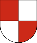
Seftigen District Amtsbezirk Seftigen | |
---|---|
District | |
Country | Switzerland |
Canton | Bern |
Capital | Belp |
Area | |
• Total | 189 km2 (73 sq mi) |
Population (2007) | |
• Total | 36,739 |
• Density | 190/km2 (500/sq mi) |
Time zone | UTC+1 (CET) |
• Summer (DST) | UTC+2 (CEST) |
Municipalities | 25 |
Seftigen District is one of the 26 administrative districts in the Canton of Bern, Switzerland. Its capital, while having administrative power, was the municipality of Seftigen.
From 1 January 2010, the district lost its administrative power while seeing its constituent municipalities being divided and partly resettled in the Bern-Mittelland (administrative district), whose administrative centre is Ostermundigen but also in the Thun (administrative district), whose administrative centre being Thun.
Since 2010, it remains therefore a fully recognised district under the law and the Constitution (Art.3 al.2) of the Canton of Bern.
The district has an area of 189 km² and consists of 25 municipalities:
Municipality | Population (Dec 2007) [1] | Area (km²) |
---|---|---|
Belp | 9,682 | 17.6 |
Belpberg | 384 | 5.7 |
Burgistein | 1,057 | 7.5 |
Gelterfingen | 250 | 3.5 |
Gerzensee | 994 | 7.8 |
Gurzelen | 779 | 4.5 |
Jaberg | 245 | 1.3 |
Kaufdorf | 954 | 2.1 |
Kehrsatz | 3,840 | 4.4 |
Kienersrüti | 50 | 0.8 |
Kirchdorf | 849 | 6.1 |
Kirchenthurnen | 277 | 1.3 |
Lohnstorf | 228 | 1.8 |
Mühledorf (BE) | 236 | 2.3 |
Mühlethurnen | 1,294 | 2.9 |
Niedermuhlern | 538 | 7.2 |
Noflen | 234 | 2.7 |
Riggisberg | 1,933 | 7.7 |
Rüeggisberg | 1,898 | 35.7 |
Rümligen | 465 | 4.7 |
Seftigen | 2,095 | 3.9 |
Toffen | 2,439 | 4.9 |
Uttigen | 1,745 | 3.0 |
Wald | 1,141 | 13.3 |
Wattenwil | 2,721 | 14.5 |
Konolfingen District is a district in the canton of Bern, Switzerland. While being an administrative district with power, its capital was the town of Konolfingen. The district contains 12 municipalities covering an area of 153 km2 (59 sq mi):
Districts of Switzerland are a political subdivision for cantons. In the federally constituted Switzerland, each canton is completely free to decide its own internal organisation. Therefore, there exists a variety of structures and terminology for the subnational entities between canton and municipality, loosely termed districts. Most cantons are divided into Bezirke. They are also termed Ämter, Amtsbezirke, district or distretto. The Bezirke generally provide only administration and court organization. However, for historical reasons districts in cantons Grisons and Schwyz are their own legal entities with jurisdiction over tax and often have their own Landsgemeinde.
The Bernese Oberland, sometimes also known as the Bernese Highlands, is the highest and southernmost part of the canton of Bern. It is one of the canton's five administrative regions. It constitutes the Alpine region of the canton and the northern side of the Bernese Alps, including many of its highest peaks, among which the Finsteraarhorn, the highest in both range and canton.
Büren District is a constitutional district in the canton of Bern in Switzerland, with its capital at Büren an der Aare. It contains 14 municipalities in an area of 88 km²:
Bern District is a constitutional district and used to be an administrative district in the canton of Bern, Switzerland. It had an area of 233 km2 (90 sq mi) and a population of 237,919.
Signau District is a district in Switzerland in the canton of Bern with its seat Signau.
Frutigen District is a district in the canton of Bern in Switzerland with its seat at Frutigen. From 1 January 2010, the district lost its administrative power while being replaced by the Frutigen-Niedersimmental, whose administrative centre is still Frutigen. Since 2010, it remains a fully recognised district under the law and the Constitution of the Canton of Berne.
Erlach District is a constitutional district in the canton of Bern, Switzerland. Its capital is Erlach.
Obersimmental District is one of the 26 administrative districts in the Canton of Bern, Switzerland. Its capital, while having administrative power was the municipality of Zweisimmen.
Fraubrunnen District is a constitutional district along of the 26 districts in the canton of Bern, Switzerland. Its capital is the municipality of Fraubrunnen. The district has an area of 124 km² and consisted of 27 municipalities.
Saanen District is one of the 26 administrative districts in the canton of Bern, Switzerland. Its capital, while having administrative power, was the municipality of Saanen. From 1 January 2010, the district lost its administrative power while being replaced by the Obersimmental-Saanen, whose administrative centre is still Saanen. Since 2010, it remains therefore a fully recognised district under the law and the Constitution of the Canton of Berne. The district has an area of 241 km2 and consists of 3 municipalities:
Schwarzenburg District is one of the 26 administrative districts in the Canton of Bern, Switzerland. Its capital, while having administrative power, was the town of Schwarzenburg, located in the municipality of Wahlern.
Laupen District is one of the 26 administrative districts in the canton of Bern, Switzerland. Its capital, while having administrative power, was the municipality of Laupen.
Nidau District is one of the 26 administrative districts in the canton of Bern, Switzerland. Its capital, while having administrative power, was the municipality of Nidau.
Niedersimmental District is one of the 26 administrative districts in the canton of Bern, Switzerland.
Thun District is one of the 26 administrative districts in the canton of Bern, Switzerland. Its capital is the municipality of Thun.
Wangen District is one of the 26 administrative districts in the canton of Bern, Switzerland. Its capital is the municipality of Wangen an der Aare.
Seftigen is a municipality in the administrative district of Thun in the canton of Bern in Switzerland.
The Auguetbrücke is a bridge over the Aare between the municipalities of Muri bei Bern and Belp in the Canton of Bern in Switzerland.
On 1 January 2010, the 26 districts of the Canton of Bern were combined into 10 new precincts.
46°53′00″N7°29′00″E / 46.8833°N 7.48333°E