
U.S. Highway 151 (US 151) is a United States Numbered Highway that runs through the states of Iowa and Wisconsin. The southern terminus for US 151 is at a junction with Interstate 80 (I-80) in Iowa County, Iowa, and its northern terminus is at Manitowoc, Wisconsin. The route, from south to north follows a northeasterly path through the two states.
The Avenue of the Saints is a 563-mile-long (906 km) highway in the Midwestern United States that connects St. Louis, Missouri, and St. Paul, Minnesota.
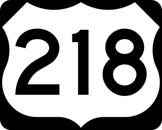
U.S. Highway 218 (US 218) is an original United States Highway that was created in 1926. Although technically a spur of US 18, US 218 neither begins nor ends at US 18, but overlaps US 18 for eight miles (13 km) near Charles City, Iowa. US 218 begins at U.S. 136 in downtown Keokuk and ends 319 miles (513 km) away at Interstate 35 (I-35) and US 14 at Owatonna, Minnesota. A large portion of US 218 in Iowa is part of the Avenue of the Saints, which connects St. Louis, Missouri, and Saint Paul, Minnesota.
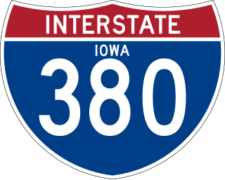
Interstate 380 (I-380) is a 73-mile (117 km) auxiliary Interstate Highway in eastern Iowa. The route extends from I-80 near Coralville to Waterloo. I-380 connects the cities of Cedar Rapids and Waterloo, the state's second- and sixth-largest cities, respectively, to the Interstate Highway System. Except for its last 1.5 miles (2.4 km) north of U.S. Highway 20 (US 20), I-380 runs concurrently with Iowa Highway 27 (Iowa 27), which represents Iowa's portion of the 560-mile (900 km) Avenue of the Saints highway connecting Saint Louis, Missouri, with Saint Paul, Minnesota.
State Road 21 (SR 21) runs mostly in a southwest-to-northeast direction in the US state of Florida from McMeekin to Jacksonville. It is also known as Blanding Boulevard for much of its length.

Iowa Highway 965 (Iowa 965) is a very short state highway in Coralville, Iowa that connects U.S. Highway 6 (US 6) to Interstate 80 (I-80) as there is no direct access between the two routes. Prior to 2003, Iowa 965 was a much longer route, extending to Cedar Rapids along the former alignment of US 218.
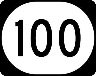
Iowa Highway 100 is a state highway located in Linn County, Iowa. The route is located primarily in Cedar Rapids and Marion and is known locally as Collins Road. It begins at US 30 / US 218 in western Cedar Rapids and ends at U.S. Highway 151 / Iowa Highway 13 in Marion.

Iowa Highway 8 is a state highway that runs from east to west in east central Iowa. Highway 8 is a short state highway in Iowa, at only 14 miles (23 km) long. Iowa 8 begins at an intersection with U.S. Highway 63 in Traer and ends at an intersection with U.S. Highway 218 northwest of Garrison. The route has largely remained the same since its designation.

Iowa Highway 92 (Iowa 92) is a state highway that runs from east to west across the state of Iowa. Iowa 92 is 279 miles (449 km) long and is part of a continuous 886-mile (1,426 km) four-state "Highway 92" which begins in Torrington, Wyoming, goes through Nebraska and Iowa and ends in La Moille, Illinois. It begins at the Missouri River in Council Bluffs, where it is a continuation of Nebraska Highway 92. It stretches across the state and serves to roughly demarcate the southern one-third of Iowa. It ends at the Mississippi River in Muscatine where it continues into Illinois as Illinois Route 92. Iowa 92 was designated in 1939 replacing the entirety of the original Iowa 2.

Iowa Highway 1 (Iowa 1) is a state highway in the U.S. state of Iowa that extends from Keosauqua to Anamosa. It travels nearly 120 miles (190 km), mainly through rich farmland and small communities. Iowa 1 provides an important link to Iowa City and the University of Iowa as it passes through campus. Portions of the route today date back to the late 1830s, when Martin Van Buren was president, making Iowa 1 one of the oldest routes in the state, pre-dating the current primary highway system by nearly eighty years. The highway was seriously damaged by the Cedar River in the Iowa flood of 2008, which closed the highway for seven weeks.

U.S. Highway 30 (US 30) is a major east–west U.S. Highway which spans 330 miles (530 km) across the state of Iowa. It is the longest primary highway in the state and is maintained by the Iowa Department of Transportation. The route in Iowa begins at the Missouri River crossing at Blair, Nebraska, and ends at the Mississippi River crossing at Clinton, Iowa. Along the way, it serves Denison and Carroll in western Iowa, Boone, Ames, and Marshalltown in central Iowa, and Tama, Cedar Rapids, and DeWitt in eastern Iowa. Cutting across the central portion of the state, US 30 runs within close proximity of the Union Pacific Railroad's Overland Route for its entire length.

Iowa Highway 16 is a state highway running from west to east in southeastern Iowa. The highway has a length of 65.18 miles (104.90 km). The western terminus of Iowa Highway 16 is at an intersection with U.S. Highway 34 (US 34) between Agency and Batavia. The eastern terminus is located at Wever at an intersection with US 61.

Iowa Highway 58 is a state highway that runs from north to south in northeast Iowa. A five-and-a-half-mile (8.9 km) portion of the highway is overlapped by the Avenue of the Saints. Iowa 58 begins at U.S. Highway 63 (US 63) in Hudson and ends at an interchange with US 218 and Iowa 57. Iowa 58's route has changed many times in its history, but has always served Black Hawk County.

Iowa Highway 150 (Iowa 150) is an 85-mile-long (137 km) state highway in eastern and northeastern Iowa. It begins at U.S. Route 218 (US 218) in Vinton and ends at US 52 and Iowa 24 in Calmar. From Vinton, it heads north and east towards Urbana where it meets Interstate 380 (I-380) and Iowa 27, the Avenue of the Saints highway. At Independence, it intersects US 20 on the south side of town. Further north, it converges with Iowa 3 in Oelwein.
Iowa Highway 934 (Iowa 934) was an unsigned state highway in Cedar Falls and Waterloo, Iowa. It was created in 1998 after University Avenue was vacated by U.S. Highway 218 (US 218), which had recently moved to a new freeway a few miles north. Iowa 934 extended from the Iowa 27 / Iowa 58 freeway in Cedar Falls, which was constructed at the same time as the US 218 freeway, to US 63.

Iowa Highway 188 is a state highway in north-central Iowa. The route is signed both north–south and east–west because of a 90-degree corner near the route's midpoint. The route begins at Iowa Highway 3 south of Clarksville and ends at U.S. Highway 63 near Tripoli.
Iowa Highway 281 is a 28-mile-long (45 km) state highway in north-central Iowa. Iowa 281 begins at the eastern city limits of Waterloo and ends at Iowa Highway 150 south of Oelwein.

U.S. Highway 18 (US 18) is the northernmost east–west United States Numbered Highway in the state of Iowa. As with all state highways in Iowa, it is maintained by the Iowa Department of Transportation. It enters the state by crossing the Big Sioux River between Inwood and Canton, South Dakota. It travels about 312 miles (502 km) and connects Spencer, Mason City, and Charles City. The highway leaves the state via the Marquette–Joliet Bridge over the Mississippi River at Marquette. Prior to becoming a U.S. Highway, the route US 18 follows was known as Primary Road No. 19 and the National Parks Pike.

Iowa Highway 412 (Iowa 412) was a state highway in Waterloo, Iowa. It began at U.S. Highway 63 (US 63) in southwestern Waterloo and traveled to the east and northeast approximately four and three-quarters miles (7.6 km) to US 218 in southeastern Waterloo. The route served as a southern bypass of Waterloo. The highway was added to the primary highway system in 1960 and given to the City of Waterloo in 1983. It was replaced in function by US 20, which that year relocated onto a freeway less than one-half mile (800 m) south of San Marnan Drive.

U.S. Highway 63 (US 63) is a United States Highway that runs through the eastern third of Iowa. It begins at the Missouri state line southwest of Bloomfield and travels north through Ottumwa, Oskaloosa, Tama, Waterloo, and New Hampton. It ends at the Minnesota state line at Chester. Between Ottumwa and Oskaloosa, the highway is a four-lane controlled-access highway. Through Waterloo and New Hampton, it is partially controlled; that is, the road as both grade-separated interchanges and at-grade intersections. The rest of the highway is largely a two-lane rural highway.


