Irvine, Wyoming

Last updated

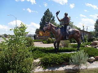
Irvine is an unincorporated community in Converse County, in the U.S. state of Wyoming. [1]

Converse County, Wyoming County in the United States

Converse County is a county located in the U.S. state of Wyoming. As of the 2010 United States Census, the population was 13,833. Its county seat is Douglas.

U.S. state constituent political entity of the United States

In the United States, a state is a constituent political entity, of which there are currently 50. Bound together in a political union, each state holds governmental jurisdiction over a separate and defined geographic territory and shares its sovereignty with the federal government. Due to this shared sovereignty, Americans are citizens both of the federal republic and of the state in which they reside. State citizenship and residency are flexible, and no government approval is required to move between states, except for persons restricted by certain types of court orders. Four states use the term commonwealth rather than state in their full official names.

Wyoming State of the United States of America

Wyoming is a state in the mountain region of the western United States. The state is the 10th largest by area, the least populous, and the second most sparsely populated state in the country. Wyoming is bordered on the north by Montana, on the east by South Dakota and Nebraska, on the south by Colorado, on the southwest by Utah, and on the west by Idaho and Montana. The state population was estimated at 577,737 in 2018, which is less than 31 of the most populous U.S. cities including Denver in neighboring Colorado. Cheyenne is the state capital and the most populous city, with an estimated population of 63,624 in 2017.

History

The community was named for Billy Irvine, a cattleman who owned land near the original town site. [2]

Related Research Articles

Douglas, Wyoming City in Wyoming, United States

Douglas is a city in Converse County, Wyoming, United States. The population was 6,120 at the 2010 census. It is the county seat of Converse County and the home of the Wyoming State Fair.

Fort Fetterman

Fort Fetterman was a wooden fort constructed in 1867 by the United States Army on the Great Plains frontier in Dakota Territory, approximately 11 miles northwest of present-day Douglas, Wyoming. Located high on the bluffs south of the North Platte River, it served as a major base for the start of several United States military expeditions against warring Native American tribes. The main role of the soldiers was to protect European-American pioneers on the Bozeman Trail. The fort is listed on the National Register of Historic Places.

Argyle, Illinois Unincorporated community in Illinois, United States

Argyle is an unincorporated community in Boone and Winnebago counties in the U.S. state of Illinois, northeast of Rockford. It is part of the Rockford, Illinois Metropolitan Statistical Area.

Garrett, Wyoming Unincorporated community in Wyoming, United States

Garrett is an unincorporated community in northern Albany County, Wyoming, United States, along the North Laramie River. It lies along local roads north of the city of Laramie, the county seat of Albany County. Its elevation is 6,785 ft (2,068 m), and it is located at 42°6′48″N105°36′36″W. Although Garrett is unincorporated, it once had a post office, with the ZIP code of 82058. The building remains, though is no longer in use. Garrett is also home to River Bridge School, a one-room schoolhouse that is part of Albany County School District #1. Aside from the schoolhouse, the land is privately owned.

Zell is an unincorporated community in Faulk County, South Dakota, United States, astride US Route 212, and was a stop on the old Chicago and North Western Railway

Laniers Mill is an unincorporated community in Pittsylvania County, in the U.S. state of Virginia.

Arabia, Nebraska Unincorporated Community in Nebraska, United States

Arabia is an unincorporated community in Cherry County, Nebraska, in the United States.

Irwin, Nebraska human settlement in United States of America

Irwin is an unincorporated community in Cherry County, Nebraska, in the United States.

Thatcher is an unincorporated community. It is located in Cherry County, Nebraska, in the United States.

Stafford, Nebraska Unincorporated community in Nebraska, United States

Stafford is an unincorporated community in Holt County, Nebraska, in the United States.

Bucknum is an unincorporated community in Natrona County, in the U.S. state of Wyoming.

Eddy, Illinois Unincorporated community in Illinois, United States

Eddy is an unincorporated community in Lake County, in the U.S. state of Illinois. Eddy is located at 42°27′41″N87°53′54″W.

Herring is a ghost town in Sac County, in the U.S. state of Iowa.

Keeline is an unincorporated community in Niobrara County, in the U.S. state of Wyoming.

Nashville, Iowa Unincorporated community in Iowa, United States

Nashville is an unincorporated community in Jackson County, in the U.S. state of Iowa.

Rubens is a ghost town in Pocahontas County, in the U.S. state of Iowa.

Strouds is an unincorporated community in Natrona County, in the U.S. state of Wyoming.

Wendte is an unincorporated community in Stanley County, in the U.S. state of South Dakota.

James, Iowa Unincorporated community in Iowa, United States

James is an unincorporated community in Plymouth County, in the U.S. state of Iowa.

Seney, Iowa Unincorporated community in Iowa, United States

Seney is an unincorporated community in Plymouth County, in the U.S. state of Iowa.

References

Coordinates: 42°39′54″N105°18′20″W / 42.66500°N 105.30556°W / 42.66500; -105.30556

Geographic coordinate system Coordinate system

A geographic coordinate system is a coordinate system that enables every location on Earth to be specified by a set of numbers, letters or symbols. The coordinates are often chosen such that one of the numbers represents a vertical position and two or three of the numbers represent a horizontal position; alternatively, a geographic position may be expressed in a combined three-dimensional Cartesian vector. A common choice of coordinates is latitude, longitude and elevation. To specify a location on a plane requires a map projection.