Wyoming is a state in the mountain region of the Western United States. The state is the 10th largest by area, the least populous, and the second most sparsely populated state in the country. Wyoming is bordered on the north by Montana, on the east by South Dakota and Nebraska, on the south by Colorado, on the southwest by Utah, and on the west by Idaho and Montana. The state population was estimated at 577,737 in 2018, which is less than 31 of the most populous U.S. cities including Denver in neighboring Colorado. Cheyenne is the state capital and the most populous city, with an estimated population of 63,624 in 2017.

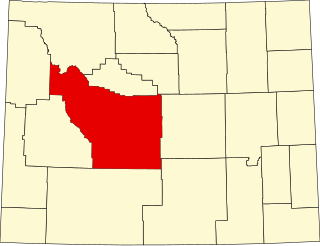
Fremont County is a county in the U.S. state of Wyoming. As of the 2010 United States Census, the population was 40,123. Its county seat is Lander. The county was founded in 1884 and is named for John C. Frémont, a general, explorer, and politician. It is roughly the size of the state of Vermont.

Big Horn County is a county in the U.S. state of Wyoming. As of the 2010 United States Census, the population was 11,668. The county seat is Basin. Its north boundary abuts the south boundary of Montana.

Middlebury is a town in Wyoming County, New York. The population was 1,508 at the 2000 census. The town is on the north border of the county.

The Territory of Wyoming was an organized incorporated territory of the United States that existed from July 25, 1868, until July 10, 1890, when it was admitted to the Union as the State of Wyoming. Cheyenne was the territorial capital. The boundaries of the Wyoming Territory were identical to the modern State of Wyoming.

The University of Wyoming (UW) is a public land-grant research university in Laramie, Wyoming. It was founded in March 1886, four years before the territory was admitted as the 44th state, and opened in September 1887. The University of Wyoming is unusual in that its location within the state is written into the state's constitution. The university also offers outreach education in communities throughout Wyoming and online.
Tri-state area is an informal term in the eastern contiguous United States for any of several regions associated with a particular town or metropolis that, with adjacent suburbs, lies across three states. Some of these involve a state boundary tripoint. Other tri-state areas have a more diffuse population that shares a connected economy and geography—especially with respect to geology, botany, or climate—such as the tri-state area of New York, New Jersey, and Connecticut. The term "tri-state area" is often present in movies, radio and television commercials.

Four Corners is a small unincorporated community in Weston County, Wyoming, United States. It is located in northeastern Wyoming near the Bear Lodge Mountains, part of the Black Hills, at the intersection of U.S. Route 85 and Wyoming Highway 585. It is located north of Newcastle, southeast of Sundance, Wyoming, and southwest of Lead, South Dakota. Originally a stage station on the famous stagecoach road Cheyenne Black Hills Stage Route connecting Cheyenne and the Union Pacific Railroad with the gold fields of Deadwood, it is today the site of a small store, bed-and-breakfast ranches, vacation homes, and tourist camps. Camp Mallo is nearby.

Three Forks is a small unincorporated community in Pennington County, South Dakota, United States. It lies at the intersection of U.S. Routes 16 and 385, just north of Hill City along Spring Creek. A small general store featuring fuel is open year-round; other businesses are open seasonally, including a campground, a motel, a miniature golf-course, and an ice-cream stand. The campground is the site of an annual Octoberfest event, and the area is heavily patronized during the Sturgis Motorcycle Rally in August of each year. In recent years, considerable residential development of the immediate area has swollen its population.

Feltonville is a working-class neighborhood in North Philadelphia It is located east of Logan and Hunting Park, west of Lawncrest and Juniata, south of Olney, and north of Fairhill and Harrowgate. Feltonville is bounded by Erie Avenue to the south, Front Street to the west, Roosevelt Boulevard to the north, Tacony Creek to the northeast, and G Street to the east.

Plympton–Wyoming is a town in the Canadian province of Ontario, located in Lambton County immediately east of Sarnia. It is the seat of the Lambton County Council.

The geography of the U.S. State of Colorado is diverse, encompassing both rugged mountainous terrain, vast plains, desert lands, desert canyons, and mesas. In 1861, the United States Congress defined the boundaries of the new Territory of Colorado exclusively by lines of latitude and longitude, stretching from 37°N to 41°N latitude, and from 102°02'48"W to 109°02'48"W longitude. Starting in 1868, official surveys demarcated the boundaries, deviating from the parallels and meridians in several places. Later surveys attempted to correct some of these mistakes but in 1925 the U.S. Supreme Court affirmed that the earlier demarcation was the official boundary. The borders of Colorado are now officially defined by 697 boundary markers connected by straight boundary lines. Colorado, Wyoming, and Utah are the only states that have their borders defined solely by straight boundary lines with no natural features. The southwest corner of Colorado is the Four Corners Monument at 36°59'56"N, 109°2'43"W. This is the only place in the United States where four states meet: Colorado, New Mexico, Arizona, and Utah.

The Cascade Canyon Barn was designed by the National Park Service to standard plans and built by the Civilian Conservation Corps in 1935. The National Park Service rustic style barn is 5 miles (8 km) west of Jenny Lake in Grand Teton National Park in the U.S. state of Wyoming.

George Washington Memorial Park is located at the center of Jackson, Wyoming. More generally known as "Town Square", the park is notable for its elk-antler arches at each corner of the park, collected from the nearby National Elk Refuge by Boy Scouts and periodically rebuilt. The square originally existed as an open space in the center of town that was made into a park in 1934. The park center also contains a stone memorial to John Colter.

The Quintin Blair House in Cody, Wyoming was designed by Frank Lloyd Wright and built in 1952-53. The house is an example of Wright's "natural house" theme, emphasizing close integration of house and landscape. It is the only Wright building in Wyoming.
Wyoming Highway 585 is a 28.05-mile-long (45.14 km) north-south Wyoming State Road located in Weston and Crook counties in northeastern Wyoming.
Mule Creek Junction is an unpopulated locale in Niobrara County, Wyoming at the junction of US 18 and US 85.

Four Mile is an unincorporated community in South Dakota, located four miles west of Custer at the junction of US 16 and Pleasant Valley Road.

Carlile Junction is the populated place in Wyoming where Wyoming Highway 24 has a terminus at US Route 14.

Flitners Corner is an unincorporated community in Big Horn County in the U.S. state of Wyoming.


