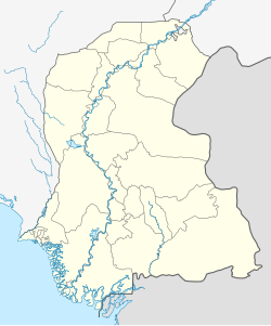
Islamkot is a town in south-eastern Sindh, Pakistan.[a] It has gained prominence due to its proximity to the Thar coalfield and the development of power generation projects, which making it a centre for investment and urban expansion in the region.[2]
Islamkot lies in the Thar Desert, about 42 kilometres (26mi) east of the district headquarters at Mithi and just over 40 kilometres (25mi) north of the international border with India's Kutch District in Gujarat. According to the 2017 census, the population of the Islamkot Town Committee stood at 24,880, reflecting an annual growth rate of 4.68%, nearly double that recorded in 1998. The surge has closely linked to planned and ongoing development initiatives in the area.[2]
The town is also known as the "Neem Tree Town" due to the abundance of neem trees.[4]Hindus constitute the larger religious community in Islamkot and outnumber Muslims.[5] It is the birthplace of the Hindu saint Shri Sant Nenuram, whose Nenuram Ashram remains an important place of pilgrimage.[6]
Economy
Commerce in Islamkot is centred on the sale of food, consumer goods, and household items. Despite a relatively high number of shops, customer turnover is modest. The town is located on a major highway between Mithi and Nagarparkar, serving as a stopover point for travellers and tourists, especially during the monsoon season.
Urban growth
Urban expansion has increased significantly in recent years, particularly along the Mithi–Islamkot road and in the town's northeast and southwest outskirts. Growth has, however, been largely unplanned. The built-up area expanded from 2.4 square kilometres (0.93sqmi) in 2004 to 6.55 square kilometres (2.53sqmi) in 2018, according to satellite imagery.
Development
The exploitation of vast coal reserves and the establishment of mining blocks are transforming the settlement's economic and physical landscape. To manage this anticipated growth, the Government of Sindh has initiated a 20-year 'Development Master Plan' to provide guidelines for sustainable urban development. Islamkot has also been designated to become the first Sustainable Development Goal (SDG)–compliant taluka (tehsil) in Sindh.[2]
This page is based on this Wikipedia article Text is available under the CC BY-SA 4.0 license; additional terms may apply. Images, videos and audio are available under their respective licenses.