
Varaždin County is a county in northern Croatia. It is named after its county seat, the city of Varaždin.

Bjelovar-Bilogora County is a county in central Croatia.

Novi Marof is a town in north-western Croatia, located south of Varaždin and east of Ivanec, in the Varaždin County. It lies on intersection of state roads D3 and D24 and is also connected with highway A4, state road D22 and R201 railway.

Krašić is a village and municipality in central Croatia, located near Jastrebarsko and Ozalj, south of Žumberak and north of Kupa, about 50 km southwest of Zagreb. Krašić comprises an area of about 3.63 km2. In the 2011 census, the total population was 2,640, in the following settlements:
Pojatno is a census-designated naselje (settlement) in the town of Zaprešić in Zagreb County, Croatia. It has a population of 1,157 people, living mainly by the main street, "Matije Gupca". Pojatno is located north of Zaprešić, 25 km (16 mi) away from Zagreb, near the Krapina River. The settlement is spread over an area of 5.37 square kilometers (2.07 sq mi).

Ivanec is a town in northern Croatia, located southwest of Varaždin and east of Lepoglava, north of the mountain Ivanščica.
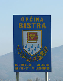
Bistra is a municipality ("općina") in Zagreb County, Croatia. The municipality was established in 1995 by separating from the former Municipality of Zaprešić and its municipal seat is Donja Bistra.
Pokupsko is a municipality in Croatia in the Zagreb County. According to the 2011 census, there are 2,224 inhabitants, absolute majority of which are Croats.

Ribnik is a village and a municipality in Karlovac County, Croatia. There are a total of 475 inhabitants in the municipality, 98.74% of whom are Croats.
Hruševec Kupljenski is a naselje (settlement) in the town of Zaprešić, Zagreb County, Croatia. According to the 2011 census, it has 432 inhabitants spread over an area of 3.02 square kilometers (1.17 sq mi).
Kupljenovo is a naselje (settlement) in the town of Zaprešić, Zagreb County, Croatia. According to the 2011 census, it has 704 inhabitants living in an area of 4.01 square kilometers (1.55 sq mi).
Merenje is a naselje (settlement) in the town of Zaprešić, Zagreb County, Croatia. According to the 2011 census, it has 129 inhabitants living in an area of 1.82 square kilometers (0.70 sq mi). This makes it the smallest settlement by area in Zaprešić.

Šibice is a naselje (settlement) in the town of Zaprešić, Zagreb County, Croatia. According to the 2011 census, it has 746 inhabitants living in an area of 2.77 square kilometers (1.07 sq mi).

Lukavec is a village in central Croatia, 20 km south of Zagreb. It is administratively part of the city of Velika Gorica, Zagreb County. The population is 1,140. A nearby fortification is well preserved.
Bobovica, Croatia is a settlement (naselje) in the Samobor administrative territory of Zagreb County, Croatia. As of 2011 it had a population of 285 people.
Javorek, Croatia is a settlement (naselje) in the Samobor administrative territory of Zagreb County, Croatia. As of 2011 it had a population of 73 people.
Donja Topličica is a settlement (naselje) in the Sveti Ivan Zelina administrative territory of Zagreb County, Croatia. As of 2011 it had a population of 68 people.
Križevčec is a settlement (naselje) in the Sveti Ivan Zelina administrative territory of Zagreb County, Croatia. As of 2011 it had a population of 102 people.
Šulinec is a settlement (naselje) in the Sveti Ivan Zelina administrative territory of Zagreb County, Croatia. As of 2011 it had a population of 214 people.


