
Bjelovar-Bilogora County is a county in central Croatia.
Pojatno is a census-designated naselje (settlement) in the town of Zaprešić in Zagreb County, Croatia. It has a population of 1,157 people, living mainly by the main street, "Matije Gupca". Pojatno is located north of Zaprešić, 25 km (16 mi) away from Zagreb, near the Krapina River. The settlement is spread over an area of 5.37 square kilometers (2.07 sq mi).
The Nova Ves is a historic street north of the Kaptol neighborhood in Zagreb, Croatia. It is administratively within the bounds of the Gornji Grad - Medveščak city district. According to the 2001 census, the street and its surrounding area had 3,456 inhabitants. In 2009, it had a population of 3,575. From the first habitation to date, the street has had a rich history as an important part of Zagreb ever since the beginnings of the modern city.

Brdovec is a municipality in the Zagreb County, Croatia. The closest town to Brdovec is neighboring Zaprešić on the east.
Dubrava is a village and a municipality ("općina") in Zagreb County, Croatia.
Pisarovina is a municipality in Croatia in the Zagreb County. According to the 2001 census, there are 3,697 inhabitants, absolute majority which are Croats.

Pušća is a municipality in Zagreb County in Croatia. According to the 2001 census, 2,484 people live in Pušća, 96.7 percent of which are Croats. The municipality covers an area of 18.20 square kilometers (7.03 sq mi) and forms part of the Zaprešić metropolitan area.
Gradec is a village and a municipality located in Zagreb County, Croatia.
Hruševec Kupljenski is a naselje (settlement) in the town of Zaprešić, Zagreb County, Croatia. According to the 2011 census, it has 432 inhabitants spread over an area of 3.02 square kilometers (1.17 sq mi).
Ivanec Bistranski is a naselje (settlement) in the town of Zaprešić, Zagreb County, Croatia. According to the 2011 census, it has 937 inhabitants living in an area of 6.65 square kilometers (2.57 sq mi).
Kupljenovo is a naselje (settlement) in the town of Zaprešić, Zagreb County, Croatia. According to the 2011 census, it has 704 inhabitants living in an area of 4.01 square kilometers (1.55 sq mi).

Lužnica is a settlement (naselje) in the town of Zaprešić, Zagreb County, Croatia. According to the 2001 census, it had 62 inhabitants, spread over an area of 1.93 square kilometers (0.75 sq mi). It is thus the smallest settlement by population in Zaprešić. Lužnica is the location of the Lužnica Castle, a baroque castle and touristic point of interest built in 1791 and owned by the Convent of St. Vincent de Paul. The nuns operate nursing home for the elderly. The castle was previously owned by Croatian nobility, namely the Čikulin, Moscon and Rauch families.
Merenje is a naselje (settlement) in the town of Zaprešić, Zagreb County, Croatia. According to the 2011 census, it has 129 inhabitants living in an area of 1.82 square kilometers (0.70 sq mi). This makes it the smallest settlement by area in Zaprešić.

Šibice is a naselje (settlement) in the town of Zaprešić, Zagreb County, Croatia. According to the 2011 census, it has 746 inhabitants living in an area of 2.77 square kilometers (1.07 sq mi).
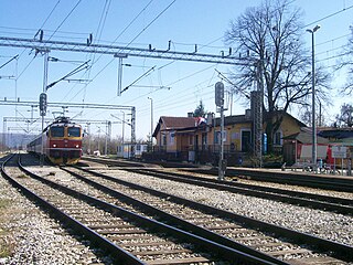
Savski Marof is a naselje (settlement) in the municipality of Brdovec, Zagreb County, Croatia. According to the 2001 census, it has 35 inhabitants living in an area of 0.78 square kilometers (0.30 sq mi). This makes it the least dense settlement and the smallest by population in Brdovec. It is second-smallest by area.
Šenkovec is a naselje (settlement) in the municipality of Brdovec, Zagreb County, Croatia. According to the 2001 census, it has 733 inhabitants living in an area of 0.90 square kilometers (0.35 sq mi).
Repišće is a naselje (settlement) in the municipality of Klinča Sela, Zagreb County, Croatia. According to the 2001 census, it has 354 inhabitants living in an area of 1.96 square kilometers (0.76 sq mi).

Ključ Brdovečki is a naselje (settlement) in the municipality of Brdovec, Zagreb County, Croatia. According to the 2001 census, it has 663 inhabitants living in an area of 3.20 square kilometers (1.24 sq mi).


