Native name: Ivujos | |
|---|---|
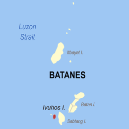 | |
 Ibugos Location within Batanes  Ibugos Ibugos (Luzon)  Ibugos Ibugos (Philippines) | |
| Geography | |
| Location | Luzon Strait |
| Coordinates | 20°19′8″N121°48′31″E / 20.31889°N 121.80861°E |
| Archipelago | Batanes Group of Islands |
| Adjacent to | Balintang Channel |
| Length | 4.0 km (2.49 mi) |
| Width | 1.8 km (1.12 mi) |
| Highest elevation | 90 m (300 ft) [1] |
| Administration | |
| Region | Cagayan Valley |
| Province | Batanes |
| Municipality | Sabtang |
| Demographics | |
| Population | uninhabited |
| Additional information | |
| Official website | Batanes Province Official Website |
 | |
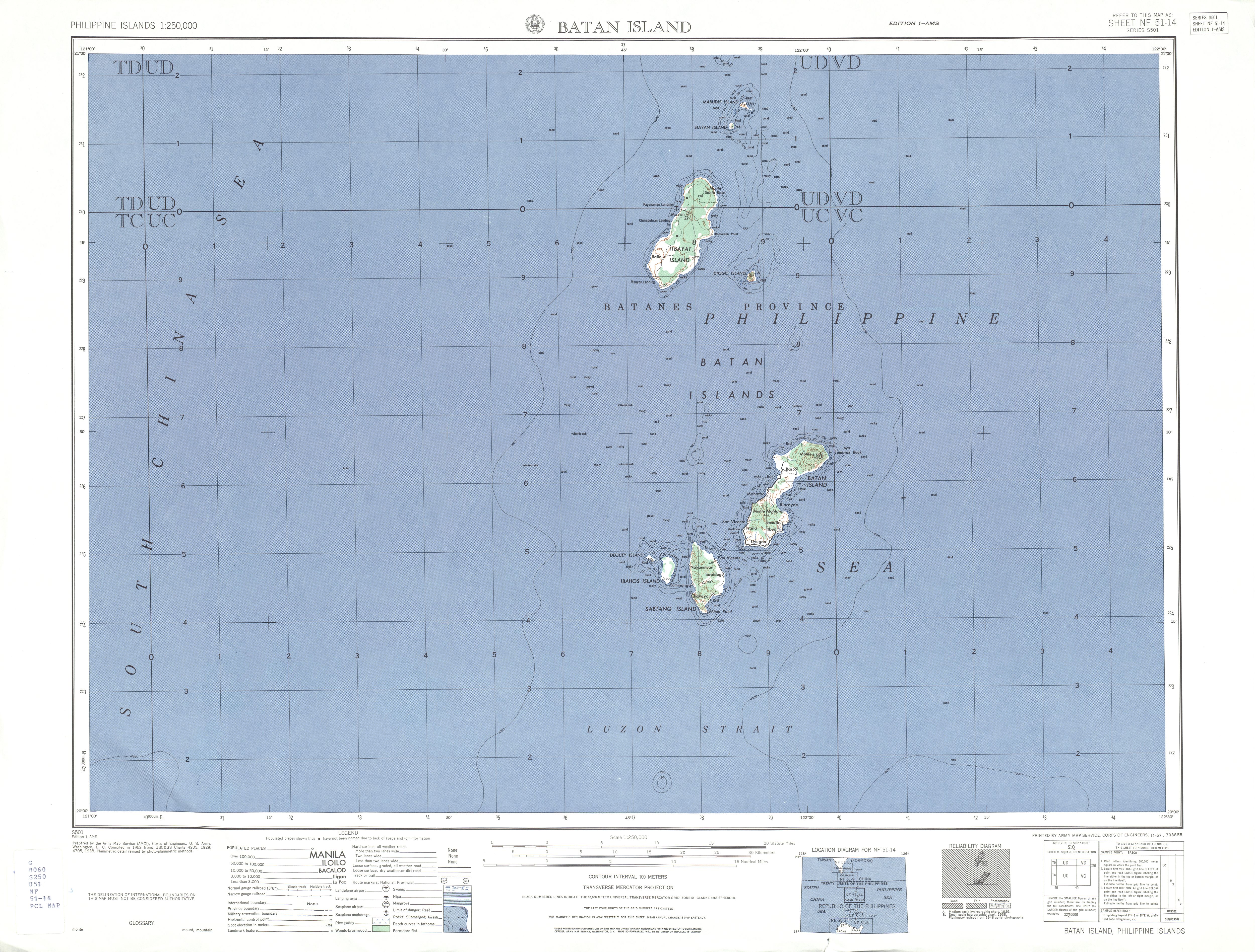
Ivuhos (also known as Ibugos, [2] Ibujos, [3] Vuhus [3] and Ibahos [1] Island) is one of the islands of Batanes, the northernmost province of the Philippines. The uninhabited island is located west of Sabtang Island and is separated by a deep channel nearly 2 kilometres (1.2 mi) wide.
Contents
Ivuhos Island is small and rather low, except a hill on the south end. A coral beach before the hill on the eastern side is the only viable landing spot on the island. The shores on both sides of the channel are bordered by reefs. [4] The flood tide sets southward with a velocity from 3 to 4 knots, and the ebb northward.