Related Research Articles

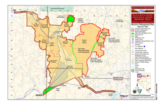
The Black Rock Desert is a semi-arid region of lava beds and playa, or alkali flats, situated in the Black Rock Desert–High Rock Canyon Emigrant Trails National Conservation Area, a silt playa 100 miles (160 km) north of Reno, Nevada that encompasses more than 300,000 acres (120,000 ha) of land and contains more than 120 miles (200 km) of historic trails. It is in the northern Nevada section of the Great Basin with a lakebed that is a dry remnant of Pleistocene Lake Lahontan.

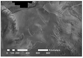
The Amery Ice Shelf is a broad ice shelf in Antarctica at the head of Prydz Bay between the Lars Christensen Coast and Ingrid Christensen Coast. It is part of Mac. Robertson Land. The name "Cape Amery" was applied to a coastal angle mapped on 11 February 1931 by the British Australian New Zealand Antarctic Research Expedition (BANZARE) under Douglas Mawson. He named it for William Bankes Amery, a civil servant who represented the United Kingdom government in Australia (1925–28). The Advisory Committee on Antarctic Names interpreted this feature to be a portion of an ice shelf and, in 1947, applied the name Amery to the whole shelf.
Porpoise Bay is an ice-filled embayment about 90 miles (140 km) wide indenting the coast of Antarctica between Cape Goodenough and Cape Morse. The United States Exploring Expedition (1838–42) under Charles Wilkes applied the name "Porpoise Bay", after the USEE brig "Porpoise", to a large bay at about 66°S, 130°E. US-ACAN's identification of Porpoise Bay is based on the correlation of Wilkes' chart (1840) with G.D. Blodgett's reconnaissance map (1955) compiled from air photos taken by USN Operation Highjump (1946–47). The name has been applied to the large embayment lying close southwest in keeping with Wilkes' original naming.

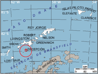
Bransfield Strait or Fleet Sea is a body of water about 100 kilometres (60 mi) wide extending for 300 miles (500 km) in a general northeast – southwest direction between the South Shetland Islands and the Antarctic Peninsula.

Saunders Coast is the portion of the coast of Marie Byrd Land between Cape Colbeck and Brennan Point, or between Shirase Coast in the west and Ruppert Coast in the east. It stretches from 158°01'W to 146°31'W. The portion west of 150°W is part of Ross Dependency, while the remaining area is unclaimed by any nation. This coast was explored from the air on December 5, 1929, by the Byrd Antarctic Expedition (1928–1930) and was first mapped from aerial photographs obtained on that flight by Capt. Harold E. Saunders, USN, for whom the coast is named. The United States Geological Survey (USGS) completely mapped the coast from ground surveys and U.S. Navy air photos, 1959–1965.

Sulzberger Bay is a bay between Fisher Island and Vollmer Island, along the coast of King Edward VII Land. Discovered by the Byrd Antarctic Expedition on December 5, 1929, and named by Byrd for Arthur H. Sulzberger, publisher of The New York Times, a supporter of the Byrd expeditions in 1928–1930 and 1933–1935.
Iselin Bank is a submarine bank in the Ross Sea off Antarctica. The name was approved by the Advisory Committee for Undersea Features in April 1980.
Endurance Ridge is an Antarctic undersea ridge, south-east of Coronation Island in the South Atlantic Ocean. It was named after the Endurance Expedition of 1914–1917, and its name was approved by the Advisory Committee for Undersea Features in June 1987.
Adélie Valley, also variously known as Adilie Valley, Dumont d'Urville Trough or Adélie Trough, is a drowned fjord on the continental margin of East Antarctica. Named in association with this long named portion of Wilkes Land on the Antarctic coast. Name approved by the Advisory Committee on Undersea Features in December 1971.
Dibble Basin is an undersea basin in the Antarctic Ocean. The name was approved by the Advisory Committee on Undersea Features in December 1971.

Möller Ice Stream is an Antarctic ice stream that drains an area of 66,000 square kilometres (25,000 sq mi) of the West Antarctic Ice Sheet as it flows north-northeast into the Ronne Ice Shelf to the west of Foundation Ice Stream. The drainage basin of this ice stream is separated by the Rambo Nunataks from the drainage basin of Foundation Ice Stream.
Colbeck Basin is a deep undersea basin of the central Ross Ice Shelf named in association with Cape Colbeck. The name was approved by the Advisory Committee for Undersea Features in June 1988.
Powell Basin is an undersea basin named for George Powell, captain of a British sealing ship, who discovered Powell Island. Name approved 10/77.
Drygalski Basinis an undersea basin named as such by the Advisory Committee for Undersea Features (ACUF) in April 1980, in association with Drygalski Ice Tongue. The name was changed to "Von Drygalski" in November 1995, in agreement with the General Bathymetric Chart of the Oceans Sub-Committee on Undersea Feature Names, but was changed back to Drygalski Basin by ACUF in June 2003.
The Dubinin Trough is an undersea trough named for Soviet Captain A.I. Dubinin, leader of the 1957 Antarctic expedition. The name was proposed by G. Agapova of the Geological Institute of the Russian Academy of Sciences, and it was approved by the Advisory Committee for Undersea Features in August 1985.
Glomar Challenger Basin is a northeast trending undersea basin in the central Ross Sea continental shelf named for the research ship Glomar Challenger. The name was approved by the Advisory Committee for Undersea Features in June 1988.
The Hero Fracture Zone is an undersea fracture zone in the Antarctic. Its name was approved by the Advisory Committee on Undersea Features in June 1987.
Mawson Bank is a submarine bank in the Ross Sea off Antarctica named for British Antarctic scientist Sir Douglas Mawson. The name was approved by the Advisory Committee for Undersea Features in June 1988.
The Hofmann Trough is a submarine bank in the Weddell Sea. It is named for Walther Hofmann (1920–1993), a cartographer/photogrammetrist on polar expeditions. The name was proposed by Heinrich Hinze of the Alfred Wegener Institute for Polar and Marine Research, Bremerhaven, Germany, and was approved by the Advisory Committee for Undersea Features in June 1997.
References
- ↑ "JOIDES Basin". Geographic Names Information System . United States Geological Survey, United States Department of the Interior . Retrieved 2012-07-30.
![]() This article incorporates public domain material from "JOIDES Basin". Geographic Names Information System . United States Geological Survey. Coordinates: 74°30′S174°0′E / 74.500°S 174.000°E
This article incorporates public domain material from "JOIDES Basin". Geographic Names Information System . United States Geological Survey. Coordinates: 74°30′S174°0′E / 74.500°S 174.000°E