The Fraser River is the longest river within British Columbia, Canada, rising at Fraser Pass near Blackrock Mountain in the Rocky Mountains and flowing for 1,375 kilometres (854 mi), into the Strait of Georgia just south of the City of Vancouver. The river's annual discharge at its mouth is 112 cubic kilometres (27 cu mi) or 3,550 cubic metres per second (125,000 cu ft/s), and each year it discharges about 20 million tons of sediment into the ocean.

The Indian River is a river in Renfrew County and Nipissing District in Eastern and Northeastern Ontario, Canada. It is in the Saint Lawrence River drainage basin, and is a left tributary of the Muskrat River.

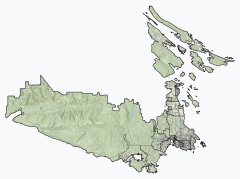
The Skootamatta River is a river in the Lake Ontario drainage basin in Hastings and Lennox and Addington Counties in Ontario, Canada. It flows from Joeperry Lake to join the Moira River in Tweed. The river's name is thought to come from Ojibwa words meaning "burnt shoreline".

Juan de Fuca Provincial Park is a provincial park located on the west coast of Vancouver Island in British Columbia, Canada. The park was established on April 4, 1996 by combining three former parks — China Beach, Loss Creek, and Botanical Beach — into one provincial park. It is the location of the majority of the Juan de Fuca Marine Trail, which is a southern compliment to the West Coast Trail within Pacific Rim National Park Reserve.

Jordan River, founded as, and still officially gazetted as, River Jordan, is a small settlement on the west coast of Vancouver Island, British Columbia, Canada, approximately 70 kilometres (43 mi) west of Victoria at the mouth of the Jordan River.

Port Renfrew is a small unincorporated community located on the south shore of Port San Juan, an inlet on the west coast of Vancouver Island in British Columbia, Canada. Port Renfrew has a population of 262 and has been touted as "the Tall Tree Capital of Canada".

Loss Creek is a river in the Capital Regional District of British Columbia, Canada. Located on southern Vancouver Island, it flows through a long, steep-sided valley to the Strait of Juan de Fuca on the Pacific Ocean.

The Pouce Coupe River is a major tributary of the Peace River in Alberta and British Columbia, Canada. Its name is officially spelled Pouce Coupé River, but it is commonly written without the acute accent.
The Whitesand River is a river in the Unorganized Part of Thunder Bay District in Northwestern Ontario, Canada, part of the Hewitson River system.
Moore Creek is a creek in South Algonquin, Nipissing District in Northeastern Ontario, Canada. It is in the Saint Lawrence River drainage basin and is a left tributary of the Madawaska River.
Moonbeam Creek is a stream in Thompson-Nicola Regional District in the Interior region of British Columbia, Canada. It is in the Pacific Ocean drainage basin and is a left tributary of the North Thompson River. The nearest communities to the mouth of the creek on British Columbia Highway 5 are Blue River 40 kilometres (25 mi) south and Valemount 50 kilometres (31 mi) north; the mouth of the creek is just downstream of confluence of the North Thompson River and the Albreda River, where the North Thompson River turns 90° right and heads south.
Canvas Creek is a stream in Thompson-Nicola Regional District in the Interior region of British Columbia, Canada. It is in the Pacific Ocean drainage basin and is a right tributary of the North Thompson River.
Maxwell Creek is a stream in the municipality of Georgian Bluffs, Grey County in Southwestern Ontario, Canada. It is in geographic Derby Township, is part of the Great Lakes Basin and is a right tributary of the Pottawatomi River.
Maxwell Creek is a stream in the municipality of Chatham-Kent in Southwestern Ontario, Canada. It is part of the Great Lakes Basin and is a left tributary of the Chenail Ecarté.
The Sombrio River is a river in the Capital Regional District of British Columbia, Canada. Located on southern Vancouver Island, it flows to the Strait of Juan de Fuca on the Pacific Ocean at Sombrio Beach.
Noyse Creek is a river in the Capital Regional District of British Columbia, Canada. Located on southern Vancouver Island, it flows from its source to its mouth as a right tributary of Loss Creek. The upper reaches of the creek were originally logged in 1967-1975 and replanted. The surrounding forest is now a prime example of a 50-year old second growth eco-system.
Gain Creek is a river in the Capital Regional District of British Columbia, Canada. Located on southern Vancouver Island, it flows from its source to its mouth as a right tributary of Loss Creek.
Classy Creek is a tributary of the Tuya River in northwest part of the province of British Columbia, Canada. It flows generally southeast and south roughly 20 km (12 mi) to join the Tuya River about 10 km (6.2 mi) north of the Tuya River's confluence with the Stikine River in the Grand Canyon of the Stikine, near Telegraph Creek Road, unofficially called Highway 51, a spur of the Stewart–Cassiar Highway.
Middle Creek is a tributary of the Tahltan River, part of the Stikine River watershed in northwest part of the province of British Columbia, Canada. It flows generally south for roughly 15 km (9.3 mi) to join the Tahltan River about 10 km (6.2 mi) north of Tahltan, British Columbia at the Tahltan River's confluence with the Stikine River. Middle Creek's watershed covers 49.6 km2 (19.2 sq mi), and its mean annual discharge is estimated at 0.449 m3/s (15.9 cu ft/s). The mouth of Middle Creek is located about 20 km (12 mi) north of Telegraph Creek, British Columbia, about 75 km (47 mi) southwest of Dease Lake, British Columbia, and about 197 km (122 mi) east of Juneau, Alaska. Middle Creek's watershed's land cover is classified as 45.2% shrubland, 30.8% conifer forest, 21.4% mixed forest, and small amounts of other cover.
The Inhini River is a tributary of the Iskut River in the northwest part of the province of British Columbia, Canada, in Cassiar Land District. From its source in the glaciers of Simma Mountain and Mount Rastus, the Inhini River flows north for about 25 km (16 mi) to the Iskut River just east of the Iskut's confluence with the Stikine River.