The Strait of Juan de Fuca is a body of water about 96 miles long that is the Salish Sea's main outlet to the Pacific Ocean. The international boundary between Canada and the United States runs down the centre of the Strait.

The North Cascades are a section of the Cascade Range of western North America. They span the border between the Canadian province of British Columbia and the U.S. state of Washington and are officially named in the U.S. and Canada as the Cascade Mountains. The portion in Canada is known to Americans as the Canadian Cascades, a designation that also includes the mountains above the east bank of the Fraser Canyon as far north as the town of Lytton, at the confluence of the Thompson and Fraser Rivers.

The richly textured landscape of the United States is a product of the dueling forces of plate tectonics, weathering and erosion. Over the 4.5 billion-year history of the Earth, tectonic upheavals and colliding plates have raised great mountain ranges while the forces of erosion and weathering worked to tear them down. Even after many millions of years, records of Earth's great upheavals remain imprinted as textural variations and surface patterns that define distinctive landscapes or provinces.

Mount Garibaldi is a dormant stratovolcano in the Garibaldi Ranges of the Pacific Ranges in southwestern British Columbia, Canada. It has a maximum elevation of 2,678 metres and rises above the surrounding landscape on the east side of the Cheakamus River in New Westminster Land District. In addition to the main peak, Mount Garibaldi has two named sub-peaks. Atwell Peak is a sharp, conical peak slightly higher than the more rounded peak of Dalton Dome. Both were volcanically active at different times throughout Mount Garibaldi's eruptive history. The northern and eastern flanks of Mount Garibaldi are obscured by the Garibaldi Névé, a large snowfield containing several radiating glaciers. Flowing from the steep western face of Mount Garibaldi is the Cheekye River, a tributary of the Cheakamus River. Opal Cone on the southeastern flank is a small volcanic cone from which a lengthy lava flow descends. The western face is a landslide feature that formed in a series of collapses between 12,800 and 11,500 years ago. These collapses resulted in the formation of a large debris flow deposit that fans out into the Squamish Valley.

The Pacific Ranges are the southernmost subdivision of the Coast Mountains portion of the Pacific Cordillera. Located entirely within British Columbia, Canada, they run northwest from the lower stretches of the Fraser River to Bella Coola and Burke Channel, north of which are the Kitimat Ranges. The Coast Mountains lie between the Interior Plateau and the Coast of British Columbia.

Juan de Fuca Provincial Park is a provincial park located on the west coast of Vancouver Island in British Columbia, Canada. The park was established on April 4, 1996 by combining three former parks — China Beach, Loss Creek, and Botanical Beach — into one provincial park. It is the location of the majority of the Juan de Fuca Marine Trail, which is a southern compliment to the West Coast Trail within Pacific Rim National Park Reserve.

Jordan River, founded as, and still officially gazetted as, River Jordan, is a small settlement on the west coast of Vancouver Island, British Columbia, Canada, approximately 70 kilometres (43 mi) west of Victoria at the mouth of the Jordan River.

Port Renfrew is a small unincorporated community located on the south shore of Port San Juan, an inlet on the west coast of Vancouver Island in British Columbia, Canada. Port Renfrew has a population of 262 and has been touted as "the Tall Tree Capital of Canada".

The Mount Meager massif is a group of volcanic peaks in the Pacific Ranges of the Coast Mountains in southwestern British Columbia, Canada. Part of the Cascade Volcanic Arc of western North America, it is located 150 km (93 mi) north of Vancouver at the northern end of the Pemberton Valley and reaches a maximum elevation of 2,680 m (8,790 ft). The massif is capped by several eroded volcanic edifices, including lava domes, volcanic plugs and overlapping piles of lava flows; these form at least six major summits including Mount Meager which is the second highest of the massif.

Mount Price is a small stratovolcano in the Garibaldi Ranges of the Pacific Ranges in southwestern British Columbia, Canada. It has an elevation of 2,049 metres and rises above the surrounding landscape on the western side of Garibaldi Lake in New Westminster Land District. The mountain contains a number of subfeatures, including Clinker Peak on its western flank, which was the source of two thick lava flows between 15,000 and 8,000 years ago that ponded against glacial ice. These lava flows are structurally unstable, having produced large landslides as recently as the 1850s. A large provincial park surrounds Mount Price and other volcanoes in its vicinity. It lies within an ecological region that surrounds much of the Pacific Ranges.

The geology of the Pacific Northwest includes the composition, structure, physical properties and the processes that shape the Pacific Northwest region of North America. The region is part of the Ring of Fire: the subduction of the Pacific and Farallon Plates under the North American Plate is responsible for many of the area's scenic features as well as some of its hazards, such as volcanoes, earthquakes, and landslides.
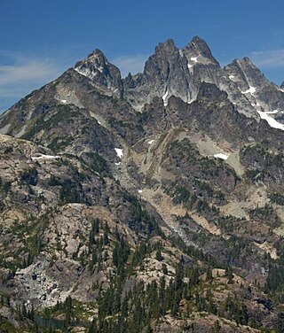
Lemah Mountain is a mountain peak in the Snoqualmie Crest, a part of the North Cascades Mountains, of the Washington state. It is located approximately 7.7 miles (12.4 km) from Snoqualmie Pass. Most noted for its five distinct summits, its name, Lemah, comes from the Chinook Jargon word Lemah, in turn derived from a French word, le main, meaning "hand". Lemah Mountain formed by rocks crumpled into mountains by the Cascadia subduction zone where the Juan de Fuca and North American plates meet.

Port San Juan is an inlet along the Pacific coast of Vancouver Island in British Columbia, Canada. It was formed from the San Juan and Leech River faults which flank the northern and southern slopes of the San Juan Valley. The San Juan and Gordon rivers empty into the inlet from the northeast.

The Leech River Fault extends across the southern tip of Vancouver Island in British Columbia, Canada, creating the distinctively straight, narrow, and steep-sided valley, occupied by Loss Creek and two reservoirs, that runs from Sombrio Point due east to the Leech River, and then turns southeast to run past Victoria. It is a thrust fault that marks the northernmost exposure of the Crescent Terrane, where basalt of the Metchosin Igneous Complex is dragged under Vancouver Island by the subducting Juan de Fuca Plate. About ten kilometres north the nearly parallel San Juan Fault marks the southern limit of rock of the Wrangellia terrane, which underlies most of Vancouver Island. Between these two northeast-dipping thrust faults are the Leech River Complex and the Pandora Peak Unit. These, along with the Pacific Rim Complex further up the coast, are remnants of the Pacific Rim Terrane which was crushed between Wrangellia and Siletzia. The contact between the bottom of Wrangellia and the top of the subducted PRT continues northwest along the coast as the West Coast Fault, and southeast towards Victoria as the Survey Mountain Fault. The Leech River Fault (LRF) extends off-shore towards Cape Flattery, where the Crescent—Pacific Rim contact continues northwest as the Tofino Fault (TF).

Sombrio Beach is a beach in the western Capital Regional District, British Columbia, Canada, southeast of the settlement of Port Renfrew. It is on the southwest coast of Vancouver Island on the Strait of Juan de Fuca, west of Sombrio Point, and astride the mouth of the Sombrio River. The beach is partly within Juan de Fuca Provincial Park and is traversed by the Juan de Fuca Marine Trail. It is on the traditional territory of the Pacheedaht Nation, and it was the site of a fishing and harvesting village called Qwa:qtłis.

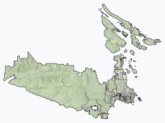
The San Juan Valley is a small valley located in the Capital Regional District of Vancouver Island in British Columbia, Canada.
The Sombrio River is a river in the Capital Regional District of British Columbia, Canada. Located on southern Vancouver Island, it flows to the Strait of Juan de Fuca on the Pacific Ocean at Sombrio Beach.
Jack Elliott Creek is a river in the Renfrew Land District of British Columbia, Canada. Located on southern Vancouver Island, it flows from its source to its mouth as a right tributary of Loss Creek.
Noyse Creek is a river in the Capital Regional District of British Columbia, Canada. Located on southern Vancouver Island, it flows from its source to its mouth as a right tributary of Loss Creek. The upper reaches of the creek were originally logged in 1967-1975 and replanted. The surrounding forest is now a prime example of a 50-year old second growth eco-system.
Gain Creek is a river in the Capital Regional District of British Columbia, Canada. Located on southern Vancouver Island, it flows from its source to its mouth as a right tributary of Loss Creek.