The Fraser River is the longest river within British Columbia, Canada, rising at Fraser Pass near Blackrock Mountain in the Rocky Mountains and flowing for 1,375 kilometres (854 mi), into the Strait of Georgia just south of the City of Vancouver. The river's annual discharge at its mouth is 112 cubic kilometres (27 cu mi) or 3,550 cubic metres per second (125,000 cu ft/s), and each year it discharges about 20 million tons of sediment into the ocean.
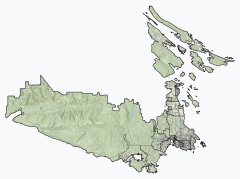
The Moira River is a river in Hastings County in eastern Ontario, Canada. It travels from its source in the centre of the county to the Bay of Quinte at the county seat Belleville.

The Skootamatta River is a river in the Lake Ontario drainage basin in Hastings and Lennox and Addington Counties in Ontario, Canada. It flows from Joeperry Lake to join the Moira River in Tweed. The river's name is thought to come from Ojibwa words meaning "burnt shoreline".

The Hayes River is a river in Northern Manitoba, Canada, that flows from Molson Lake to Hudson Bay at York Factory. It was historically an important river in the development of Canada and is now a Canadian Heritage River and the longest naturally flowing river in Manitoba.
The Magpie River is a river in Algoma District, northeastern Ontario, Canada, The river empties into Michipicoten Bay on Lake Superior near the town of Wawa. The river drains an area of about 1,900 square kilometres (734 sq mi).

Loss Creek is a river in the Capital Regional District of British Columbia, Canada. Located on southern Vancouver Island, it flows through a long, steep-sided valley to the Strait of Juan de Fuca on the Pacific Ocean.

The Pouce Coupe River is a major tributary of the Peace River in Alberta and British Columbia, Canada. Its name is officially spelled Pouce Coupé River, but it is commonly written without the acute accent.
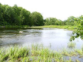
West Highland Creek is a river in Toronto, Ontario, Canada, and is a tributary of Highland Creek in the Lake Ontario drainage basin. The creek and its tributaries are entirely within the old City of Scarborough, and provide the watershed for the northwest of the city.
The Whitesand River is a river in the Unorganized Part of Thunder Bay District in Northwestern Ontario, Canada, part of the Hewitson River system.
Moore Creek is a creek in South Algonquin, Nipissing District in Northeastern Ontario, Canada. It is in the Saint Lawrence River drainage basin and is a left tributary of the Madawaska River.
The Tuya River is a major tributary of the Stikine River in northwest part of the province of British Columbia, Canada. From its source at High Tuya Lake in Tuya Mountains Provincial Park just south of Ash Mountain, the highest peak of the Tuya Range, the Tuya River flows south about 200 km (120 mi) to meet the Stikine River in the Grand Canyon of the Stikine. The Tuya River's main tributary is the Little Tuya River. The Tuya River divides the Tanzilla Plateau on the east from the Kawdy Plateau, to the northwest, and the Nahlin Plateau, to the southwest. All three are considered sub-plateaus of the Stikine Plateau. The Tuya River's watershed covers 3,575 km2 (1,380 sq mi), and its mean annual discharge is estimated at 36.9 m3/s (1,300 cu ft/s). The mouth of the Tuya River is located about 24 km (15 mi) northeast of Telegraph Creek, British Columbia, about 67 km (42 mi) southwest of Dease Lake, British Columbia, and about 210 km (130 mi) east of Juneau, Alaska. The Tuya River's watershed's land cover is classified as 35.7% shrubland, 31.4% conifer forest, 14.0% mixed forest, 7.2% herbaceous, and small amounts of other cover.

The Porcupine River is a river in the James Bay and Moose River drainage basins in the city of Timmins, Cochrane District in northeastern Ontario, Canada. It flows 32 kilometres (20 mi) from Porcupine Lake to its mouth at Night Hawk Lake, the source of the Frederick House River, a tributary of the Abitibi River.
The Whitefish River is a river in the James Bay and Moose River drainage basins in Cochrane and Timiskaming Districts in northeastern Ontario, Canada. It flows 75 kilometres (47 mi) from Mount Sinclair Lake to its mouth at Night Hawk Lake, the source of the Frederick House River, a tributary of the Abitibi River.
Moonbeam Creek is a stream in Thompson-Nicola Regional District in the Interior region of British Columbia, Canada. It is in the Pacific Ocean drainage basin and is a left tributary of the North Thompson River. The nearest communities to the mouth of the creek on British Columbia Highway 5 are Blue River 40 kilometres (25 mi) south and Valemount 50 kilometres (31 mi) north; the mouth of the creek is just downstream of confluence of the North Thompson River and the Albreda River, where the North Thompson River turns 90° right and heads south.
Canvas Creek is a stream in Kamloops Division Yale Land District in the Interior region of British Columbia, Canada. It is in the Pacific Ocean drainage basin and is a right tributary of the North Thompson River.

The North Sydenham River is a river in the municipalities of Saint Clair and Chatham-Kent in Southwestern Ontario, Canada. It is a tributary of the Sydenham River, and is part of the Great Lakes Basin.
Allen Creek is a stream in the municipality of Dysart et al, Haliburton County in Central Ontario, Canada. It is a tributary of Benoir Lake and is in the Ottawa River drainage basin.
Jack Elliott Creek is a river in the Renfrew Land District of British Columbia, Canada. Located on southern Vancouver Island, it flows from its source to its mouth as a right tributary of Loss Creek.
Noyse Creek is a river in the Capital Regional District of British Columbia, Canada. Located on southern Vancouver Island, it flows from its source to its mouth as a right tributary of Loss Creek. The upper reaches of the creek were originally logged in 1967-1975 and replanted. The surrounding forest is now a prime example of a 50-year old second growth eco-system.
Ruhl Creek is a stream in the township municipality of Brockton, Bruce County in Southwestern Ontario, Canada. It is in the Lake Huron drainage basin and is a right tributary of the Saugeen River.