The Moira River is a river in Hastings County in eastern Ontario, Canada. It travels from its source in the centre of the county to the Bay of Quinte at the county seat Belleville.

The Skootamatta River is a river in the Lake Ontario drainage basin in Hastings and Lennox and Addington Counties in Ontario, Canada. It flows from Joeperry Lake to join the Moira River in Tweed. The river's name is thought to come from Ojibwa words meaning "burnt shoreline".

The Hayes River is a river in Northern Manitoba, Canada, that flows from Molson Lake to Hudson Bay at York Factory. It was historically an important river in the development of Canada and is now a Canadian Heritage River and the longest naturally flowing river in Manitoba.
The Magpie River is a river in Algoma District, northeastern Ontario, Canada, The river empties into Michipicoten Bay on Lake Superior near the town of Wawa. The river drains an area of about 1,900 square kilometres (734 sq mi).

Loss Creek is a river in the Capital Regional District of British Columbia, Canada. Located on southern Vancouver Island, it flows through a long, steep-sided valley to the Strait of Juan de Fuca on the Pacific Ocean.

The Pouce Coupe River is a major tributary of the Peace River in Alberta and British Columbia, Canada. Its name is officially spelled Pouce Coupé River, but it is commonly written without the acute accent.
Moore Creek is a creek in South Algonquin, Nipissing District in Northeastern Ontario, Canada. It is in the Saint Lawrence River drainage basin and is a left tributary of the Madawaska River.

The Porcupine River is a river in the James Bay and Moose River drainage basins in the city of Timmins, Cochrane District in northeastern Ontario, Canada. It flows 32 kilometres (20 mi) from Porcupine Lake to its mouth at Night Hawk Lake, the source of the Frederick House River, a tributary of the Abitibi River.
The Whitefish River is a river in the James Bay and Moose River drainage basins in Cochrane and Timiskaming Districts in northeastern Ontario, Canada. It flows 75 kilometres (47 mi) from Mount Sinclair Lake to its mouth at Night Hawk Lake, the source of the Frederick House River, a tributary of the Abitibi River.
Peterson Creek is a river in the Ottawa River drainage basin in Lanark Highlands, Lanark County and North Frontenac, Frontenac County in eastern Ontario, Canada. It flows 9.5 kilometres (5.9 mi) from and unnamed lake to its mouth at the South Branch Clyde River.
The Partridge River is a river in the Yukon and British Columbia, Canada. It is in the Bering Sea drainage basin and is a tributary of Bennett Lake.
Moonbeam Creek is a stream in Thompson-Nicola Regional District in the Interior region of British Columbia, Canada. It is in the Pacific Ocean drainage basin and is a left tributary of the North Thompson River. The nearest communities to the mouth of the creek on British Columbia Highway 5 are Blue River 40 kilometres (25 mi) south and Valemount 50 kilometres (31 mi) north; the mouth of the creek is just downstream of confluence of the North Thompson River and the Albreda River, where the North Thompson River turns 90° right and heads south.
Canvas Creek is a stream in Kamloops Division Yale Land District in the Interior region of British Columbia, Canada. It is in the Pacific Ocean drainage basin and is a right tributary of the North Thompson River.
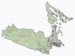
The Chenal Ecarté is a river in the municipalities of Saint Clair and Chatham-Kent in Southwestern Ontario, Canada. It is a left distributary of the St. Clair River that flows to Lake St. Clair, and thus is part of the Great Lakes Basin. The river also separates mainland Ontario from the northeast edge of Walpole Island, and the entire eastern edge of St. Anne Island, which both are part of the Walpole Island 46 reserve of the Walpole Island First Nation.

The North Sydenham River is a river in the municipalities of Saint Clair and Chatham-Kent in Southwestern Ontario, Canada. It is a tributary of the Sydenham River, and is part of the Great Lakes Basin.
Straggle Creek is a stream in the municipality of Dysart et al, Haliburton County in Central Ontario, Canada. It is a right tributary of Allen Creek and is in the Ottawa River drainage basin.
Allen Creek is a stream in the municipality of Dysart et al, Haliburton County in Central Ontario, Canada. It is a tributary of Benoir Lake and is in the Ottawa River drainage basin.
Jack Elliott Creek is a river in the Renfrew Land District of British Columbia, Canada. Located on southern Vancouver Island, it flows from its source to its mouth as a right tributary of Loss Creek.
Gain Creek is a river in the Capital Regional District of British Columbia, Canada. Located on southern Vancouver Island, it flows from its source to its mouth as a right tributary of Loss Creek.
Ruhl Creek is a stream in the township municipality of Brockton, Bruce County in Southwestern Ontario, Canada. It is in the Lake Huron drainage basin and is a right tributary of the Saugeen River.