Alameda County is a county located in the U.S. state of California. As of the 2020 census, the population was 1,682,353, making it the 7th-most populous county in the state and 21st most populous nationally. The county seat is Oakland. Alameda County is in the San Francisco Bay Area, occupying much of the East Bay region.

Kern County is a county located in the U.S. state of California. As of the 2020 census, the population was 909,235. Its county seat is Bakersfield.

San Bernardino County, officially the County of San Bernardino, is a county located in the southern portion of the U.S. state of California, and is located within the Inland Empire area. As of the 2020 U.S. Census, the population was 2,181,654, making it the fifth-most populous county in California and the 14th-most populous in the United States. The county seat is San Bernardino.

Monterey County, officially the County of Monterey, is a county located on the Pacific coast in the U.S. state of California. As of the 2020 census, its population was 439,035. The county's largest city and county seat is Salinas.

Stanislaus County is a county located in the San Joaquin Valley of the U.S. state of California. As of the 2020 census, its population was 552,878. The county seat is Modesto.

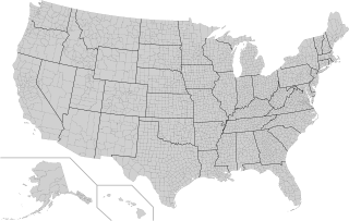
In the United States, a county or county equivalent is an administrative or political subdivision of a state that consists of a geographic region with specific boundaries and usually some level of governmental authority. The term "county" is used in 48 states, while Louisiana and Alaska have functionally equivalent subdivisions called parishes and boroughs, respectively. The specific governmental powers of counties vary widely between the states, with many providing some level of services to civil townships, municipalities, and unincorporated areas. Certain municipalities are in multiple counties; New York City is uniquely partitioned into five counties, referred to at the city government level as boroughs. Some municipalities have consolidated with their county government to form consolidated city-counties, or have been legally separated from counties altogether to form independent cities. Conversely, those counties in Connecticut, Rhode Island, eight of Massachusetts's 14 counties, and Alaska's Unorganized Borough have no government power, existing only as geographic distinctions.

The Districts of Pakistan ; are the third-order administrative divisions of Pakistan, below provinces and divisions, but forming the first-tier of local government. In total, there are 170 districts in Pakistan including the Capital Territory and the districts of Azad Kashmir and Gilgit Baltistan. These districts are further divided into Tehsils, Union Councils.

An urban area, built-up area or urban agglomeration is a human settlement with a high population-density and an infrastructure of built environment.

Kapurthala district is a district of Punjab state in northern India. The city of Kapurthala is the district headquarters.

Mohali district, officially known as Sahibzada Ajit Singh Nagar district or SAS Nagar district, is one of the twenty three districts of Punjab, a state in north-west India. It was formed in April 2006 and is 18th district of Punjab, created next to Pathankot district. This district was carved out of areas falling in Ropar and Patiala District. It is situated next to the union territory of Chandigarh and Panchkula district of Haryana.

The United States census of 2020 was the 24th decennial United States census. Census Day, the reference day used for the census, was April 1, 2020. Other than a pilot study during the 2000 census, this was the first U.S. census to offer options to respond online or by phone, in addition to the paper response form used for previous censuses.

Riverside County is a county located in the southern portion of the U.S. state of California. As of the 2020 census, the population was 2,418,185, making it the fourth-most populous county in California and the 10th-most populous in the United States. The name was derived from the city of Riverside, which is the county seat.

San Diego County, officially the County of San Diego, is a county in the southwestern corner of the U.S. state of California. As of the 2020 census, the population was 3,298,634, making it California's second-most populous county and the fifth-most populous in the United States. Its county seat is San Diego, the second-most populous city in California and the eighth-most populous city in the United States. It is the southwesternmost county in the 48 contiguous United States, and is a border county. It is also home to 18 Native American tribal reservations, the most of any county in the United States.

Jammu and Kashmir is a region administered by India as a union territory and consists of the southern portion of the larger Kashmir region, which has been the subject of a dispute between India and Pakistan since 1947, and between India and China since 1962. The Line of Control separates Jammu and Kashmir from the Pakistani-administered territories of Azad Kashmir and Gilgit-Baltistan in the west and north. It lies to the north of the Indian states of Himachal Pradesh and Punjab and to the west of Ladakh which is administered by India as a union territory.


