Jaipur | |
---|---|
Village and Mandal | |
Coordinates: 18°50′56″N79°34′32″E / 18.8490001°N 79.5755196°E Coordinates: 18°50′56″N79°34′32″E / 18.8490001°N 79.5755196°E | |
Country | |
State | Telangana |
District | Adilabad |
Languages | |
• Official | Telugu |
Time zone | UTC+5:30 (IST) |
PIN | |
Vehicle registration | TS |
Website | telangana |
Jaipur is a village and a mandal (or tehsil) in the Mancherial district, the northernmost district in the state of Telangana in south India. [1] [2]
A tehsil is an administrative division in some countries of South Asia. It is an area of land within a city or town that serves as its administrative centre, with possible additional towns, and usually a number of villages. The terms in India have replaced earlier geographical terms, such as pargana and thana.
Mancherial district is a district located in the northern region of the Indian state of Telangana. It was a part of the Adilabad district prior to the re-organisation of districts in the state. Mancherial District is carved out of erstwhile Adilabad District. It is surrounded by Komaram Bheem, Nirmal, Jagtial, Peddapalli and Bhupalpally districts of Telangana and with Maharashtra state.
Telangana is a state in India situated on the centre-south stretch of the Indian peninsula on the high Deccan Plateau. It is the eleventh largest state and the twelfth-most populated state in India with a geographical area of 112,077 km2 (43,273 sq mi) and 35,193,978 residents as per 2011 census. On 2 June 2014, the area was separated from the northwestern part of Andhra Pradesh as the newly formed 29th state with Hyderabad as its historic permanent capital. Its other major cities include Warangal, Nizamabad and Karimnagar. Telangana is bordered by the states of Maharashtra to the north, Chhattisgarh to the east, Karnataka to the west, and Andhra Pradesh to the east and south. The terrain of Telangana region consists mostly of hills, mountain ranges, and thick dense forests covering an area of 27,292 sq. km. As of 2019, the state of Telangana is divided into 33 districts.
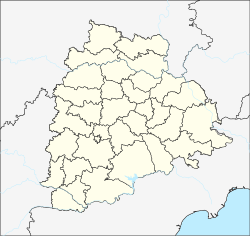
Jaipur is located at 18°50′56″N79°34′32″E / 18.8490001°N 79.5755196°E . [3]
As of 2011 [update] Census of India, Jaipur had a population of 2492. The total population constitute, 1254 males and 1238 females with a sex ratio of 987 females per 1000 males. 190 children are in the age group of 0–6 years, with child sex ratio of 979 girls per 1000 boys. The average literacy rate stands at 65.73%. [4]
The decennial Census of India has been conducted 15 times, as of 2011. While it has been undertaken every 10 years, beginning in 1872 under british Viceroy Lord Ripon, the first complete census was taken in 1881. Post 1949, it has been conducted by the Registrar General and Census Commissioner of India under the Ministry of Home Affairs, Government of India. All the censuses since 1951 were conducted under the 1948 Census of India Act. The last census was held in 2011. The next will be held in 2021. Also it was 1st conducted at the time of industrial revolutions too
Bellampalli is a town in Mancherial district of the Indian state of Telangana. It is a municipality and mandal headquarters of Bellampalli mandal of Bellampalli revenue division.
Mandamarri is a town and a municipality in Mancherial district in the Indian state of Telangana.
Naspur is muncipality and a suburb and mandal in Mancherial district of the Indian state of Telangana. Located the north bank of godavari river.
Huzurabad is a town in Huzurabad mandal of Karimnagar district of the Indian state of Telangana. It is the newly formed Municipality in the district It falls in semi urban city category and It is centrally located on Warangal and Karimnagar cities on NationalHighway563 which connects with the NH63 stretched between Jagdalpur(Chattisgarh) to Nizamabad (Telangana).
Nagari is a town in Chittoor district of the Indian state of Andhra Pradesh. It is the mandal headquarters of Nagari mandal in Chittoor revenue division.
Singapur is a census town in Mancherial district in the Indian state of Telangana.
Bheemini a Mandal in Mancherial district in the state of Telangana in India.
Dandepalle is a mandal in Adilabad district in the state of Telangana in India.
Nennal is a Mandal in Mancherial district in the state of Telangana in India.
Vemanapally is a Mandal in Adilabad district in the state of Telangana, in south India.
Burgampahad is the headquarters of Burgampahad mandal in Bhadradri Kothagudem district of the Indian state of Telangana.
Chennur is a census town in Mancherial district of the Indian state of Telangana. located on the banks of Godavari river. Generally Godavari flows from west to east but the Godavari river in Chennur flows towards the north for 5 Kosa (15 km) hence it is known as "Panchkosha Uttara Wahini". and It is a Municipal Council and the headquarters of Chennur mandal, It is located in Chennur mandal of Mancherial revenue division and Chennur is assembly constituency.
Bela is a village in the Adilabad district, the northernmost district in the state of Telangana in south India.
Dandepallol is a village in Mancherial district of the Indian state of Telangana. It is located in Dandepalle mandal of Mancherial revenue division.
Tandur is a mandal in Mancherial district of the Indian state of Telangana. It is located in Bellamaplly revenue division.
Nirmal district is a district located in the northern region of the Indian state of Telangana. It was a part of the Adilabad district prior to the re-organisation of districts in the state.
Velal is a village in Jaipur mandal, Mancherial district, Telangana state, India. It is the location of the Sri Gattu Mallanna Swamy Temple that is notable for the Maha Shivaratri festival.
Pegadapalli or Pegadapalle is a village in Jaipur Mandal in Mancherial District of the Indian state of Telangana. It belongs to the Telangana region.
This article about a location in Adilabad district, Telangana is a stub. You can help Wikipedia by expanding it. |