Jalumi War

Last updated
Jalumi War (Ogun Jalumi)
Part of Kiriji War
Date1 November 1878
Location
The towns of Ikirun, Inisa, and Iba in what is now Osun State, Nigeria
7°55′N4°40′E / 7.92°N 4.66°E / 7.92; 4.66
Result Ibadan victory; Eastern forces form the Ekiti-Parapo union; Ijebu and Egba regions declare war on Ibadan
Belligerents
Eastern Yoruba: Western Yoruba:
Commanders and leaders
  • Fabunmi of the Ekiti
  • Adeyale of Ila
  • Ogunmodede of Ijesha
  • Ayimoro of Ijesha
  • Ajia of Ilorin
  • Balogun Ajayi Ogboriefon of Ibadan
  • The Osi Ilori of Ibadan
Nigeria relief location map.jpg
Red pog.svg
Location within Nigeria

The Jalumi War, also called the Battle of Ikirun, was a battle that took place on 1 November 1878 in the north east of present-day Osun State, Nigeria. It was part of the larger conflict named the Ibadan War. The forces of Ibadan were victorious in detail over a force of rebellious Yorubas including soldiers from Ilorin, Ekiti, Ila and Ijesha. Despite the victory, fighting continued in the years that followed until the Ilorins were finally defeated in 1897.

Contents

Background

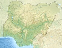
The Jalumi War took place in the hilly country of the northeast of Osun State in the area that includes Ikirun, Iba, Inisa, Mesin Ipole [1] (the present Imesi-ile ), Okuku and Eko-Ende. It was one of the series of civil wars in Yorubaland between 1793 and 1893. [2]

In June 1878, word came to Ibadan that the Ilorins had joined the Ekitis and Ilas in the alliance against them. [3] The Ekitis and Ila, now joined by the Ijeshas, laid siege to Ikirun. The Emir of Ilorin sent his forces, led by Ajia, to join his allies around Ikurin. They suffered a setback at Otan, but were reinforced and joined the siege. [4] When news reached Ibadan they were unable to send help until their army returned on 14 October 1878 from an expedition to Meko. The Balogun Ogboriefon was told to march to the aid of Ikirun with five days. [4]

It was the peak of the rainy season, and many Ibadan soldiers drowned crossing the Oba and Osun rivers. The Balogun had to share command with the Osi Ilori, a jealous and incompetent man. [5] On 30 October 1878, the Ikiruns had been pressed back and fought within their town walls. The Balogun of Ibadan entered the town the next day with his relief force. The attacking forces at this time were in three groups. The Ilorins under Ajia were to the northeast, near the Ikirun farms. The Ilas under Prince Adeyale and the Ekitis under Fabunmi were camped together nearby. The Ijeshas were to the east, led by Ayimoro and Ogunmodede, encamped in the small town of Iba. [6]

Battle

On 1 November 1878, the three besieging forces advanced against Ikirun. The Balogun left the Osi Ilori and his followers with the Ikiruns to fight the Ilorins, Ekitis and Ilas, while he took his soldiers to fight the Ijeshas. The first group was defeated, their leader the Osi Ilori was taken alive, and the rest retreated to Ikirun. [7] When the Balogun heard of the failure, he did not panic, but through clever maneuvers defeated and ruthlessly destroyed the Ijeshas. [7] He then returned, defeated the Ilorins and drove them out of their camp, but not before they had killed the Osi. He then defeated the demoralized Ekitis and Ilas. The victory was complete. [8]

The people of Ofa heard that the Ilorins were in retreat, and cut the bridge across the Otin River in their rear. The Ilorins were pushed into the flooded river by the victorious Ibadans, and thousands of men, women and horses drowned. [8] Jalumi means "drown in the river". The battle is so named because of the drowning of the forces of Ilorin. [9]

War charms were used by both sides in the Ibadan war, and some thought that the Muslim charms were more powerful than the traditional Yoruba ones. [10] According to a verbal report given one hundred years later, an actor named Ojelade from Inisha who lived in Okuku impressed the Balogun of Ibadan with his magical powers. He and his troupe were asked to help the Ibadan forces against the rebels. It is said that Ojelade disguised himself as a white man, which made the enemy flee since "they could not fight the ghost of a white man." The members of the troupe could not be hurt. They stretched out their arms, and the bullets were caught in their clothes and fell to the ground, where they were collected and shot back at the enemy. Through these and other actions the troupe helped with the victory. [11] A war cannon monument marking the end of the war is located at the Odo Otin River bank, Inisa, Odo Otin LGA till today.

Aftermath

Despite the Ibadan victory, the Ijebu refused to ally with them and the Egba would not give them passage to the coast. The Ekiti formed a military confederation called the Ekiti Parapo commanded by the Ogedengbe of Ilesha, and formed a tighter alliance with the Ijesha. The Ibadan found themselves fighting on three fronts. [12] Okuku, which had been under the control of Ilorin, now came within the control of Ibadan, which posted a representative to the town. [13] However the region continued to be harried by the Ilorins. This continued after the British had negotiated peace in 1893, and ended only after the British Captain Bower destroyed the main Ilorin army near Otan using rockets in 1896. Ilorin itself fell the next year. [14]

Related Research Articles

<span class="mw-page-title-main">Yorubaland</span> Cultural region of the Yoruba people in West Africa

Yorubaland is the homeland and cultural region of the Yoruba people in West Africa. It spans the modern-day countries of Nigeria, Togo and Benin, and covers a total land area of 142,114 km2 (54,871 sq mi). Of this land area, 106,016 km2 (74.6%) lies within Nigeria, 18.9% in Benin, and the remaining 6.5% is in Togo. Prior to European colonization, a portion of this area was known as Yoruba country. The geo-cultural space contains an estimated 55 million people, the majority of this population being ethnic Yoruba.

<span class="mw-page-title-main">Ekiti State</span> State of Nigeria

Ekiti State is a state in southwestern Nigeria, bordered to the North by Kwara State for 61 km, to the Northeast by Kogi State for 92 km, to the South and Southeast by Ondo State, and to the West by Osun State for 84 km. Named for the Ekiti people—the Yoruba subgroup that make up the majority of the state's population—Ekiti State was carved out from a part of Ondo State in 1996 and has its capital as the city of Ado-Ekiti.

<span class="mw-page-title-main">Osun State</span> State of Nigeria

Osun State, occasionally known as the State of Osun by the state government, is a state in southwestern Nigeria; bounded to the east by Ekiti and Ondo states for 84 km and for 78 km respectively, to the north by Kwara State for 73 km, to the south by Ogun State for 84 km and to the west by Oyo State, mostly across the River Osun. Named for the River Osun—a vital river which flows through the state—the state was formed from the southeast of Oyo State on 27 August 1991 and has its capital as the city of Osogbo.

<span class="mw-page-title-main">Olagunsoye Oyinlola</span> Nigerian politician and general (born 1951)

Ọlagunsoye Oyinlọla is a retired Nigerian general, he became governor of Osun State, Nigeria in May 2003, and was reelected in 2007. He was a member of the ruling Peoples Democratic Party (PDP). On 26 November 2010 a court of appeals nullified his election. He later defected to the APC shortly before the 2014 Osun State governorship election. He was former military administrator of Lagos State.

The Ìgbómìnà are a subgroup of the Yoruba ethnic group, which originates from the north central and southwest Nigeria. They speak a dialect called Ìgbómìnà or Igbonna, classified among the Central Yoruba of the three major Yoruba dialectical areas. The Ìgbómìnà spread across what is now southern Kwara State and northern Osun State. Peripheral areas of the dialectical region have some similarities to the adjoining Ekiti, Ijesha and Oyo dialects. Idoba is on Owode Ofaro Land

Òkè-Ìlá Òràngún is an ancient city in southwestern Nigeria that was capital of the middle-age Igbomina-Yoruba city-state of the same name.

Oba-Igbomina, is an ancient Igbomina town in northeastern Isin Local Government Area of Kwara State. It is one of the five related Yoruba towns named "Oba", the others being

Inisa is a city in Osun State in the south-western Nigeria. It is in the Yoruba cultural and ethnic region of the country, and is a trading center for cocoa and other agricultural products grown in the surrounding area. Its population as of 2007 was 180,553. Inisa had been from time immemorial, a warrior community. She was deeply involved in the struggle for the survival of Yoruba race during the period of internecine wars and particularly, during the onslaught and incursions of the Fulani into Yorubaland in the 19th century. Inisa people participated actively in the series of the wars. They fought in the Osogbo war of 1840, the Jalumi War of 1878, the Ofa war (1886–1890) and the Daparu war. The Ofa war resulted from the desire of Ilorin-fulani to avenge their defeat at the Jalumi on Ofa and the neighboring towns. The war was fought during the reign of Oba Oloyede Ojo, Otepola 1. They laid siege on Ofa for several years before Ofa was eventually sacked around 1890. The Daparu war resulted from the sack and fall of Ofa. The Fulani now desired to sack all the towns and villages between Ofa and Osogbo and bring them under the rule of the Fulani of Ilorin. They continued to attack, raid, and wage wars against the people. Only Inisa was courageous enough to face the Fulani forces, as the other towns and villages were deserted, seeking refuge at the Ibadan war camp in Ikirun.

Ejigbo is a prominent city in Yoruba Land and the headquarters of Ejigbo Local Government Area, one of the oldest local government areas of Osun State in Nigeria. Ejigbo is strategically placed in the middle of the region, as 35 kilometres (22 mi) north-east of Iwo, 30 km (19 mi) from Ogbomoso in the north and 24 km (15 mi) from Ede in the south-east. It is about 40 km (25 mi) north-west of Osogbo, the capital of Osun State, and about 95 km (59 mi) north-east of Ibadan. It is part of the Ede North/Ede South/Egbedore/Ejigbo federal constituency. The population is 138,357 according to the GeoNames geographical database. The average elevation is 426 metres (1,398 ft).

The Ilorin Emirate is a traditional state based in the city of Ilorin in Kwara State, Nigeria. It is largely populated by the Yoruba-speaking people, though the kingdom is a hybrid state due to the influence of the many other tribes that make up the city.

Ọba Timi Abibu Sàngólámì (Ọ)Lágúnjú was a Yoruba monarch of the town of Ede, and leader in the 19th century. He was the first Muslim Timi that Ede produced, he also belonged to the first generation of Yoruba Muslims who held high political office in the pre-colonial era and who used their positions to enhance the growth of his town, Ede and his religion, Islam. Indeed, Abibu Lagunju was the second Muslim Oba in Yorubaland given the fact that he was already on the throne for a couple of years when, in November 1857, the American Baptist Missionary, Reverend W.H. Clarke, visited Ede.

Okuku is a city in the Odo Otin Local Government Area of Ọṣun State, Nigeria.

The Otin River is a river in Osun State, Nigeria. It is impounded by the Eko-Ende Dam.

Eko-Ende is a community in the Ifelodun Local Government Area of Ọṣun State, Nigeria.

Iba is a community in the Ifelodun Local Government Area of Ọṣun State, Nigeria.

<span class="mw-page-title-main">Ekiti people</span> Sub-group of the Yorubas of West Africa

The Ekiti people are one of the largest historical subgroups of the larger Yoruba people of West Africa, located in Nigeria. They are classified as a Central Yoruba group, alongside the Ijesha, Igbomina, Yagba and Ifes. Ekiti State is populated exclusively by Ekiti people; however, it is but a segment of the historic territorial domain of Ekiti-speaking groups, which historically included towns in Ondo State such as Akure, Ilara-Mokin, Ijare, and Igbara-oke. Ogbagi, Irun, Ese, Oyin, Igasi, Afin and Eriti in the Akoko region, as well as some towns in Kwara State, are also culturally Ekiti, although belong in other states today.

The Kiriji War, also known as the Ekiti–Parapo War, was a 16-year-long civil war between the subethnic kingdoms of the Yoruba people, specifically divided between the Western Yoruba, which was mainly the Ibadan and Oyo-speaking Yorubas, and the Eastern Yoruba, who were the Ekiti people, Ijesha, Ijebu people, and others.

Imesi-ile is an ancient town in the northeastern part of the Obokun Local Government in Osun State, Nigeria. In the 19th century, this town was the epicenter of the Jalumi and the Kiriji wars among the Yoruba nations, and the foundation of peace among all warring Yoruba kingdoms, in Nigeria. The town is about one-hour drive from Ilesa; and less than an-hour drive from Osogbo, Osun state capital. It is located on an extremely high hill and almost entirely surrounded by mountains. Because of its unique location and its natural hills and caves within the mountains covering several miles; it was an easy choice for protections during wars in the historic past.

Fabunmi of Okemesi born Prince Fábùnmi Ìṣọ̀lá, also known as Orara l'ada, was a Yoruba warlord, chief and ultimately king. He was known to have singlehandedly triggered the longest civil war in Nigeria - the Kiriji War.

Igbajo is a town in the southwest of Nigeria, in the Boluwaduro Local Government Area in Osun State. Igbajo was founded in the 12th century. As of 2015 it had a population of 25,117. The majority of people in Igbajo are ethnically Yoruba.

References

Citations

  1. Johnson, Samuel (2012). The History of the Yorubas From the Earliest Times to the British Protectorate. Great Britain: Forgotten Books. p. 423. ISBN   9781642275308.
  2. The Jalumi War in Yoruba History, Odo-Otin.
  3. Johnson 2010, p. 424.
  4. 1 2 Johnson 2010, p. 426.
  5. Johnson 2010, p. 427.
  6. Johnson 2010, p. 428.
  7. 1 2 Johnson 2010, p. 430.
  8. 1 2 Johnson 2010, p. 434.
  9. Lakemfa 2010.
  10. McKenzie 1997, p. 109.
  11. Granqvist 1993, p. 149.
  12. Smith 1988, p. 144.
  13. Barber 1991, p. 50.
  14. Barber 1991, p. 61.

Sources