The 1991 Nepal census was a widespread national census conducted by the Nepal Central Bureau of Statistics.

Jorpati is a village and former Village Development Committee that is now part of Gokarneshwar Municipality in Kathmandu District in Province No. 3 of central Nepal. At the 2011 census it had a population of 84,567 making it one of the largest villages in the world. At the time of the 1991 Nepal census it had a population of 10,796 and had 1988 households in it.

Thankot is a village and former Village Development Committee that is now part of Chandragiri Municipality in Kathmandu District in Province No. 3 of central Nepal. It lies on the lap of Chandragiri hill. According to the 2011 Nepal census it has a population of 12047 and has 2820 households.

Tinthana is a village and former Village Development Committee that is now part of Chandragiri Municipality in Kathmandu District in Province No. 3 of central Nepal. At the time of the 2011 Nepal census it had a population of 9,726.

Saudiyar is a town and Village Development Committee in Dang Deokhuri District in the Rapti Zone of south-western Nepal. At the time of the 1991 Nepal census it had a population of 8,052 persons living in 1067 individual households.

Bajung is a village development committee in Parbat District in the Dhawalagiri Zone of Western Development Region, Nepal.It is surrounded by Deupurkot in the north-east, Tilahar in south-east, Durlung in South-west and Kyang in North-west. It is popularly said to be extended from the top of Maidan, a hill-top with historical identity to the basin of Modi River. At the time of the 2011 Nepal census it had a population of 4228 people living in 1,076 individual households.

Nalma is a village development committee in Lamjung District in the Gandaki Zone of northern-central Nepal. At the time of the 1991 Nepal census it had a population of 2082 people living in 409 individual households. The villages of Nalma VDC are as follows:
- Jyarkhang
- Bakhrijagat
- Syare, Lausibot, Kochme
- Puran Gaun
- Gairi Gaun
- Danda Gaun
- Bartu
- Chodo khora
- Fedi
- Ramche Khola

Chhinnamasta is a village development committee in Saptari District in the Sagarmatha Zone of south-eastern Nepal. At the time of the 2011 Nepal census it had a population of 10,136 people living in 1,916 individual households.
Mahadeva is a village development committee in Saptari District in the Sagarmatha Zone of south-eastern Nepal. At the time of the 2011 Nepal census it had a population of 5,187 people living in 1,135 individual households.

Katahariya is a Municipality in Rautahat District in the Narayani Zone of south-eastern Nepal since September 2017.Before September 2017, Katahariya was one of the Village Development Committees with 8 wards. In the time of the 1991 Nepal census it had a population of 4619 people living in 835 individual households.One of the famous temple of katahariya is Boudhimai temple.
Katahariya is famous for its vegetables and cattle market. It's also known as Katahariya Bazaar. It has a well-maintained Farmers' market(Vegetable) and Cattle(domestic-animal) market. Katahariya is a fast-growing VDC, the main occupations of local people being business and farming. Katahariya became Municipality since September 2017 by merging different Gaupalika such as Hathiyahi, Birti Prastoka, Bhasedhawa, Bagahi, Pipra Pokhariya, etc. Now there are 9 wards in this Municipality. In the recent local level election conducted on 18 Sep, 2017, Shiyaram Kushwaha (FIROZ) became the Mayor from Maoist party by winning from about 1200 more votes from Nepali congress.

Sripur Chhatiwan a village development committee in Makwanpur District in the Narayani Zone of southern Nepal. At the time of the 2011 Nepal census it had a population of 21,523 holding its position to highest population rank among the list of village development committees of Nepal.

Pokhariya is a municipality in Parsa District in the Narayani Zone of southern Nepal. At the time of the 2011 Nepal census it had a population of 6,995 people living in 1,015 individual households.

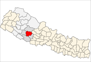
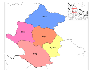
Jankot is the village development committee in Rolpa District in the Rapti Zone of north-eastern Nepal. At the time of the 2011 Nepal census it had a population of 2853 people living in 599 individual households.

Jang is a village development committee in Rukum District in the Rapti Zone of western Nepal. At the time of the 2011 Nepal census it had a population of 3084 people living in 578 individual households.

Jhula is a village development committee in Rukum District in the Rapti Zone of western Nepal. At the time of the 2011 Nepal census it had a population of 3334 people living in 686 individual households.

Pathari Sanischare (पथरी-शनिश्चरे) is a Municipality in Morang District in the Koshi Zone of south-eastern Nepal. It was formed by merging two existing village development committees i.e. Pathari and Sanischare in May 2014.
Nepal conducted a widespread national census in 2011 by the Nepal Central Bureau of Statistics. Working with the 58 municipalities and the 3915 Village Development Committees at a district level, they recorded data from all the municipalities and villages of each district. The data included statistics on population size, households, sex and age distribution, place of birth, residence characteristics, literacy, marital status, religion, language spoken, caste/ethnic group, economically active population, education, number of children, employment status, and occupation.
The 2001 Nepal census was conducted by the Nepal Central Bureau of Statistics. According to Census, the population of Nepal in 2001 was 23,151,423. Working with Nepal's Village Development Committees at a district level, they recorded data from all the main towns and villages of each district of Nepal. The data included statistics on population size, households, sex and age distribution, place of birth, residence characteristics, literacy, marital status, religion, language spoken, caste/ethnic group, economically active population, education, number of children, employment status, and occupation.

Balan-Bihul is a rural municipality in Saptari District in the Sagarmatha Zone of south-eastern Nepal. At the time of the 2017 Nepal census it had a population of 26,068 people living in 6560 individual households.


