Jinawang

Last updated
Jinabang
जिनाबाङ
Nepal adm location map.svg
Red pog.svg
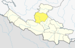
Jinabang
Location in Nepal
Coordinates: 28°25′N82°24′E / 28.41°N 82.40°E / 28.41; 82.40
CountryFlag of Nepal.svg    Nepal
Zone Rapti Zone
District Rolpa District
Population
 (2011) [1]
  Total5,156
Time zone UTC+5:45 (Nepal Time)

Jinabang is a village development committee in Rolpa District in the Rapti Zone of north-eastern Nepal. At the time of the 2011 Nepal census it had a population of 5156 people living in 979 individual households.there peoples are worked in agricultural such as kiwi,apple,potato.

Related Research Articles

<span class="mw-page-title-main">Village development committee (Nepal)</span> Former lower administrative part of Nepals local development ministry

A village development committee in Nepal was the lower administrative part of its Ministry of Federal Affairs and Local Development. Each district had several VDCs, similar to municipalities but with greater public-government interaction and administration. There were 3,157 village development committees in Nepal. Each village development committee was further divided into several wards depending on the population of the district, the average being nine wards.

Mulpani is a village and former Village Development Committee that is now part of Kageshwari-Manohara Municipality in Kathmandu District in Province No. 3 of central Nepal. Mulpani was previously known as Bhaimal, meaning "no fear". At the time of the 1991 Nepal census it had a population of 4,718 living in 843 households. The main occupation of the people living in this village is agriculture. Mulpani is surrounded by Bagmati and Manohara river. Mulpani is famous for the Nepal's biggest International Cricket Ground, known as Mulpani Cricket Stadium, which is under construction. In the recent years, Mulpani has seen much change in its infrastructure and people as well. The main occupation in Mulpani was agriculture but now employment is more diverse.

Phu, Nepal is a village development committee in Manang District in the Gandaki Zone of northern Nepal. At the time of the 2011 Nepal census it had a population of 176 people living in 36 individual households.

<span class="mw-page-title-main">Ghyaru</span> Village development committee in Gandaki Zone, Nepal

Ghyaru is a village development committee in Manang District in the Gandaki Zone of northern Nepal. At the time of the 2011 Nepal census it had a population of 71 people living in 33 individual households.

<span class="mw-page-title-main">Khangsar</span> Village development committee in Gandaki Zone, Nepal

Khangsar is a village development committee in Manang District in the Gandaki Zone of northern Nepal. At the time of the 2011 Nepal census it had a population of 257 people in 58 individual households.

<span class="mw-page-title-main">Nar, Nepal</span> Village development committee in Gandaki Zone, Nepal

Nar is a village development committee in Manang District in the Gandaki Zone of northern Nepal. In the 2011 Nepal census it had a population of 362 people, living in 86 individual households.

<span class="mw-page-title-main">Pisang</span> Village development committee in Gandaki, Nepal

Pisang is a village development committee in Manang District in the Gandaki Zone of northern Nepal. At the time of the 2011 Nepal census it had a population of 307 people living in 105 individual households. The village is located in the Marshyangdi River valley, directly south of Pisang Peak, north of Annapurna II, and west of Paungda Danda.

Chhinnamasta is a village development committee in Saptari District in the Sagarmatha Zone of south-eastern Nepal. At the time of the 2011 Nepal census it had a population of 10,136 people living in 1,916 individual households.

Kalyanpur is a former village development committee, and now headquarters of Khadak Municipality in Saptari District in the Sagarmatha Zone of south-eastern Nepal. At the time of the 2011 Nepal census it had a population of 8,724 people living in 1,705 individual households. This is one of the well-developed village development committee in Saptari District. Kalyanpur is a village development committee in Saptari District in the Sagarmatha Zone of south-eastern Nepal. At the time of the 2011 Nepal census it had a population of 8724 people living in 1705 individual households. This is one of the well-developed village development committee in Saptari District. VDC Name :Kalyanpur VDC Households :1705 District Name :Saptari Area in Square Km :19.1 Zone :Sagarmatha Development Region :Eastern Ecological Zone :Terai Ecological Sub Zone :Eastern Terai Male :4144 Female :4580 Total Population :8724 Population Density :457 per km2

<span class="mw-page-title-main">Mahadeva Rural Municipality</span> Former Village Development Committee in Nepal

Mahadeva is a rural municipality formerly, village development committee in Saptari District in the Sagarmatha Zone of south-eastern Nepal. It is located on the eastern side of the district headquarter Rajbiraj. At the time of the 2011 Nepal census it had a population of 5,187 people living in 1,135 individual households.

<span class="mw-page-title-main">Jelbang</span> Village development committee in Lumbini Province, Nepal

Jelbang, also known as Jelbang, is a name of Nepalese village in Rolpa District of the Lumbini Province, and is situated at the Southern Part of the Jaljala Mountain. At the time of the 2011 Nepal census it had a population of 2896 people living in 510 individual households. The town is populated by Magars.

Jaimakasala is a village development committee in Rolpa District in the Rapti Zone of north-eastern Nepal. At the time of the 2011 Nepal census it had a population of 3020 people living in 580 individual households.

Jankot is the village development committee in Rolpa District in the Rapti Zone of north-eastern Nepal. At the time of the 2011 Nepal census it had a population of 2853 people living in 599 individual households.

Jaulipokhari is a village development committee in Rolpa District in the Rapti Zone of north-eastern Nepal. At the time of the 1991 Nepal census it had a population of 3555 people living in 654 individual households.

Jedwang is a village development committee in Rolpa District in the Rapti Zone of north-eastern Nepal. At the time of the 2011 Nepal census it had a population of 3802 people living in 737 individual households.

Jhenam is a village development committee in Rolpa District in the Rapti Zone of north-eastern Nepal. At the time of the 2011 Nepal census it had a population of 5516 people living in 1062 individual households.

Nuwakot is a former village development committee in Western Rukum District in Karnali Province of western Nepal. At the time of the 2011 Nepal census it had a population of 5709 people living in 1059 individual households..

Pathari Shanishchare (पथरी-शनिश्चरे) is a Municipality in Morang District in the Koshi Zone of south-eastern Nepal. It was formed by merging three existing village development committees i.e. Hasandaha, Pathari and Sanischare in May 2014.

Nepal conducted a widespread national census in 2011 by the Nepal Central Bureau of Statistics. Working with the 58 municipalities and the 3,915 Village Development Committees at a district level, they recorded data from all the municipalities and villages of each district. The data included statistics on population size, households, sex and age distribution, place of birth, residence characteristics, literacy, marital status, religion, language spoken, caste/ethnic group, economically active population, education, number of children, employment status, and occupation.

Rajgadh is a rural municipality in Saptari District in the Sagarmatha Zone of south-eastern Nepal. At the time of the 2021 Nepal census it had a population of 32,975 people living in 5,687 individual households.

References

  1. "National Population and Housing Census 2011(Village Development Committee/Municipality)" (PDF). Government of Nepal. National Planning Commission of Nepal. November 2012. Archived from the original (PDF) on 2018-10-05. Retrieved 2017-01-05.