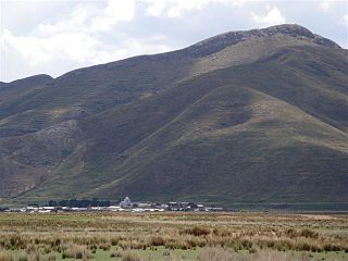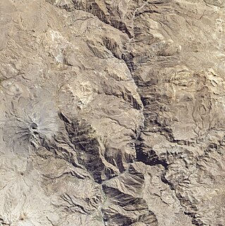
Pukarani is a mountain with an archaeological site of the same name in the Andes of Peru, about 4,301.9 m (14,114 ft) high. It is located in the Puno Region, Lampa Province, Nicasio District.

Choquepirhua is a mountain in the Chila mountain range in the Andes of Peru, about 5,400 metres (17,717 ft) high. It lies in the Arequipa Region, Castilla Province, on the border of the districts of Chachas and Choco. Choquepirhua is situated south of Chila.

Pirhuane is a 4,994-metre-high (16,385 ft) mountain in the Moquegua Region in the Andes of Peru. It is situated in the General Sánchez Cerro Province, Ubinas District. Pirwani is situated northeast of the active volcano Ubinas. Like the mountains south of Pirhuane, Pacoorcco and Huitoni, Pirhuane lies on the eastern border of the buffer zone of the Salinas and Aguada Blanca National Reservation.

Qullqi is a 5,038-metre-high (16,529 ft) mountain in the Andes of Peru. It is situated in the Lima Region, Huarochirí Province, Huanza District. Qullqi lies east of the Qiwlla River (Quiula) and west of the Qullqi valley (Collque). One of the nearest places is Qullqi (Collque) southeast of the mountain.

Qullqi Q'awa is a 5,207-metre-high (17,083 ft) mountain in the Andes of Peru. It is situated in the Cusco Region, Espinar Province, in the west of the Condoroma District. Qullqi Q'awa lies near the border with the Puno Region, southwest of Sawanani Lake (Saguanani) and southeast of Chuqi Pirwa.

Quellhuacota is a mountain in the Vilcanota mountain range in the Andes of Peru, about 5,300 metres (17,388 ft) high. It is located in the Cusco Region, Canchis Province, San Pablo District, and in the Puno Region, Melgar Province, Nuñoa District. It is situated southwest of the mountains Jochajucho, Jatun Sallica and Wiqu, and northeast of the mountain Sampu.

Pirwani is a mountain in the Andes of Bolivia, about 4,840 metres (15,879 ft) high. It is situated in the Potosí Department, Antonio Quijarro Province, in the east of the Uyuni Municipality. Janq'u Qullu lies south-west of the mountains Warachi Qullu and Janq'u Qullu. It is situated east of the Chillawa River (Chillahua) which flows to the south.

Chuqi Pirwa is a mountain in the Andes of Peru, about 5,200 m (17,100 ft) high. It is situated in the Cusco Region, Espinar Province, Condoroma District, and in the Puno Region, Lampa Province, Ocuviri District. Chuqi Pirwa lies southwest of Sawanani Lake (Saguanani) and northwest of Qullqi Q'awa.

Qina Mich'ini is a mountain in the Andes of southern Peru, about 4,800 metres (15,748 ft) high. It is situated in the Moquegua Region, Mariscal Nieto Province, Carumas District. Qina Mich'ini lies southwest of the mountain named Wilaquta and southeast of Phaq'u Tanka, Arichuwa and Qhini Jamach'ini.

Jat'u K'achi is a mountain in the Andes of southern Peru, about 5,200 metres (17,060 ft) high. It is located on the border of the Moquegua Region, General Sánchez Cerro Province, Ichuña District, and the Puno Region, Puno Province, San Antonio District. Jat'u K'achi lies west of the mountain Chuqipata, northeast of Millu and southeast of Pura Purani.

Pirhuane is a mountain in the northern extensions of the Vilcanota mountain range in the Andes of Peru, about 4,800 metres (15,748 ft) high. It is situated in the Cusco Region, Quispicanchi Province, Ocongate District. Pirhuane lies northeast of the lake named Singrenacocha, between the Ayacachi group in the north and the main range in the south.

Sumpiruni is a 5,063-metre-high (16,611 ft) mountain in the Vilcanota mountain range in the Andes of Peru. It is situated in the Puno Region, Carabaya Province, Macusani District. Sumpiruni lies west of Catautira. This is where the Ninahuisa River originates. It flows along the southern slopes of Catautira before it turns to the northeast.

Quellhuacotarriti is a mountain in the Carabaya mountain range in the Andes of Peru, about 5,200 m (17,100 ft) high. It is located in the Puno Region, Carabaya Province, Macusani District. Quellhuacotarriti lies southwest of Allincapac and south of Vela Cunca.

Pirhuani is a mountain in the Vilcanota mountain range in the Andes of Peru, about 5,000 m (16,000 ft) high. It is located in the Puno Region, Carabaya Province, Corani District. Pirhuani lies southwest of Macho Ritti. It is situated at the Lajamayu valley.

Pirwani is a mountain in the Andes of Peru, about 5,000 m (16,000 ft) high. It is located in the Puno Region, Melgar Province, on the border of the districts of Antauta and Nuñoa. Pirwani lies south of Kuntur Pata. The Pirwani River originates near the mountain. It is a right tributary of the Crucero River whose waters flow to Lake Titicaca.

Qina Mich'i is a 5,030-metre-high (16,500 ft) mountain in the Andes of southern Peru. It is located in the Tacna Region, Candarave Province, Candarave District. Qina Mich'i lies north of Such'i Lake (Suches). Jichu Qullu is the name of the mountain southwest of it.

Pirwa is a mountain in the Andes of Peru, about 5,125 m (16,814 ft) high. It is located in the Arequipa Region, Caylloma Province, Tisco District. It lies northwest of Jañuma Pirwa.

Chuqi Pirwa is a mountain in the Andes of Peru, about 4,800 m (15,700 ft) high. It is located in the Arequipa Region, Caylloma Province, Tisco District, and in the Espinar Province, Yauri District. It lies northeast of Jañuma Pirwa and east of Pirwa.

Kirani is a mountain in the Andes of Peru, about 5,000 metres (16,404 ft) high. It is located in the Puno Region, Lampa Province, Paratia District. Kirani lies northeast of Yanawara, east of Ananta Lake.

Pirwata is a 5,060-metre-high (16,600 ft) mountain in the Bolivian Andes. It is located in the Cochabamba Department, on the border of the Ayopaya Province, Morochata Municipality, and the Quillacollo Province, Quillacollo Municipality.


