
Ste-Anne-du-Nord River is a tributary of the northwest shore of the Saint Lawrence River where it flows at the height of Beaupré. This river flows in Capitale-Nationale, in the province of Quebec, Canada. The river passes through Canyon Sainte-Anne before joining the Saint Lawrence River at Beaupré.

The Rivière aux Écorces is a tributary of the Pikauba River, in the province of Quebec, in Canada. Its course successively crosses the regional county municipalities (MRC) of:
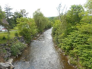
The Rivière aux Canots is a tributary of the Rivière aux Écorces, in the province of Quebec, in Canada. Rivière aux Canots crosses the MRC of:
The rivière aux Écorces du Milieu is a tributary of the rivière aux Écorces, flowing in the unorganized territories of Lac-Jacques-Cartier, the La Côte-de-Beaupré Regional County Municipality, in the administrative region of Capitale-Nationale, in the province from Quebec, to Canada. The course of the Rivière aux Écorces du Milieu crosses the western part of the Laurentides Wildlife Reserve.
The rivière aux Écorces North-East is a tributary of the rivière aux Écorces, flowing in the unorganized territories of Lac-Jacques-Cartier, the La Côte-de-Beaupré Regional County Municipality, in the administrative region of Capitale-Nationale, in the province of Quebec, Canada. The course of the rivière aux Écorces North-East crosses the western part of the Laurentides Wildlife Reserve.
The Malbaie is a freshwater body located in the administrative region of Capitale-Nationale, in the province of Quebec, in Canada. Lac Malbaie straddles the regional county municipalities (RCMs) of:
The rivière du Camp Brûlé is a tributary of the east bank of the rivière des Neiges, flowing in the unorganized territory of Lac-Jacques-Cartier, in the La Côte-de-Beaupré Regional County Municipality, in the administrative region of Capitale-Nationale, in the province of Quebec, in Canada.
The Savane River is a tributary of the east bank of the rivière des Neiges, flowing in the unorganized territory of Lac-Jacques-Cartier, in the La Côte-de-Beaupré Regional County Municipality, in the administrative region of Capitale-Nationale, in the province of Quebec, in Canada.
The Rivière des Sept Crans is a tributary of the rivière aux Chiens. It flows on the north shore of the Saint Lawrence river, in the unorganized territory of Lac-Jacques-Cartier, as well as the municipalities of Beaupré and Château-Richer, in the La Côte-de-Beaupré Regional County Municipality in the administrative region of Capitale-Nationale, in the province of Quebec, in Canada.
The rivière aux Chiens flows south, on the north shore of the Saint Lawrence river, in the municipalities of Beaupré and Château-Richer, in the La Côte-de-Beaupré Regional County Municipality, in the administrative region of Capitale-Nationale, in the province from Quebec, to Canada. It empties into the St. Lawrence River at Beaupré.
The lac Savane is a body of fresh water located northeast of the city of Quebec, in the administrative region of Capitale-Nationale, in the province of Quebec, in Canada. This body of water straddles the regional county municipalities of:
The Savane du Nord river is a tributary of the Sainte-Anne River, flowing on the north bank of the Saint Lawrence River. This river successively crosses the unorganized territory of Lac-Pikauba and the city of Baie-Saint-Paul, in the Charlevoix, in the administrative region of Capitale-Nationale, in the province of Quebec, in Canada. The upper part begins in the southeast of the territory of the Laurentides Wildlife Reserve; then its course leaves this reserve to follow on the south side the limit of the reserve.
The rivière du Mont Saint-Étienne is a tributary of the Sainte-Anne river, flowing on the north bank of the Saint Lawrence River, in the unorganized territory of Lac-Jacques-Cartier and the municipality of Saint-Ferréol-les-Neiges, in the La Côte-de-Beaupré Regional County Municipality, in the administrative region of Capitale-Nationale, in the province of Quebec, in Canada.
The Petite rivière Savane is a tributary of the Sainte-Anne River, flowing on the north bank of the Saint Lawrence River, in the territory unorganized from Lac-Jacques-Cartier, in the La Côte-de-Beaupré Regional County Municipality, in the administrative region of Capitale-Nationale, in the province of Quebec, in Canada.
The Rivière des Roches is a tributary of the west bank of the Sainte-Anne River, on the north bank of the Saint Lawrence River. This river flows in the unorganized territory of Lac-Jacques-Cartier and in the municipality of Saint-Ferréol-les-Neiges, in the La Côte-de-Beaupré Regional County Municipality, in the administrative region of Capitale-Nationale, in the province of Quebec, in Canada.
The Rivière Brûlé is a tributary of the Sainte-Anne River, flowing on the north bank of the Saint Lawrence River, in the non-territory organized from Lac-Jacques-Cartier, in the La Côte-de-Beaupré Regional County Municipality, in the administrative region of Capitale-Nationale, in the province of Quebec, in Canada.
The lac Allioux is a freshwater body located northeast in of Quebec City, in the unorganized territory of Lac-Jacques-Cartier, in the La Côte-de-Beaupré Regional County Municipality, in the administrative region of Capitale-Nationale, in the province of Quebec, in Canada. This body of water is part of the Laurentides Wildlife Reserve.
The Petite rivière Malbaie is a tributary of the east bank of the Malbaie River, flowing in the unorganized territory of Lac-Pikauba, in the Charlevoix Regional County Municipality, in the administrative region of Capitale-Nationale, in the province of Quebec, in Canada. This watercourse crosses zec des Martres and Grands-Jardins National Park.
The Rivière des Îlets is a tributary of the southern bank of the upper part of the Rivière du Gouffre, flowing in the unorganized territory of Lac-Pikauba, in the Charlevoix Regional County Municipality, in the administrative region of Capitale-Nationale, in the province of Quebec, in Canada.
Le Gros Bras is a tributary of the eastern bank of the lower part of the rivière du Gouffre, flowing in the unorganized territory of Lac-Pikauba and the municipality of Saint-Urbain, in the Charlevoix Regional County Municipality, in the administrative region of Capitale-Nationale, in the province of Quebec, in Canada. The upper part of this watercourse begins in Grands-Jardins National Park.
