Outlet of lake Peter and tributariesKdu Moineau, de la Statue and Paludeen;
outlet of lakes des Anophèles and Vert;
outlet of lake Fern;
outlet of lakes Belhumeux and Tiros.
•right
(upstream)
Outlet of Lake Youkata;
outlet of lakes du Sud, Blois, Téléjac,
Épistakis, Kariba and Grégoire;
outlet of lake Bouleau;
outlet of lake des Quinze and its tributaries.
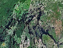
The Jean-Pierre River is a tributary of the Jean-Pierre Bay, on the south shore of the Gouin Reservoir, flowing into the territory of the town of La Tuque, into the administrative region of Mauricie, in Quebec, in Canada.
The Jean-Pierre River flows successively into the townships of Dansereau, Bureau and Leblanc, south of the Gouin Reservoir and on the west side of the upper Saint-Maurice River. Forestry is the main economic activity of this valley; recreational tourism activities, second.
The route 405, connecting the Gouin Dam to the village of Wemotaci, Quebec by the west bank of the Saint-Maurice River, serves the Jean-Pierre River Valley and also the peninsula that stretches north on 30.1 kilometres (18.7mi) in the Gouin Reservoir. Some secondary forest roads are in use nearby for forestry and recreational tourism activities.
The surface of the Jean-Pierre River is usually frozen from mid-November to the end of April, however, safe ice circulation is generally from early December to late March.
Geography
The adjacent hydrographic slopes of the Jean-Pierre River are:
The Jean-Pierre River originates at the mouth of Machinila Lake (length: 0.5 kilometres (0.31mi); altitude: 500 metres (1,600ft)). The mouth of this lake head is located at:
4.2 kilometres (2.6mi) south-east of the mouth of the Jean-Pierre River (confluence with Jean-Pierre Bay of Gouin Reservoir);
132 kilometres (82mi) north-west of downtown La Tuque.[2]
From the mouth of the head lake, the course of the Jean-Pierre River flows over 23.4 kilometres (14.5mi) according to the following segments:
5.1 kilometres (3.2mi) north-east, then north across Lac Jean-Pierre (length: 2.3 kilometres (1.4mi); altitude: 474 metres (1,555ft)) on its full length, to its mouth. Note: Lake Jean-Pierre straddles the townships of Dansereau and Bureau;
3.3 kilometres (2.1mi) north across Lake Sylvain (length: 1.0 kilometre (0.62mi); altitude: 474 metres (1,555ft)) on its full length, then the Minister's Lake (length: 3.9 kilometres (2.4mi); altitude: 465 metres (1,526ft)) on 1.8 kilometres (1.1mi), to its mouth;
4.0 kilometres (2.5mi) northwesterly to the mouth of Lake Peter (length: 2.9 kilometres (1.8mi); altitude: 425 metres (1,394ft)) that the current crosses over a hundred meters;
3.2 kilometres (2.0mi) north-east between the mountains, to the outlet of South Lake (coming from the East);
7.4 kilometres (4.6mi) southwesterly, passing between two mountains, cutting a forest road, then crossing a lake (length: 3.5 kilometres (2.2mi); altitude: 413 metres (1,355ft)) formed by a widening of the river, to the eastern limit of the township of Leblanc;
0.4 kilometres (0.25mi) northwesterly in the Township of Leblanc to its mouth.[3]
The confluence of the "Jean-Pierre River" with the Gouin Reservoir is located at:
The Jean-Pierre River flows on the eastern shore of Jean-Pierre Bay (length: 7.9 kilometres (4.9mi) advancing south), straddling the townships of Aubin and Leblanc. From this mouth, the current flows northward on 7.4 kilometres (4.6mi) through Jean-Pierre Bay; then, the current flows eastward on 12.0 kilometres (7.5mi) across the Kikendatch Bay to the Gouin Dam. From there, the current flows along the Saint-Maurice River to Trois-Rivières, where it flows on the North Shore of the St. Lawrence River.
Toponymy
The term "Jean-Pierre" is a first name of French origin.
The Wapous River is a tributary of the Gouin Reservoir, flowing in the territory of the town of La Tuque, in the administrative region of Mauricie, in Quebec, in Canada.
The Atimokateiw River is a tributary of the south shore of the Gouin Reservoir, flowing into the territory of the town of La Tuque, in the area of Mauricie, Quebec, Canada.
The Toussaint River is a tributary of the north shore of the Gouin Reservoir, flowing in Quebec, in Canada in the administrative region of:
The Kakospictikweak River is a tributary of the North Shore of Gouin Reservoir, sinking in Quebec, Canada in the administrative region of Mauricie of:
The Pokotciminikew River is a tributary of the North Shore of the Kakospictikweak River, flowing into the territory of the town of La Tuque, in the administrative region of Mauricie, in Quebec, Canada. The course of this river successively crosses the cantons of Pfister, Balete and Mathieu.
The Leblanc River is a tributary of the De La Galette River, flowing on the south shore of the Gouin Reservoir, in the territory of the town of La Tuque, in the Mauricie administrative region, in Quebec, in Canada.
The Lac de la Galette is a freshwater body of the town of La Tuque, in Haute-Mauricie, forming a bay on the south shore of Gouin Reservoir and west of the upper Saint-Maurice River, in the administrative region of Mauricie, in the province of Quebec, in Canada.
The De La Galette River is a tributary of the southern shore of Gouin Reservoir, flowing into the territory of the town of La Tuque, in the administrative region of the Mauricie, in Quebec, in Canada.
The Kikendatch Bay is a freshwater body that leads to the Gouin Reservoir, in the territory of La Tuque, in Haute-Mauricie, in the administrative region of Mauricie, in the province of Quebec, in Canada.
The Jean-Pierre Bay is a freshwater body of the south-eastern part of the Gouin Reservoir, in the territory of the town of La Tuque, in Haute-Mauricie, in the administrative region of Mauricie, in the province of Quebec, in Canada.
The Lake Brochu is a vast expanse of freshwater in the south-eastern part of the Gouin Reservoir, in the territory of the town of La Tuque, in the administrative region of Mauricie, in the province of Quebec, in Canada.
The Bouzanquet Bay is a vast freshwater body of the south-eastern part of the Gouin Reservoir, in the territory of the town of La Tuque, in Haute-Mauricie, in the administrative region of Mauricie, in the province of Quebec, in Canada.
The Chapman Lake is a vast expanse of freshwater in the central part of the Gouin Reservoir, in the territory of the town of La Tuque, in Haute-Mauricie, in the administrative region of Mauricie, in the province of Quebec, in Canada.
The Nemio River is a tributary of the south shore of the Gouin Reservoir, flowing in the town of La Tuque, in the administrative region of Mauricie, in Quebec, in Canada.
The Flapjack River is a tributary of the Mattawa Bay of the Southwest of Gouin Reservoir, flowing into the town of La Tuque, into the administrative area of the Mauricie, in Quebec, in Canada.
Mattawa Bay is a freshwater body of the southwestern part of the Gouin Reservoir in the territory of the town of La Tuque, in the Mauricie administrative region, in the province of Quebec, in Canada.
The Tessier Lake is a freshwater body located on the south side of the southwestern part of the Gouin Reservoir, in the territory of the town of La Tuque, in the region of Mauricie, in the province of Quebec, in Canada.
The Faucher River is a tributary of Tessier Lake located on the southwestern side of the Gouin Reservoir. This river runs in the town of La Tuque, in the administrative region of Mauricie, in Quebec, in Canada.
Bignell Creek is a tributary of the Adolphe-Poisson Bay located on the southwestern side of the Gouin Reservoir. This stream runs entirely in forest zone in the town of La Tuque, in the administrative region of Mauricie, in Quebec, in Canada.
Provancher Creek is a tributary of the upper part of the Mégiscane River located to the west of Gouin Reservoir, flowing entirely into forest area in the town of La Tuque, in the administrative region of Mauricie, in Quebec, in Canada.
This page is based on this Wikipedia article Text is available under the CC BY-SA 4.0 license; additional terms may apply. Images, videos and audio are available under their respective licenses.