Related Research Articles

Helena is the capital city of the U.S. state of Montana and the seat of Lewis and Clark County.

Madison County is a county in the U.S. state of Montana. As of the 2020 census, the population was 8,623. Its county seat is Virginia City. The county was founded in 1865; at the time it was part of the Montana Territory.

Jefferson County is a county in Montana, United States. As of the 2020 census, the population was 12,085. Its county seat is Boulder. The county was created in 1865 and named for President Thomas Jefferson.

Gallatin County is located in the U.S. state of Montana. With its county seat in Bozeman, it is the second-most populous county in Montana, with a population of 118,960 in the 2020 Census.

Glendive is a city in and the county seat of Dawson County, Montana, United States, and home to Dawson Community College. Glendive was established by the Northern Pacific Railway when they built the transcontinental railroad across the northern tier of the western United States from Minnesota to the Pacific Coast. The town was the headquarters for the Yellowstone Division that encompassed 875 route miles (1,408 km); 546 (879) in main line and 328 (528) in branches with the main routes from Mandan, North Dakota, to Billings, Montana, and from Billings to Livingston. The town of Glendive is an agricultural and ranching hub of eastern Montana sited between the Yellowstone River and the Badlands. Makoshika State Park is located just east of Glendive.

Boulder is a town in and the county seat of Jefferson County, Montana, United States. It is on the north bank of the Boulder River between Butte and Helena, slightly east of the Continental Divide, at the intersection of Interstate 15 and Montana Highway 69. The population was 1,201 at the 2020 census. It is part of the Helena Micropolitan Statistical Area, which includes all of Lewis and Clark and Jefferson counties; its population is 83,058 according to the 2020 Census.

Whitehall is a town in Jefferson County, Montana, United States. The population was 1,006 at the 2020 census. It is part of the Helena Micropolitan Statistical Area.

Basin is an unincorporated community and census-designated place (CDP) in Jefferson County, Montana, United States. It lies approximately 10 miles (16 km) southeast of the Continental Divide in a high narrow canyon along Interstate 15 about halfway between Butte and Helena. Basin Creek flows roughly north to south through Basin and enters the Boulder River on the settlement's south side. The population was 212 at the 2010 census, down from 255 at the 2000 census.

Cardwell is a census-designated place (CDP) in Jefferson County, Montana, United States. The population was 62 at the 2020 census. It is part of the Helena Micropolitan Statistical Area.

Libby is a city in northwestern Montana, United States and the county seat of Lincoln County. The population was 2,775 at the 2020 census.

Jefferson Hills is a borough in Allegheny County, Pennsylvania, United States. In the 2020 census, the population was 12,424. It is part of the Pittsburgh metropolitan area.

The Emergency Alert System (EAS) is a national warning system in the United States designed to allow authorized officials to broadcast emergency alerts and warning messages to the public via cable, satellite, or broadcast television, and both AM/FM and satellite radio.

NOAA Weather RadioNWR; also known as NOAA Weather Radio All Hazards is an automated 24-hour network of VHF FM weather radio stations in the United States that broadcast weather information directly from a nearby National Weather Service office. The routine programming cycle includes local or regional weather forecasts, synopsis, climate summaries or zone/lake/coastal waters forecasts. During severe conditions the cycle is shortened into: hazardous weather outlooks, short-term forecasts, special weather statements or tropical weather summaries. It occasionally broadcasts other non-weather related events such as national security statements, natural disaster information, environmental and public safety statements, civil emergencies, fires, evacuation orders, and other hazards sourced from the Federal Communications Commission's (FCC) Emergency Alert System. NOAA Weather Radio uses automated broadcast technology that allows for the recycling of segments featured in one broadcast cycle into another and more regular updating of segments to each of the transmitters. It also speeds up the warning transmitting process.
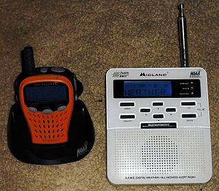
A weather radio is a specialized radio receiver that is designed to receive a public broadcast service, typically from government-owned radio stations, dedicated to broadcasting weather forecasts and reports on a continual basis, with the routine weather reports being interrupted by emergency weather reports whenever needed. Weather radios are typically equipped with a standby alerting function—if the radio is muted or tuned to another band and a severe weather bulletin is transmitted, it can automatically sound an alarm and/or switch to a pre-tuned weather channel for emergency weather information. Weather radio services may also occasionally broadcast non-weather-related emergency information, such as in the event of a natural disaster, a child abduction alert, or a terrorist attack.

Coburn Hill is located 4.2 miles (7 km) southeast of Billings, Montana in Yellowstone County. Its most predominant feature is Sacrifice Cliffs, part of the Rimrocks surrounding the city. Another feature is several radio and television broadcast towers located on the hill.

The 2020 United States presidential election in Montana was held on Tuesday, November 3, 2020, as part of the 2020 United States presidential election in which all 50 states plus the District of Columbia participated. Montana voters chose electors to represent them in the Electoral College via a popular vote, pitting the Republican Party's nominee, incumbent President Donald Trump and running mate Vice President Mike Pence, against Democratic Party nominee, former Vice President Joe Biden, and his running mate California Senator Kamala Harris. Montana has three electoral votes in the Electoral College.
The Boulder Monitor is a weekly newspaper in Boulder, Montana in the United States.

The COVID-19 pandemic was confirmed to have reached the U.S. state of Montana on March 14, 2020. As of June 4, 2021, the Montana Department of Public Health and Human Services (MDPHHS) has reported 112,260 positive cases and 1,632 deaths in the state.
The National Public Health Emergency Team for COVID-19 (NPHET) was a National Public Health Emergency Team within Ireland's Department of Health that oversaw and provided national direction, support, guidance and expert advice on developing and implementing a strategy to control the coronavirus disease 2019 (COVID-19) pandemic in Ireland.

In June 2022, the U.S. state of Montana was hit by heavy, damaging floods in multiple major watersheds including the Yellowstone River. Heavy rain and melting snow over the weekend June 10–13 caused large areas of Yellowstone National Park to be evacuated. On June 14, the water plant in Billings was temporarily shut down. Many houses were damaged as a result, and a number of roads and bridges were destroyed by floodwaters.
References
- ↑ Binkowski, Bruce (February 19, 2020). "Special programming coming to Jefferson County radio". The Monitor. Retrieved July 7, 2020.
- ↑ "COVID-19 updates on county radio". The Monitor. April 1, 2020. Retrieved July 7, 2020.
| | This article about a radio station in Montana is a stub. You can help Wikipedia by expanding it. |