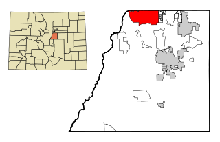
Morgan County is a county in northern Utah, United States. As of the 2010 census, the population was 9,469. Its county seat and largest city is Morgan. Morgan County is part of the Ogden-Clearfield, UT Metropolitan Statistical Area as well as the Salt Lake City-Provo-Orem, UT Combined Statistical Area.
Interstate 80 (I-80) is an east–west transcontinental freeway in the United States that runs from downtown San Francisco, California, to Teaneck, New Jersey, in the New York City Metropolitan Area. The highway was designated in 1956 as one of the original routes of the Interstate Highway System. Its final segment was opened to traffic in 1986. It is the second-longest Interstate Highway in the United States, following I-90. The Interstate runs through many major cities including Oakland, Sacramento, Reno, Salt Lake City, Omaha, Des Moines, and Toledo, and passes within 10 miles (16 km) of Chicago, Cleveland, and New York City.
Highlands Ranch is a census-designated place (CDP) in Douglas County, Colorado, United States. The population was 96,713 at the 2010 census. Located 12 miles (19 km) south of Denver, Highlands Ranch is an unincorporated community and was the twelfth-most populous CDP in the United States in 2010.

Ken Caryl is a census-designated place (CDP) in Jefferson County, Colorado, United States. The population was 32,438 as of the 2010 census.

Kamas is a city in southwestern Summit County, Utah, United States. It is part of the Salt Lake City, Utah Metropolitan Statistical Area. The population was 1,811 at the 2010 census.

Stansbury Park is a census-designated place (CDP) in Tooele County, Utah, United States. The population was 5,145 at the 2010 Census; it was 2,385 at the 2000 census; the 1990 census population was 1,049.

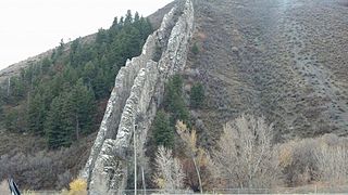
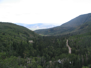
Parleys Canyon is a canyon located in the U.S. state of Utah. The canyon provides the route of Interstate 80 (I-80) up the western slope of the Wasatch Mountains and is a relatively wide, straight canyon other than near its mouth. The mountain pass at the top of the canyon is known as Parleys Summit. With an elevation of 7,120 feet (2,170 m), the pass is the highest point along I-80 in the state of Utah. Both features are named for Parley P. Pratt, an early settler of the Salt Lake Valley and leader of the Church of Jesus Christ of Latter-Day Saints who surveyed the area to find a better transportation route through the Wasatch Mountains than the previous route which traversed Emigration Canyon.

St. Vrain Creek is a tributary of the South Platte River, approximately 32.2 miles (51.8 km) long, in north central Colorado in the United States. It drains part of the foothills north of Boulder and the Colorado Piedmont area in the vicinity of Longmont.

Littlefield is an unincorporated community and census-designated place in Mohave County located in the Arizona Strip region of the U.S. state of Arizona. As of the 2010 census, its population was 308. It lies just south of Interstate 15, next to the Virgin River, approximately 10 miles northeast of Mesquite, Nevada. Littlefield is located in the 86432 zip code.

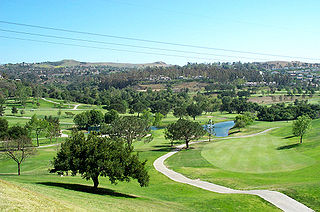
Clairemont is a community within the city of San Diego, California, United States. It has a population of about 81,600 residents and an area of roughly 13.3 square miles (34 km2). Clairemont Mesa is bordered by Interstate 805 on the east, Interstate 5 to the west, State Route 52 to the north, and the community of Linda Vista to the south. The community of Clairemont Mesa can be subdivided into the neighborhoods of North Clairemont, Bay Ho, Clairemont Mesa East, Clairemont Mesa West, and Bay Park.
Interstate 80 (I-80) is a part of the Interstate Highway System that runs from San Francisco, California, to Teaneck, New Jersey. The portion of the highway in the U.S. state of Utah is 196.35-mile-long (315.99 km), through the northern part of the state. From west to east, I-80 crosses the state line from Nevada in Tooele County and traverses the Bonneville Salt Flats—which are a part of the larger Great Salt Lake Desert. It continues alongside the Wendover Cut-off—the corridor of the former Victory Highway—U.S. Route 40 (US-40) and the Western Pacific Railroad Feather River Route. After passing the Oquirrh Mountains, I-80 enters the Salt Lake Valley and Salt Lake County. A short portion of the freeway is concurrent with I-15 through Downtown Salt Lake City. At the Spaghetti Bowl, I-80 turns east again into the mouth of Parley's Canyon and Summit County, travels through the mountain range and intersects the eastern end of I-84 near Echo Reservoir before turning northeast towards the Wyoming border near Evanston. I-80 was built along the corridor of the Lincoln Highway and the Mormon Trail through the Wasatch Range. The easternmost section also follows the historical routes of the First Transcontinental Railroad and US-30S.
Anaheim Hills is a planned community encompassing the eastern portions of the city of Anaheim, in Orange County, California.
Canyon Creek is a residential neighborhood located in far northwest Austin, Texas. The neighborhood is located in ZIP Code 78726 and is bordered by Farm To Market 2222 (FM2222) on the south, Ranch Road 620 North (RR620) on the west, Anderson Mill Road on the north, and a major headwater tributary of Bull Creek to the east as well as the Balcones Canyonland Preserve. The preserve gives the neighborhood of over 1300 homes a semi-rural feeling despite being less than four miles to major shopping and employment centers. The major bisecting road is Boulder Lane, which winds its way through the picturesque, upper-middle-class neighborhood of single-family homes. Boulder Lane is a loop, and crosses RR620 in two places. The neighborhood is approximately 5 miles from Lake Travis and Lake Austin. Ranch Road 620 runs into the new toll roads of State Highway 45 at Lakeline Mall. Fast ways to get downtown is by taking 620 to 183 and going south. Another fast route is taking 620 to 2222 and then onto 360 to the left or the right. Left will take you to Gateway Theater on 183 and right will take you out to southern Austin and that is also a good route to the airport and San Antonio.

Zion National Park is an American national park located in southwestern Utah near the town of Springdale. A prominent feature of the 229-square-mile (590 km2) park is Zion Canyon, which is 15 miles (24 km) long and up to 2,640 ft (800 m) deep. The canyon walls are reddish and tan-colored Navajo Sandstone eroded by the North Fork of the Virgin River. The lowest point in the park is 3,666 ft (1,117 m) at Coalpits Wash and the highest peak is 8,726 ft (2,660 m) at Horse Ranch Mountain. Located at the junction of the Colorado Plateau, Great Basin, and Mojave Desert regions, the park has a unique geography and a variety of life zones that allow for unusual plant and animal diversity. Numerous plant species as well as 289 species of birds, 75 mammals, and 32 reptiles inhabit the park's four life zones: desert, riparian, woodland, and coniferous forest. Zion National Park includes mountains, canyons, buttes, mesas, monoliths, rivers, slot canyons, and natural arches.
Wasatch Mountain State Park is a state park of Utah, United States, located in the northern part of the state within the Wasatch Back area on the north and west edges of the Heber Valley in Wasatch County near the city of Midway.

Springville is a city in Utah County, Utah, United States that is part of the Provo-Orem Metropolitan Statistical Area. The population was 29,466 in 2010, according to the United States Census. Springville is a bedroom community for commuters who work in the Provo-Orem and Salt Lake City metropolitan areas. Other neighboring cities include Spanish Fork and Mapleton. Springville has the nickname of "Art City" or "Hobble Creek".

Scenic, Arizona is a census-designated place in Mohave County in extreme northwestern Arizona. As of the 2010 census, its population was 1,643. Scenic is recognized as a distinct area by Mohave County planners and documents which reference its existence and is shown on official maps of Mohave County.

The Lake Mountains are a 15-mile-long (24 km) mountain range located on the western edge of the Utah Valley in northwestern Utah County, Utah, United States. The range forms the northwest border of Utah Lake, and its proximity allows its use for communication towers, mostly in its north section, bordering Eagle Mountain.

Buckskin Mountain is a 16-mile (26 km) mountain ridge that spans from Coconino County, Arizona to Kane County, Utah in the United States, that is divided almost equally between the two counties.

Promontory Point is an ghost town in Box Elder County, Utah, United States, that is located about 1.7 miles (2.7 km) northeast of Promontory Point (cape).