Bass is a generic common name shared by many species of ray-finned fish from the large clade Percomorpha, mainly belonging to the orders Perciformes and Moroniformes, encompassing both freshwater and marine species. The word bass comes from Middle English bars, meaning "perch", despite that none of the commonly referred bass species belong to the perch family Percidae.
Sea bass is a common name for a variety of different species of marine fish. Many fish species of various families have been called sea bass.

The Atlantic goliath grouper or itajara, also known as the jewfish, is a saltwater fish of the grouper family and one of the largest species of bony fish. The species can be found in the West Atlantic ranging from northeastern Florida, south throughout the Gulf of Mexico and the Caribbean Sea, and along South America to Brazil. In the East Pacific it ranges from Mexico to Peru. In the East Atlantic, the species ranges in West Africa from Senegal to Cabinda. The species has been observed at depths ranging from 1 to 100 meters.

The Channel Islands are an eight-island archipelago located within the Southern California Bight in the Pacific Ocean, off the coast of California. They define the Santa Barbara Channel between the islands and the California mainland. The four Northern Channel Islands are part of the Transverse Ranges geologic province, and the four Southern Channel Islands are part of the Peninsular Ranges province. Five of the islands are within the Channel Islands National Park. The waters surrounding these islands make up Channel Islands National Marine Sanctuary. The Nature Conservancy was instrumental in establishing the Channel Islands National Marine Sanctuary.

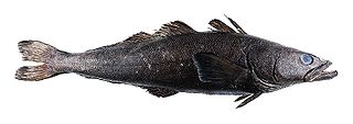
The Patagonian toothfish, also known as Chilean sea bass, mero, icefish, and Antarctic cod, is a species of notothen found in cold waters between depths of 45 and 3,850 m in the southern Atlantic, Pacific, and Indian Oceans and Southern Ocean on seamounts and continental shelves around most Subantarctic islands.

The Channel Islands National Marine Sanctuary is a sanctuary off the coast of Santa Barbara and Ventura counties in Southern California 350 miles (563 km) south of San Francisco and 95 miles (153 km) north of Los Angeles. It was designated on October 2, 1980, by the National Oceanic and Atmospheric Administration and was expanded in 2007.

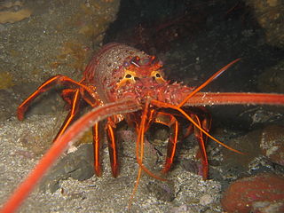
The California spiny lobster is a species of spiny lobster found in the eastern Pacific Ocean from Monterey Bay, California, to the Gulf of Tehuantepec, Mexico. It typically grows to a length of 30 cm (12 in) and is a reddish-brown color with stripes along the legs, and has a pair of enlarged antennae but no claws. The interrupted grooves across the tail are characteristic for the species.

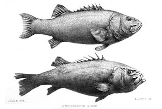
The giant sea bass is a fish native to the North Pacific Ocean. Although commonly referred to as a giant sea bass, black sea bass or giant black sea bass, it is actually a wreckfish in the family Polyprionidae rather than in the sea bass family Serranidae.

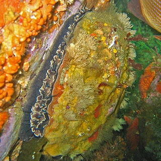
Haliotis rufescens is a species of very large edible sea snail in the family Haliotidae, the abalones, ormers (British) or pāua. It is distributed from British Columbia, Canada, to Baja California, Mexico. It is most common in the southern half of its range.

Carmel Bay State Marine Conservation Area (SMCA) is a marine protected area in Carmel Bay. Carmel Bay is adjacent to the city of Carmel-by-the-Sea and is near Monterey, on California’s central coast. The marine protected area covers 2.12 square miles. Recreational fishing of finfish and limited commercial taking of kelp is permitted within the SMCA.

Carmel Pinnacles State Marine Reserve (SMR) is a marine protected area in Carmel Bay including a unique underwater pinnacle formation with adjacent kelp forest, submarine canyon head, and surfgrass. Carmel Bay is adjacent to the city of Carmel-by-the-Sea and is near Monterey, on California's central coast.

Point Sur State Marine Reserve (SMR) and Point Sur State Marine Conservation Area (SMCA) are two adjoining marine protected areas that lie offshore of Point Sur, part of the Big Sur area on California's central coast. The combined area of these marine protected areas is 19.68 square miles (51.0 km2). The SMR protects all marine life within its boundaries. Fishing and taking of all living marine resources is prohibited in the SMR. Within the SMCA, fishing and taking of all living marine resources is prohibited except the commercial and recreational take of salmon and albacore.
Arrow Point to Lion Head Point (SMCA) is a marine protected area on Catalina Island that includes offshore, island marine habitat off California’s south coast. The SMCA covers 0.67 square miles (1.7 km2). In general an SMCA protects marine life by limiting the removal of marine wildlife from within their borders. In this SMCA all recreational take is allowed in accordance with current regulations, except the recreational take of invertebrates is prohibited.
Lovers Cove State Marine Conservation Area and Casino Point State Marine Conservation Area (SMCAs) are two nearby marine protected areas that include offshore, island marine habitat on opposite sides of Avalon Harbor, Catalina Island, off California's south coast. The SMCAs cover 0.06 and 0.01 square miles respectively. These SMCAs function essentially as dive areas in this popular diving and water sports area. The SMCAs protect marine life by limiting the removal of marine wildlife from within their borders.

Cat Harbor State Marine Conservation Area (SMCA) is a marine protected area that includes offshore, island marine habitat at Catalina Island off California's south coast. The SMCA covers 0.24 square miles (0.62 km2). The SMCA protects marine life by limiting the removal of marine wildlife from within their borders. Cat Harbor SMCA prohibits take of all living marine resources except: recreational take of finfish by hook-and-line or by spearfishing, squid by hook-and-line, and lobster and sea urchin is allowed; commercial take of sea cucumbers by diving only, and spiny lobster and sea urchin is allowed. Aquaculture of finfish pursuant to any required state permits is allowed.

Farnsworth Onshore and Farnsworth Offshore State Marine Conservation Areas (SMCAs) are two contiguous marine protected areas that include offshore, island marine habitat off California's south coast. The SMCAs covers 2.57 sq mi (6.7 km2) and 6.67 sq mi (17.3 km2) respectively. The SMCAs protect marine life by limiting the removal of marine wildlife from within their borders.
Long Point State Marine Reserve (SMR) is a marine protected area that includes offshore, island marine habitat off California's south coast. The SMR covers 1.66 square miles (4.3 km2). The SMR protect marine life by prohibiting the removal of marine wildlife from within its borders. Long Point SMR prohibits take of all living marine resources.

Oxyjulis californica is a species of wrasse native to the eastern Pacific Ocean along the coasts of California and Baja California. Its distribution extends from Salt Point in Sonoma County, California, to southern central Baja California, near Cedros Island. It is a very common species; its common name in Spanish is señorita.

Stereolepis is a genus of marine ray-finned fish in the family Polyprionidae, the wreckfish, which is native to the Pacific Ocean.


