
Namli Mera is a mountainous rural area located in Abbottabad District, Khyber Pakhtunkhwa province, Pakistan. It is one of the 51 union councils of Abbottabad District, and takes its name from the two largest hamlets in the Union Council, Namli and Mera. These settlements are nestled on mountain ridges about 20 kilometres from the city of Abbottabad, in the foothills of Miranjani, the highest peak in the district. A metalled road connects Namli Mera to the main Abbottabad—Nathia Gali road and is an alternate route to reach Nathia Gali from Abbottabad. Namli Mera is around 3 kilometres away Bagnotar on the main road.the main population area starts from chanat Al Noor masjid and along there is a famous Gull super store owned by sardar Nafees gul onward to this there is a main market named as pull market of maira kalan

Sheikhul Bandi is one of the 51 union councils (sub-divisions) of Abbottabad District in Khyber-Pakhtunkhwa province of Pakistan. The Union council takes its name from a neighbourhood which is 3 km (1.9 mi) from the city of Abbottabad. It is located at 34° 8' 60N, 73° 13' 60E, in the valley toward the north-west of the Sarban Hills.
Bal Dheri is one of the 51 union councils of Abbottabad District in Khyber-Pakhtunkhwa province of Pakistan, the union council of Baldheri is named after the main village of the area. The population of Baldheri Union Council is 14,796.
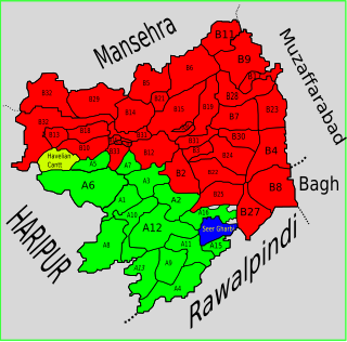
Seer Gharbi,سير غربي, is one of the 51 union councils of Abbottabad District in Khyber-Pakhtunkhwa province of Pakistan. It is located in the southeastern part of the province, bordering the Rawalpindi District of Punjab province.
Bagnotar is a union council of Abbottabad District in Khyber-Pakhtunkhwa province of Pakistan. Bagnator is situated on the Abbottabad-Nathi Gali Road some 18 kilometers away from Abbottabad.
Dewal Manal is one of the 51 union councils of Abbottabad District in the Khyber-Pakhtunkhwa province of Pakistan.
Langra is one of the 51 union councils of Abbottabad District in the Khyber Pakhtunkhwa province of Pakistan.
Birote Kalan is one of the 51 union councils of Abbottabad District in the Khyber-Pakhtunkhwa province of Pakistan.

Dalola is one of the 51 union councils (sub-divisions) of Abbottabad District in Khyber-Pakhtunkhwa province of Pakistan.
Kuthwal is one of the 51 union councils of Abbottabad District in the Khyber-Pakhtunkhwa province of Pakistan. It is located to the north west of Abbottabad city.
Rahi is a village in the Union Council of Phallah, Abbottabad District, Khyber Pakhtunkhwa, Pakistan. It is located in the south west of the district.
Pattan Kalan is one of twenty-nine union councils of the Abbottabad District, in the Khyber-Pakhtunkhwa province of Pakistan. It lies within an area that was affected by the 2005 earthquake, after which a total of 27 small camps were set up in the area.
Sarbhana is one of the 51 union councils of Abbottabad District in Khyber-Pakhtunkhwa province of Pakistan.
Phal Kot(Sehana) is one of the 51 union councils of Abbottabad District in Khyber-Pakhtunkhwa province of Pakistan. It is situated in Abbottabad, N.W.F.P., Pakistan, its geographical coordinates are 34° 9' 0" North, 73° 23' 0" East. Its original name is Phal Kot.
Bagh is a union council of Abbottabad District in Khyber-Pakhtunkhwa province of Pakistan, it has two high schools GHS Bagh and GMS Kehial The main tribe of this area are the Jadun and the [[Dhund Abbasis]

Karnol is a village and union council of Mansehra District in the Khyber-Pakhtunkhwa province of Pakistan. It is located at 34°23′N73°23′E at an altitude of 797 metres (2618 feet) lying in the south east of the district near to Abbottabad and the Kashmir frontier and lies in an area affected by the 2005 Kashmir earthquake.
Peeran is a village and union council of Mansehra District in the Khyber-Pakhtunkhwa province of Pakistan. It is located in District Mansehra. It is in an area affected by the 2005 Kashmir earthquake.

Gujar Khan Tehsil, headquartered at Gujar Khan, is one of the seven Tehsils (sub-divisions) of Rawalpindi District in the Punjab province of Pakistan. It is administratively subdivided into 36 Union Councils and according to the 1998 census has a population of 42,0000. In 2017 census Gujar Khan has a population of 678,503
Bain Gojri is a village of Abbottabad District in Khyber Pakhtunkhwa province of Pakistan. It is located at 34°8'0N 73°7'0E with an elevation of either 1,093 metres (3,586 ft) or 3,589 feet. Neighbouring settlements include Patian, Bagwal Bandi and Saliot.
Baghati is a village of Abbottabad District in Khyber Pakhtunkhwa province of Pakistan. It is located at 34°8'0N 73°8'0E with an altitude of 1306 metres. Neighbouring settlements include Bain Gojri, Banseri and Sohlan.
