Ottawa County is a county located in the northeastern corner of the U.S. state of Oklahoma. As of the 2020 census, the population was 30,285. Its county seat is Miami. The county was named for the Ottawa Tribe of Oklahoma. It is also the location of the federally recognized Modoc Nation and the Quapaw Nation, which is based in Quapaw.

Miami County is a county located in east-central Kansas and is part of the Kansas City metropolitan area. Its county seat and most populous city is Paola. As of the 2020 census, the county population was 34,191. The county was named for the Miami tribe.

Linn County is a county in the U.S. state of Kansas, located in along the eastern edge of Kansas, and is part of the Kansas City metropolitan area. Its county seat is Mound City, and its most populous city is Pleasanton. As of the 2020 census, the county population was 9,591. The county was named for Lewis Linn, a U.S. Senator from Missouri.

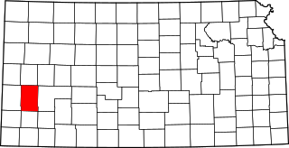
Kearny County is a county located in the U.S. state of Kansas. Its county seat and most populous city is Lakin. As of the 2020 census, the county population was 3,983. The county is named in honor of Philip Kearny, a general during the American Civil War that died during the Battle of Chantilly.

Johnson County is a county in the U.S. state of Kansas, along the border of the state of Missouri. Its county seat is Olathe. As of the 2020 census, the population was 609,863, the most populous county in Kansas. The county was named after Thomas Johnson, a Methodist missionary who was one of the state's first settlers. Largely suburban, the county contains a number of suburbs of Kansas City, Missouri, including Overland Park, a principal city of and second most populous city in the Kansas City Metropolitan Area.

Franklin County is a county located in the eastern portion of the U.S. state of Kansas. Its county seat and most populous city is Ottawa. As of the 2020 census, the county population was 25,996. The county was named for Benjamin Franklin, a founding father of the United States. Formerly it was considered part of the Kansas City metropolitan area, but was removed in 2013.

Anderson County is a county located in East Central Kansas, in the Central United States. Its county seat and most populous city is Garnett. As of the 2020 census, the county population was 7,836. The county was named for Joseph C. Anderson, a Kansas territorial legislator and border ruffian during the "Bleeding Kansas" era.

Paola is a city in and the county seat of Miami County, Kansas, United States. As of the 2020 census, the population of the city was 5,768.

Jingoism is nationalism in the form of aggressive and proactive foreign policy, such as a country's advocacy for the use of threats or actual force, as opposed to peaceful relations, in efforts to safeguard what it perceives as its national interests. Colloquially, jingoism is excessive bias in judging one's own country as superior to others – an extreme type of nationalism.

Kansas' 2nd congressional district is a congressional district in the U.S. state of Kansas that covers most of the eastern part of the state, except for the core of the Kansas City Metropolitan Area. The district encompasses less than a quarter of the state. The state capital of Topeka, the cities of Emporia, Junction City and Leavenworth and most of Kansas City are located within this district. The district is currently represented by Republican Jake LaTurner.

K-52 is an approximately 23-mile-long (37 km) east–west state highway in eastern Kansas. Its western terminus is at an intersection with K-31 southeast of Mound City. K-52 then overlaps U.S. Route 69 for eight miles (13 km) through Pleasanton and Trading Post, then splits off to the east. three miles (4.8 km) later, it crosses into Missouri, becoming Route 52.

Elk is a ghost town in Chase and Marion counties in the U.S. state of Kansas. It is currently a ghost town that lays along Middle Creek northwest of Elmdale and straddled the county line between Chase and Marion County.

Industry is an unincorporated community in Clay and Dickinson counties in the U.S. state of Kansas. It is located approximately 13 miles north of Abilene.

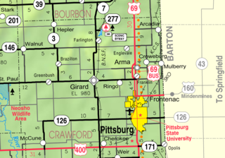
Opolis is an unincorporated community in Crawford County, Kansas, United States. As of the 2020 census, the population of the community and nearby areas was 104.

Bucyrus is an unincorporated community in Miami County, Kansas, United States. As of the 2020 census, the population of the community and nearby areas was 171. It is located 6 miles (9.7 km) east-southeast of Spring Hill, and named after Bucyrus, Ohio. It is part of the Kansas City metropolitan area.

Hillsdale is an unincorporated community in Miami County, Kansas, United States. As of the 2020 census, the population of the community and nearby areas was 247. Hillsdale is located near U.S. Route 169 and K-7 6 miles (9.7 km) north-northeast of Paola. It is part of the Kansas City metropolitan area.

The 2012 United States House of Representatives elections in Kansas were held on Tuesday, November 6, 2012, to elect the four U.S. representatives from the state of Kansas. The elections coincided with the elections of other federal and state offices, including a quadrennial presidential election.

Stanton is an unincorporated community in Miami County, Kansas, United States. It is part of the Kansas City metropolitan area.

New Lancaster is an unincorporated community in Miami County, Kansas, United States. It is part of the Kansas City metropolitan area.

Wagstaff is an unincorporated community in Miami County, Kansas, United States. It is part of the Kansas City metropolitan area.


