Cachardistrict is an administrative district in the state of Assam in India. After independence, the pre-existing undivided Cachar district was split into four districts: Dima Hasao, Hailakandi, Karimganj, and the current Cachar district. Silchar is Cachar district's center of government.

Karimganj district is one of the 31 districts of the Indian state of Assam. Karimganj town is both the administrative headquarters district and the biggest town of this district. It is located in southern Assam and borders Tripura and the Sylhet Division of Bangladesh. It makes up the Barak Valley alongside Hailakandi and Cachar. Karimganj was previously part of the Sylhet District before the Partition of India. It became a district in 1983.

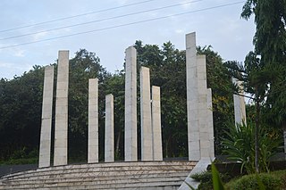
Silchar is a city and the headquarters of the Cachar district of the state of Assam, India. It is second largest city of Assam after Guwahati in terms of area, population and GDP. It is also administrative capital of Barak Valley division. It is located 343 kilometres south east of Guwahati. It was founded by Captain Thomas Fisher in 1832 when he shifted the headquarters of Cachar to Janiganj in Silchar. It earned the moniker "Island of Peace" from Indira Gandhi, the then Prime Minister of India. Silchar is the site of the world's first polo club and the first competitive polo match. In 1985, an Air India flight from Kolkata to Silchar became the world's first all-women crew flight. Silchar was a tea town and Cachar club was the meeting point for tea planters.
Ambikapur Part-X is a census town in Cachar district in the state of Assam, India.
Badarpur Railway Town is a census town in Cachar district in the state of Assam, India. Together with adjacent Badarpur Town, it forms the Badarpur Urban Area, one of two notified urban areas in the district.
Durga Nagar Part-V is a census town in Cachar district in the state of Assam, India.
Hindustan Paper Corporation Limited Township, Panchgram is an industrial township in Panchgram under Cachar district, state of Assam. It is the finest township of the Barak Valley Under Hindustan Paper Corporation Limited.
Kanakpur Part-II is a census town in Cachar district in the Indian state of Assam.
Lakhipur, is a town and a Municipal Board in Cachar district in the Indian state of Assam.
Silchar Part-X is a census town in Cachar district in the Indian state of Assam.
Uttar Krishnapur Part-I is a census town in Cachar district in the Indian state of Assam.
Singerband or Singerbond is a village under Singerband Gaon Panchayat in the district of Cachar (Assam), India under Lakhipur sub division.
Banskandi is a Block level area in Cachar district, Assam, India, almost 13 km from Silchar.
Thangjam Leikai is a small village in the Cachar district of Indian state of Assam. The village is also known as "Thangjamleikai" in short. It is registered as "Dakshin Mohanpur Part-II" in official revenue document. Non-Meitei people of its surrounding area call this village "Amoldar".
Kalain is situated in a strategic location of the Cachar district of Assam, India. It is about 28.5 kilometres (17.7 mi) from the district headquarters, Silchar, and is called the Gateway to Barak Valley. There are three railway stations that connect Kalain smoothly to rest of the valley and the state of Assam; one at Hilara, one at Sukritipur. and one at Bihara

Channighat is a village panchayat in Narsingpur Tehsil in Cachar district of Assam State, India. It is located 39 km (24 mi) south of Silchar, 31 km (19 mi) from Narsingpur and 245 km (152 mi) from the state capital at Dispur.
Dholai is a village in Narsingpur Tehsil in Cachar District of Assam State, India. It is located 30 km towards South from District headquarters Silchar. 22 km from Narsingpur
Sonabarighat is a town in Sonai, Cachar district, in Assam, India. The birthplace of the late Moinul Hoque Choudhury is situated at the tri-junction of the Aizawl-Sonai-Silchar road.
Bihara is a village in the outskirts of Silchar Town in Cachar district of Assam. This village is known for some of major Religious center in the area namely.

Binnakandi Ghat is a village under Binnakandi Gaon Panchayat in the District of Cachar (Assam), India under Lakhipur sub division.

