Related Research Articles

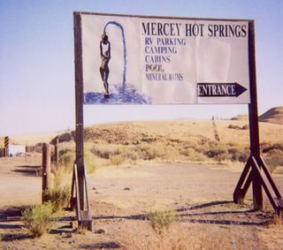
Mercey Hot Springs is an unincorporated community and historical hot springs resort in the Little Panoche Valley of Fresno County, central California, about 60 miles (97 km) west-southwest of Fresno.

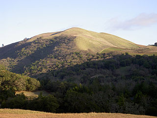
Bald Mountain is a name given to over fifty summits in California.
Ingram Creek, originally Arroyo de la Suerte, is a 14-mile-long (23 km) tributary of the San Joaquin River in Stanislaus County, in the San Joaquin Valley of California.
Kalmia is an unincorporated community in Harford County, Maryland, United States. The Husband Flint Mill Site was listed on the National Register of Historic Places in 1975.
Cantua Creek, formerly in Spanish Arroyo de Cantúa, was named for José de Guadalupe Cantúa, a prominent Californio Ranchero in the 19th-century Mexican era of Alta California.
The Anticline Ridge is a ridge, southeast of Joaquin Ridge, declining from its 3,629 foot / 1,106 meter high point, Black Mountain in the north at 36°18′16″N120°24′12″W, to the southeast into low hills bound on the southeast by Los Gatos Creek that divides it from the Guijarral Hills. It is located in the inner California Coast Ranges, in Fresno County, California, east of the town of Coalinga. Anticline Ridge and Guijarral Hills divides Pleasant Valley from the San Joaquin Valley to the east. California State routes 33 and 198, which join together for the stretch through and north of Coalinga, cut across the Coalinga field and cross Anticline Ridge.
Temescal Mountains, also known as the Sierra Temescal, are one of the northernmost mountain ranges of the Peninsular Ranges in western Riverside County, in Southern California in the United States. They extend for approximately 25 mi (40 km) southeast of the Santa Ana River east of the Elsinore Fault Zone to the Temecula Basin and form the western edge of the Perris Block.
Dawson is an unincorporated community in Shelby County, in the U.S. state of Ohio.
La Vereda del Monte was a backcountry route through remote regions of the Diablo Range, one of the California Coast Ranges. La Vereda del Monte was the upper part of La Vereda Caballo,, used by mesteñeros from the early 1840s to drive Alta California horses to Sonora for sale.
Owens is an unincorporated community in Wright County, in the U.S. state of Missouri. Owens is located on Missouri Route E, approximately seven miles north of Norwood.
French Ranch is a locale northeast of Hollister in the Diablo Range, in San Benito County, California. It lies on a flat just south of Wildcat Canyon at an elevation of 1,821 feet at the foot of Frenchs Pass. It lies west of an unnamed stream that descends northward to its confluence with Wildcat Canyon Creek from the north slope of Antimony Peak.
Frenchs Flat is a flat along the divide of the Diablo Range south of Pacheco Pass in Santa Clara County, California. It lies at an elevation of 1,362 feet south southwest of Pacheco Pass.
Frenchs Pass is a gap on the divide of the Diablo Range and on the boundary of San Benito County and Merced County, California. The pass is at an elevation of 2,428 feet on the north shoulder of 3,257-foot Antimony Peak.

Joaquin Rocks are a group of three pillars of rock, originally known as "Las Tres Piedras", located on Joaquin Ridge, in the Diablo Range, in Fresno County, California. The Joaquin Rocks are at an elevation of 4,121 feet, and are the most distinguishing feature of Joaquin Ridge. The three pillars of rock are clearly visible on the ridge for many miles from many directions in the San Joaquin Valley and from their summits have a view of much of the valley. It is located, 3 miles (4.8 km) west-northwest of Black Mountain and 3 miles (4.8 km) southwest of Ragged Valley.
Ragged Valley is a valley, in the Diablo Range in Fresno County, California. It was named for the ragged appearance of its surface. It is bound on the east by the Big Blue Hills and on the west by Joaquin Ridge. It extends northwesterly from its large mouth at Domengine Creek to the divide between Salt Creek and Cantua Creek where it has its head at 36°21′42″N120°25′25″W.
Black Mountain is a summit and the high point of Anticline Ridge in the Diablo Range of Fresno County, California. It rises to an elevation of 3,629 feet.
Joaquin Spring, originally known as Valenzuela Spring, is a spring on Joaquin Ridge in the Diablo Range in Fresno County, California. The spring is located on the southwestern slope of the ridge, about 500 feet below Joaquin Rocks, at an elevation of 3,520 feet.
References
- ↑ U.S. Geological Survey Geographic Names Information System: Lillis Ranch
- ↑ U.S. Geological Survey Geographic Names Information System: Spanish Lake
- 1 2 U.S. Geological Survey Geographic Names Information System: Joaquin Rocks
- 1 2 U.S. Geological Survey Geographic Names Information System: Joaquin Ridge
- ↑ U.S. Geological Survey Geographic Names Information System: Black Mountain
- ↑ U.S. Geological Survey Geographic Names Information System: Ragged Valley
- ↑ U.S. Geological Survey Geographic Names Information System: Portuguese Canyon
- ↑ U.S. Geological Survey Geographic Names Information System: Joaquin Spring