Johar Valley

Last updated

Johar valley as seen from Munsiyari. Munsiari IMG 20160617 132452119 (32987221606).jpg
Johar valley as seen from Munsiyari.
Johar Valley
Transparent.svg
Transparent.svg
16km
9.9miles
TIBET
(CHINA)
Transparent square.svg
NEPAL
Transparent square.svg
KUMAON
(INDIA)
Transparent square.svg
AS-rzeka-icon.svg
Kali
River
Transparent square.svg
AS-rzeka-icon.svg
Gori
Ganga
Transparent square.svg
AS-rzeka-icon.svg
Darma /
Dhauli
Transparent square.svg
AS-rzeka-icon.svg
Lasser
Yankti
Transparent square.svg
AS-rzeka-icon.svg
Darma
Transparent square.svg
AS-rzeka-icon.svg
Kuthi
Yankti
Transparent square.svg
AS-rzeka-icon.svg
Tinkar
Khola
AS-rzeka-icon.svg
Kalapani
Transparent square.svg
Mountain pass 12x12 e.svg
Kungribingri La
Transparent square.svg
Mountain pass 12x12 n.svg
Unta Dhura
Transparent square.svg
Red pog.svg
Milam
Transparent square.svg
Red pog.svg
Munsyari
Transparent square.svg
Red pog.svg
Askot
Transparent square.svg
Red pog.svg
Dharchula
Transparent square.svg
Red pog.svg
Jauljibi
Transparent square.svg
Red pog.svg
Tawaghat
Transparent square.svg
Red pog.svg
Gunji
Transparent square.svg
Red pog.svg
Kuthi
Mountain pass 12x12 ne.svg
Limpiyadhura
Red pog.svg
Kalapani
Mountain pass 12x12 se.svg
Lipulekh
Pass
Transparent square.svg

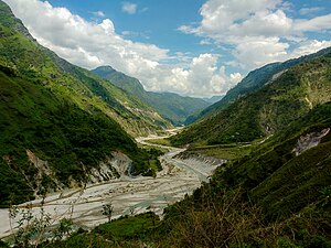
Johar Valley (also known as Milam Valley or Gori Ganga Valley) is a valley located in Pithoragarh district of Uttarakhand, India, along the Gori Ganga river. The valley used to be a major trade route with Tibet. The best known villages in the valley are Martoli and Milam. [1]

Contents

Munsiari-Bugdiar-Milam Road (MBMR), the paved motorable road being constructed by the BRO as part of the India–China Border Roads (ICBRs) with expected completion date of March 2026, runs through the Johar Valley of Gori Ganga River and connects Milam village with the district sub-division headquarter Munsiyari. [2]

Geography

The alpine trans-humant village of Milam is located one kilometer below the snout of the Milam glacier. Here a left-bank stream called Gonka joins the north to south flowing Gori Ganga River. The valley provides the approach route for access to peaks such as Nanda Devi East, Hardeol, Trishuli, Panchchuli and Nanda Kot.

See also

References

  1. McCarrel, Angie, ed. (2008). Integrated Rural Planning and Development: Johar Valley, Uttarakhand, India (PDF). faculty.washington.edu (Report). University of Washington. Archived from the original (PDF) on 5 June 2020. Retrieved 5 June 2020.
  2. इंडो-चीन बॉर्डर रोड के पहले फेज की एक सड़क अब भी पूरी नहीं, जानिए पूरा मामला, navbharattimes, 22 March 2025.