
Cartography is the study and practice of making and using maps. Combining science, aesthetics and technique, cartography builds on the premise that reality can be modeled in ways that communicate spatial information effectively.

A geographic information system (GIS) consists of integrated computer hardware and software that store, manage, analyze, edit, output, and visualize geographic data. Much of this often happens within a spatial database, however, this is not essential to meet the definition of a GIS. In a broader sense, one may consider such a system also to include human users and support staff, procedures and workflows, the body of knowledge of relevant concepts and methods, and institutional organizations.

A map is a symbolic depiction emphasizing relationships between elements of some space, such as objects, regions, or themes.

Physical geography is one of the three main branches of geography. Physical geography is the branch of natural science which deals with the processes and patterns in the natural environment such as the atmosphere, hydrosphere, biosphere, and geosphere. This focus is in contrast with the branch of human geography, which focuses on the built environment, and technical geography, which focuses on using, studying, and creating tools to obtain,analyze, interpret, and understand spatial information. The three branches have significant overlap, however.
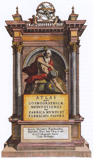
An atlas is a collection of maps; it is typically a bundle of maps of Earth or of a region of Earth.

In modern mapping, a topographic map or topographic sheet is a type of map characterized by large-scale detail and quantitative representation of relief features, usually using contour lines, but historically using a variety of methods. Traditional definitions require a topographic map to show both natural and artificial features. A topographic survey is typically based upon a systematic observation and published as a map series, made up of two or more map sheets that combine to form the whole map. A topographic map series uses a common specification that includes the range of cartographic symbols employed, as well as a standard geodetic framework that defines the map projection, coordinate system, ellipsoid and geodetic datum. Official topographic maps also adopt a national grid referencing system.

Economic geography is the subfield of human geography which studies economic activity and factors affecting them. It can also be considered a subfield or method in economics. There are four branches of economic geography. There is, primary sector, Secondary sector, Tertiary sector, & Quaternary sector.
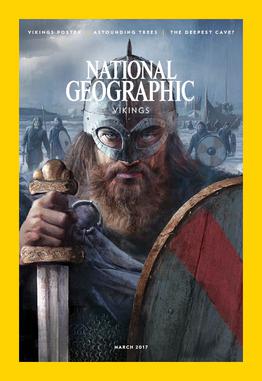
National Geographic is an American monthly magazine published by National Geographic Partners.

A gazetteer is a geographical index or directory used in conjunction with a map or atlas. It typically contains information concerning the geographical makeup, social statistics and physical features of a country, region, or continent. Content of a gazetteer can include a subject's location, dimensions of peaks and waterways, population, gross domestic product and literacy rate. This information is generally divided into topics with entries listed in alphabetical order.

The Royal Geographical Society (with the Institute of British Geographers), often shortened to RGS, is a learned society and professional body for geography based in the United Kingdom. Founded in 1830 for the advancement of geographical sciences, the Society has 16,000 members, with its work reaching the public through publications, research groups and lectures.

The United States Board on Geographic Names (BGN) is a federal body operating under the United States Secretary of the Interior. The purpose of the board is to establish and maintain uniform usage of geographic names throughout the federal government of the United States.

Swisstopo is the official name for the Swiss Federal Office of Topography, Switzerland's national mapping agency.

Augustus Heinrich Petermann was a German cartographer.
The Anton Melik Geographical Institute was founded in 1946 by the Slovenian Academy of Sciences and Arts. In 1976 it was named after the Slovene geographer and academy member Anton Melik (1890–1966), who was the first head of the institute. Since 1981, the institute has been a member of the Research Center of the Slovenian Academy of Sciences and Arts. Until 1992 the institute was mainly engaged with researching glaciers, glacial and fluvial transformations of land surfaces, flooded areas, natural disasters, mountain farms, and social geography. Since 1993 the institute's main task has been to conduct geographical studies of Slovenia and its landscapes and to prepare basic geographical texts on Slovenia as a country and as part of the world.

A thematic map is a type of map that portrays the geographic pattern of a particular subject matter (theme) in a geographic area. This usually involves the use of map symbols to visualize selected properties of geographic features that are not naturally visible, such as temperature, language, or population. In this, they contrast with general reference maps, which focus on the location of a diverse set of physical features, such as rivers, roads, and buildings. Alternative names have been suggested for this class, such as special-subject or special-purpose maps, statistical maps, or distribution maps, but these have generally fallen out of common usage. Thematic mapping is closely allied with the field of Geovisualization.
A historical geographic information system is a geographic information system that may display, store and analyze data of past geographies and track changes in time. It can be regarded as a tool for historical geography.

Jacques Bertin was a French cartographer and theorist, known from his book Sémiologie Graphique, published in 1967. This monumental work, based on his experience as a cartographer and geographer, represents the first and widest intent to provide a theoretical foundation to Information Visualization, with his most lasting contribution being his set of visual variables that can be used to construct map symbols and other graphical techniques one of then being the Bertin Projection, an innovative map projection type.
Geography is a field of science devoted to the study of the lands, features, inhabitants, and phenomena of Earth. The first recorded use of the word γεωγραφία was as a title of a book by Greek scholar Eratosthenes. Geography is an all-encompassing discipline that seeks an understanding of Earth and its human and natural complexities—not merely where objects are, but also how they have changed and come to be. While geography is specific to Earth, many concepts can be applied more broadly to other celestial bodies in the field of planetary science. One such concept, the first law of geography, proposed by Waldo Tobler, is "everything is related to everything else, but near things are more related than distant things." Geography has been called "the world discipline" and "the bridge between the human and the physical sciences."
Borden D. Dent (1938–2000) was an American geographer and cartographer who served as professor emeritus and chairman of the Department of Geography and Anthropology at Georgia State University. His textbook, Cartography: Thematic Map Design, is one of the seminal texts in the field, and its sixth edition was reissued in 2009.

The geographical bias on Wikipedia is an inequality in the distribution of its content with respect to the geographical association of article subjects. It is an element of criticism of Wikipedia, in addition to other biases, such as gender bias, racial bias, or ideological. The research shows that despite considerable differences of this distribution depending on the language of Wikipedia, there is a common trend towards more content related to the United States and Western Europe coupled with the scarcity of information about certain regions in the rest of the world.