
Geomatics is defined in the ISO/TC 211 series of standards as the "discipline concerned with the collection, distribution, storage, analysis, processing, presentation of geographic data or geographic information". Under another definition, it consists of products, services and tools involved in the collection, integration and management of geographic (geospatial) data. It is also known as geomatic(s) engineering. Surveying engineering was the widely used name for geomatic(s) engineering in the past.
Geoinformatics is the science and technology that develop and use data, software, and computing facilities in the cyberinfrastructure ecosystem to address the needs of geosciences and related branches of science and engineering.
The American Congress on Surveying and Mapping (ACSM) was an American professional association representing the interests of those engaged in measuring and communicating geospatial data.

The Survey of India is India's central engineering agency in charge of mapping and surveying. Set up in 1767 to help consolidate the territories of the British East India Company, it is one of the oldest Engineering Departments of the Government of India. Its members are from Survey of India Service cadre of Civil Services of India and Army Officers from the Indian Army Corps of Engineers. It is headed by the Surveyor General of India. At present, the Surveyor General is Sunil Kumar.

The International Cartographic Association (ICA), is an organization formed of national member organizations, to provide a forum for issues and techniques in cartography and geographic information science (GIScience). ICA was founded on June 9, 1959, in Bern, Switzerland. The first General Assembly was held in Paris in 1961. The mission of the International Cartographic Association is to promote the disciplines and professions of cartography and GIScience in an international context. To achieve these aims, the ICA works with national and international governmental and commercial bodies, and with other international scientific societies.

The Faculty of Geodesy at the University of Zagreb is the only Croatian institution providing high education in Geomatics engineering and the largest faculty in this domain in southeastern Europe.

The UNSW School of Surveying and Geospatial Engineering (SAGE), part of the UNSW Faculty of Engineering, was founded in 1970 and disestablished in 2013.
The Finnish Geospatial Research Institute, formerly Finnish Geodetic Institute is a research institute in Finland specializing in geodesy and geospatial information science and technology. It merged into the National Land Survey of Finland in 2015, when its name was changed. It is located in Masala, Kirkkonummi.
Prof. em. Dr. Armin Gruen is, since 1984, professor and head of the Chair of photogrammetry at the Institute of Geodesy and Photogrammetry (IGP), Federal Institute of Technology (ETH) Zurich, Switzerland. Since 1 August 2009, he is retired and is now with the Chair of Information Architecture, ETH Zurich Faculty of Architecture. He is currently acting as a principal investigator on the Simulation Platform of the SEC-FCL in Singapore.
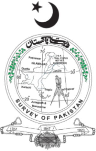
Survey of Pakistan is the sole national mapping and land surveying government agency of Pakistan. Its head of department is titles as "Surveyor General of Pakistan".
The Faculty of Geodesy and Land Management is one of the sixteen faculties of University of Warmia and Mazury in Olsztyn and prepares students to work in the following fields: digital photogrammetry and Internet photogrammetry, close range photogrammetry, engineering geodesy, satellite geodesy, higher geodesy, geomatics and spatial information systems, land management, numerical cartography, cadastral survey and common appraisal, mathematics and mathematical statistics, spatial and archeological reconstruction, positioning and navigation systems, remote sensing and photointerpretation, theory of deterministic chaos in dynamic analyses, theory of environment and real estate evaluation. Students of land management are prepared to work in local governments in the fields of real estate management and turnover, spatial planning, property counselling and expertise. Research on application of global satellite navigation systems, improving methods of acquiring, gathering and processing geodetic and satellite data and their use in special information systems as well as optimizing methods of space management are only a few examples of scientific fields of interest of the faculty employees.
The Indian Institute of Surveying & Mapping (IISM), formerly known as Survey Training Institute, is an institution of Survey Education, learning and training. It is situated at the Survey of India campus in Uppal, Hyderabad.

Sri Lanka Sikhamani Thamotharam Somasekaram was a leading Sri Lankan Tamil geographer and Surveyor General.

The Institute of Geomatics (IG) was a public consortium made up of the Autonomous Government of Catalonia and the Polytechnic University of Catalonia, created by Decree Law 256/1997 of the Autonomous Government of Catalonia, on September 30, 1997. It was a founding member of the Associació Catalana d'Entitats de Recerca (ACER).
Least-squares adjustment is a model for the solution of an overdetermined system of equations based on the principle of least squares of observation residuals. It is used extensively in the disciplines of surveying, geodesy, and photogrammetry—the field of geomatics, collectively.

The Surveying and Spatial Sciences Institute (SSSI) is the professional association for surveyors and spatial science workers, including cartography, hydrography, remote sensing, engineering and mining surveying, photogrammetry and spatial information in Australia. The Institute's members are involved in communities of practice such as land administration, land development, natural resource management, forestry, agriculture, defence, marine environment, local government, health, education, transport, tourism, and many more. The institute deals with policy, administration, collection, measurement, analysis, interpretation, portrayal and dissemination of spatially- related land and sea information, together with associated planning, design and management.

Department of Geodesy Gdańsk University of Technology – continues the tradition of the Department of Surveying and Cartography, established at Gdańsk University of Technology in 1945.
Geographic data and information is defined in the ISO/TC 211 series of standards as data and information having an implicit or explicit association with a location relative to Earth . It is also called geospatial data and information, georeferenced data and information, as well as geodata and geoinformation.

Pix4D is a Swiss software company that specializes in photogrammetry. It was founded in 2011 as a spinoff from the École Polytechnique Fédérale de Lausanne (EPFL) Computer Vision Lab in Switzerland. It develops a suite of software products that use photogrammetry and computer vision algorithms to transform DSLR, fisheye, RGB, thermal and multispectral images into 3D maps and 3D modeling. The company has 7 international offices, with its headquarters in Lausanne, Switzerland.

Qihao Weng is an American geographer, urban, environmental sustainability, and remote sensing scientist. He has been a Chair Professor at the Hong Kong Polytechnic University since July 2021, and was the Director of the Center for Urban and Environmental Change and is a professor of geography in the Department of Earth and Environmental Systems at the Indiana State University.