Surveying and Spatial Sciences Institute

Last updated

AbbreviationSSSI
Merger ofSpatial Sciences Institute (SSI); Institute of Surveyors Australia (ISA); Australian Urban and Regional Information Systems Association (AURISA); Remote Sensing and Photogrammetry Association of Australia (RSPAA)
Website www.sssi.org.au

The Surveying and Spatial Sciences Institute (SSSI) is the professional association for surveyors and spatial science workers, including cartography, hydrography, remote sensing, engineering and mining surveying, photogrammetry and spatial information in Australia. [1] The Institute's members are involved in communities of practice such as land administration, land development, natural resource management, forestry, agriculture, defence, marine environment, local government, health, education, transport, tourism, and many more. The institute deals with policy, administration, collection, measurement, analysis, interpretation, portrayal and dissemination of spatially- related land and sea information, together with associated planning, design and management.

Contents

SSSI is located in eight different regions across Australia, providing services in the six states and two territories. [2] The institute's headquarters are located at National Surveyors House in Canberra, Australia.

Background

The spatial sciences range from the traditional practices of surveying and cartography to the more recent practices using GPS, remote sensing and GIS. The spatial sciences involve the skills and understanding to capture, store, manage, manipulate, analyse, model, visualise, set-out and govern information that can be referenced to location.

Information that can be related to a location is termed spatial information. Though predominantly perceived as geo (earth) related, spatial information can range from the anatomic to astronomic scale, from the real to the abstract entity, over any time period.

SSSI acquire, integrate, manage, analyse, interpret, map or distribute information about a location in space and time. They develop, design, and provide related equipment, software and value-added services; undertake applied research, knowledge management and technology development; and manage, educate and train others.

Objectives

The institute's purpose & objectives are to support members in application and practice of surveying and spatial science. This is supported by promoting and representing professional interests of members that work in the discipline of surveying & spatial science. Additionally, the institute also facilitates the exchange of ideas and knowledge between members of the institute via lectures and conferences.[ citation needed ]

In short, the institute provides with the following benefits to its members:

  1. Advocacy
  2. Events
  3. Professional Development
  4. Certification
  5. Migration Skill Assessment

History

The Spatial Sciences Institute (SSI) represents the interests of the spatial information community within the Asia-Pacific region. The Spatial Sciences Institute (SSI) is a not-for-profit professional body with headquarters in Canberra, Australia. Its membership spans the disciplines of surveying, information technology, town planning, cartography, archeology, spatial information (GPS, remote sensing and GIS) professions and others.

In 1952, six State Institutes combined to form Institute of Surveyors Australia (ISA), the result of more than seventy years of intermittent effort.

Institute of Surveyors Australia (ISA), Australian Urban and Regional Information Systems Association (AURISA) and Remote Sensing and Photogrammetry Association of Australia (RSPAA) amalgamated to form SSI in 2003.

The SSI merged with the Institute of Surveyors Australia (ISA) to form the Surveying and Spatial Sciences Institute (SSSI) in July 2009. [3]

In 2009, SSSI participated in Q150 (the 150th anniversary of the founding of Queensland) by placing permanent memorials to early explorer/surveyors of Queensland at significant locations. [4] They include a memorial to surveyor to Francis Peter MacCabe at the Calliope River Historical Village ( 23°57′34.71″S151°09′06.26″E / 23.9596417°S 151.1517389°E / -23.9596417; 151.1517389 (Calliope River Historical Village Q150 survey mark) ) [5]

The current name, "Surveying and Spatial Sciences Institute", has been chosen by a democratic process which gave all members of both SSI and ISA a vote in choosing the name. Initially, a call for suggested names was distributed with over 200 names proposed. A two stage vote was held with a short list of four names offered after the first round of voting and a substantial majority selecting the final name. Over 1200 members participated in both stages of the vote evenly spread across both SSI and ISA memberships.

Leadership

Past presidents

YearPresident
2009Jonathon Saxon
2009-10Michael Giudici
2010Jonathon Saxon
2010-11Gypsy Bhalla
2011-13Gary Maguire
2013-15John Trinder
2015-16Bernard O'Sullivan
2016-18Gabriel Van Wyk

Board members

The board of management of the Institute are responsible for the governance, strategic planning, fiduciary oversight and monitoring against the strategic plan.

The members of the Board of Directors are

The Consultative Council handles membership, professional development, certification and service delivery.

Commissions

Membership of the institution are divided into Commissions, with the first ones being

  1. Land Surveying;
  2. Hydrography;
  3. Engineering and Mining Surveying;
  4. Spatial Information and Cartography and
  5. Remote Sensing and Photogrammetry

The role of a Commission Committee is to formulate and discuss policy for the Commission and to advice the Directors on matters relating to the Commission.

Membership

Membership categories are necessary in a professional institute to differentiate between differing levels of qualification and experience. Movement through the membership occurs via an articulation process which involves satisfying the prescribed progression and professional certification criteria.

Membership Categories

  1. Honorary Fellows
  2. Fellows
  3. Member
  4. Associate member
  5. Affiliate
  6. First year graduate
  7. Second year graduate
  8. Part time student
  9. Overseas Membership
  10. Student

Special Interest Groups

Special Interest Groups are based on specific grouping of members of the Institute. A representative from these groups are invited by Directors to participate at any meeting, Committee, Council or Board of the institute.

Young Professionals

The Young Professionals are members of the institute who are under 36 years old. Their role within the Institute is to foster member and growth of the institute through service delivery to young surveying and spatial professionals; representation of young surveying and spatial professional in the Institute; provision of leadership to young professionals within the profession; and the engendering of the community awareness of the surveying and spatial sciences and the Institute.

There is a Young Professionals regional committee within each state, and these committees work with the broader regional committees of each region as well as the commissions to deliver events, opportunities and networking for members.

Women in Spatial

This special interest group, is based on a grouping of members on a specific topic or subject. Most regions hold special events for women in surveying & spatial sciences to encourage women to engage and develop skills.

Other efforts

Certification

SSSI offers a certification program to enable members and non-members to gain recognition of their competencies through a formal “portfolio-based” process. Certifications are available for general competencies [6] and specialist competencies including spatial information, [7] hydrographic surveying, [8] remote sensing, [9] and engineering surveying. [10]

Migration Skill Assessment

The Institute carries out an authorised assessment of skills and qualifications for migration to Australia. Only Surveyor ANZSCO 232212 general skilled occupation can be assessed by SSSI.

Events and awards

The Institute conducts various events & awards for its members to facilitate knowledge sharing and networking.

  1. LOCATE : A geo-spatial conference which is conducted annually
  2. APSEA: The Asia Pacific Spatial Excellence Awards are conducted to celebrate achievement of top spatial and surveying professionals
  3. SEASC: South East Asia Survey Congress is a surveying event that will be conducted for the first time at Darwin, Australia in 2019
  4. E-CPD : A webinar which is accessible by SSSI members.

Publications

The official publication of SSSI is POSITION which is published once in two months. It is an Australian magazine of surveying, mapping and geo-information while Geo-message is a monthly newsletter.

The Journal of Spatial Science is an academic journal owned jointly by SSSI and Mapping Sciences Institute, Australia. This journal publishes original peer-reviewed research and review papers that contribute to the theory and practice of the survey and spatial sciences. The Journal also publishes professional papers that describe aspects of professional practise and implementation of techniques related to cartography, geodesy, geographic information science, hydrography, photogrammetry, remote sensing or surveying.

Partners

National

International

See also

Related Research Articles

<span class="mw-page-title-main">Topography</span> Study of the forms of land surfaces

Topography is the study of the forms and features of land surfaces. The topography of an area may refer to the land forms and features themselves, or a description or depiction in maps.

<span class="mw-page-title-main">Geomatics</span> Geographic data discipline

Geomatics is defined in the ISO/TC 211 series of standards as the "discipline concerned with the collection, distribution, storage, analysis, processing, presentation of geographic data or geographic information". Under another definition, it consists of products, services and tools involved in the collection, integration and management of geographic (geospatial) data. It is also known as geomatic(s) engineering. Surveying engineering was the widely used name for geomatic(s) engineering in the past.

<span class="mw-page-title-main">Geoinformatics</span> Application of information science methods in geography, cartography, and geosciences

Geoinformatics is a technical science primarily within the domain of Computer Science. It focuses on the programming of applications, spatial data structures, and the analysis of objects and space-time phenomena related to the surface and underneath of Earth and other celestial bodies. The field develops software and web services to model and analyse spatial data, serving the needs of geosciences and related scientific and engineering disciplines. The term is often used interchangeably with Geomatics, although the two have distinct focuses; Geomatics emphasizes acquiring spatial knowledge and leveraging information systems, not their development.

The American Congress on Surveying and Mapping (ACSM) was an American professional association representing the interests of those engaged in measuring and communicating geospatial data.

The Indian Institute of Remote Sensing is an institute for research, higher education and training in the field of remote sensing, geoinformatics and GPS technology for natural resources, environmental and disaster management under the Indian Department of Space, which was established in the year 1966. It is located in the city of Dehradun, Uttarakhand.

<span class="mw-page-title-main">International Cartographic Association</span>

The International Cartographic Association (ICA), is an organization formed of national member organizations, to provide a forum for issues and techniques in cartography and geographic information science (GIScience). ICA was founded on June 9, 1959, in Bern, Switzerland. The first General Assembly was held in Paris in 1961. The mission of the International Cartographic Association is to promote the disciplines and professions of cartography and GIScience in an international context. To achieve these aims, the ICA works with national and international governmental and commercial bodies, and with other international scientific societies.

The American Society for Photogrammetry and Remote Sensing (ASPRS) is an American learned society devoted to photogrammetry and remote sensing. It is the United States' member organization of the International Society for Photogrammetry and Remote Sensing. Founded in 1934 as American Society of Photogrammetry and renamed in 1985, the ASPRS is a scientific association serving over 7,000 professional members around the world. As a professional body with oversight of specialists in the arts of imagery exploitation and photographic cartography. Its official journal is Photogrammetric Engineering & Remote Sensing (PE&RS), known as Photogrammetric Engineering between 1937 and 1975.

<span class="mw-page-title-main">Faculty of Geodesy, University of Zagreb</span>

The Faculty of Geodesy at the University of Zagreb is the only Croatian institution providing high education in Geomatics engineering and the largest faculty in this domain in southeastern Europe.

<span class="mw-page-title-main">Chartered Institution of Civil Engineering Surveyors</span> Professional surveying organisation

The Chartered Institution of Civil Engineering Surveyors or CICES is a professional association in the field of civil engineering surveying, headquartered in the United Kingdom. CICES members consist mainly of commercial managers, quantity surveyors, and geospatial engineers working and studying within civil engineering surveying. The institution began in 1969 as the Association of Surveyors in Civil Engineering, became a registered educational charity in 1992, and received a royal charter in 2009. The institution advocates for engineering projects and education.

<span class="mw-page-title-main">UNSW School of Surveying and Geospatial Engineering</span>

The UNSW School of Surveying and Geospatial Engineering (SAGE), part of the UNSW Faculty of Engineering, was founded in 1970 and disestablished in 2013.

<span class="mw-page-title-main">Survey of Pakistan</span>

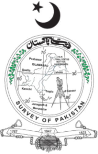
Survey of Pakistan is the sole national mapping and land surveying government agency of Pakistan. Its head of department is titles as "Surveyor General of Pakistan".

The Faculty of Geodesy and Land Management is one of the sixteen faculties of University of Warmia and Mazury in Olsztyn and prepares students to work in the following fields: digital photogrammetry and Internet photogrammetry, close range photogrammetry, engineering geodesy, satellite geodesy, higher geodesy, geomatics and spatial information systems, land management, numerical cartography, cadastral survey and common appraisal, mathematics and mathematical statistics, spatial and archeological reconstruction, positioning and navigation systems, remote sensing and photointerpretation, theory of deterministic chaos in dynamic analyses, theory of environment and real estate evaluation. Students of land management are prepared to work in local governments in the fields of real estate management and turnover, spatial planning, property counselling and expertise. Research on application of global satellite navigation systems, improving methods of acquiring, gathering and processing geodetic and satellite data and their use in special information systems as well as optimizing methods of space management are only a few examples of scientific fields of interest of the faculty employees.

The Indian Institute of Surveying & Mapping (IISM), formerly known as Survey Training Institute, is an institution of Survey Education, learning and training. It is situated at the Survey of India campus in Uppal, Hyderabad.

The Urban and Regional Information Systems Association (URISA) is a non-profit association of professionals using geographic information systems (GIS) and other information technologies to solve challenges at all levels of government. URISA promotes the effective and ethical use of spatial information and technology for the understanding and management of urban and regional systems.

<span class="mw-page-title-main">Q150</span> 150th anniversary of Queensland, Australia as an independent colony and state

Q150 was the sesquicentenary of the Separation of Queensland from New South Wales in 1859. Separation established the Colony of Queensland which became the State of Queensland in 1901 as part of the Federation of Australia. Q150 was celebrated in 2009.

<span class="mw-page-title-main">Association of British Columbia Land Surveyors</span> Canadian non-profit organization

The Association of British Columbia Land Surveyors (ABCLS) is a self-governing, non-profit, non-governmental organization which sets educational requirements, examines for admission, and regulates professional land surveyors within British Columbia, Canada. The ABCLS is responsible for developing bylaws and guidelines for the conduct of its members, establishing and administering entry requirements for the profession, and liaising with governmental bodies and other associations to improve the quality of the profession's service to the public.

<span class="mw-page-title-main">Kaduna Polytechnic</span> College in Kaduna, Nigeria

Kaduna Polytechnic is one of the earliest polytechnics in Nigeria, located at Tudun Wada area of Kaduna South local government of Kaduna state, North-Western Nigeria. It was established in 1956 as Kaduna Technical Institute after the British Government accepted the upgrading of Yaba Higher College to a technical institute and also proposed the establishment of technical institutes in Kaduna and Enugu through the recommendation of the Higher Education Commission. The polytechnic offers National Diploma and Higher National Diploma courses at the undergraduate level. In 2019/2020 academic session the institute will start awarding National Diploma in Railway Engineering Technology as approved by NBTE on 30 January 2020. The board of Governors of Kaduna Polytechnic was set up in 1991, with representative of eleven state governments, universities, rectors. The board is responsible for the supervision and control of the school. They are called the Governing Council.

Geographic data and information is defined in the ISO/TC 211 series of standards as data and information having an implicit or explicit association with a location relative to Earth. It is also called geospatial data and information, georeferenced data and information, as well as geodata and geoinformation.

Sisi Zlatanova is a Bulgarian/Dutch researcher in geospatial data, geographic information systems, and 3D modeling. She works as a professor in the faculty of the Built Environment, at the University of New South Wales (UNSW), and is president of Technical Commission IV (Spatial Information Science) of the International Society for Photogrammetry and Remote Sensing.

The Journal of Spatial Science is an academic journal about spatial sciences published by Taylor & Francis on behalf of the Mapping Sciences Institute (Australia) and the Surveying and Spatial Sciences Institute. It covers cartography, geodesy, geographic information science, hydrography, digital image analysis and photogrammetry, remote sensing, surveying and related areas. Its editor-in-chief is Graeme Wright; its 2018 impact factor is 1.711.

References

  1. "Welcome to SSSI". SSSI. Surveying and Spatial Sciences Institute. Archived from the original on 23 July 2014. Retrieved 14 July 2014.
  2. "Regions". Archived from the original on 14 August 2018. Retrieved 14 August 2018.
  3. Queensland Government. "Professional associations | Queensland's surveying history". www.qld.gov.au. Retrieved 5 July 2023.
  4. "About SSSI Q150 Project". Surveying and Spatial Science Institute. Archived from the original on 27 February 2015. Retrieved 15 July 2014.
  5. "About the marker locations – Some interesting information". Surveying and Spatial Sciences Institute. Archived from the original on 27 February 2015. Retrieved 7 December 2017.
  6. "General Certification". Archived from the original on 14 August 2018. Retrieved 14 August 2018.
  7. "GISP-AP Certification". Archived from the original on 14 August 2018. Retrieved 14 August 2018.
  8. "Hydrographic Surveyor". Archived from the original on 14 August 2018. Retrieved 14 August 2018.
  9. "RS&P Certification". Archived from the original on 14 August 2018. Retrieved 14 August 2018.
  10. "ESP-AP". Archived from the original on 14 August 2018. Retrieved 14 August 2018.