
Nanda Devi is the second-highest mountain in India, after Kangchenjunga, and the highest located entirely within the country. It is the 23rd-highest peak in the world.

Kamet is the second highest mountain in the Garhwal region of Uttarakhand, India, after Nanda Devi. It lies in the Chamoli District of Uttarakhand. Its appearance resembles a giant pyramid topped by a flat summit area with two peaks.

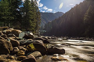
Kullu is a district in Himachal Pradesh, India. It borders Shimla district to the south, Mandi and Kangra districts to the west, and the Lahaul and Spiti district to the north and east. The largest valley in this mountainous district is the Kullu Valley. The Kullu valley follows the course of the Beas River, and ranges from an elevation of 833m above sea level at Aut to 3330m above sea level at the Atal Tunnel South Portal, below the Rohtang Pass. The town of Kullu, or simply Kullu, located on the right side of the Beas River, serves as the administrative headquarters of the Kullu district. The Kullu district also incorporates several riverine tributary valleys of the Beas, including those of the Parvati, Sainj, and Tirthan rivers, and thus some regions somewhat distant from the Kullu valley. The economy of the district relies mainly on horticulture, agriculture, tourism, and traditional handicrafts.
K12 is the second highest peak in the Saltoro Mountains, a subrange of the Karakoram range in the Siachen region of Ladakh. Its name comes from its designation given during the original survey of the Karakoram range. In 1984, an Indian army expedition under Colonel Prem Chand took hold of this peak, from the side of Siachen glacier by traversing from the west.
Oropolitics comes from the Greek oros meaning mountain and politikos meaning citizen. In modern usage it denotes the use of mountaineering for political purposes.
Debsa Pass is a 5,360-metre-high (17,590 ft) mountain pass in the Himalaya mountains between the Kullu and Spiti Districts of Himachal Pradesh, India.
Parvati River is a river in the Parvati Valley in Himachal Pradesh, northern India that flows into the Beas River at Bhuntar, some 10 km south of Kullu. It rises from the Man Talai Glacier below the Pin Parbati Pass and flows in a gradual curve from north-northwest to west-southwest past the important temple town of Manikaran.
Lieutenant Colonel James Owen Merion Roberts MVO MBE MC was one of the greatest Himalayan mountaineer-explorers of the twentieth century; a highly decorated British Army officer who achieved his greatest renown as "the father of trekking" in Nepal. His exploratory activities are comparable to those of Eric Shipton and Bill Tilman.

Tirsuli is a Himalayan mountain peak in the Pithoragarh district of Uttarakhand, India. It is part of the complex of mountains, including Tirsuli West, Hardeol, Dunagiri, Changabang, and Kalanka, which make up the northeast wall of the Nanda Devi Sanctuary, in the Garhwal Himalaya. It rises at the northern end of the Johar Valley, which drains into the Gori Ganga. This peak should not be confused with nearby Trisul, which is on the southwest side of the Sanctuary.
Saltoro Kangri, formerly known as Peak 36, is the highest peak of the Saltoro Mountains subrange of Karakoram range, also known as the Saltoro Range, which is a part of the Karakoram. Saltoro Kangri is a name generally used for the twin peaks, Saltoro Kangri I and Saltoro Kangri II, connected by a saddle. While comparing the heights the generic term Saltoro Kangri is applied to the higher peak, Saltoro Kangri I, which is the 31st highest mountain in the world in remote reaches of Karokaram. It is located on Indian side of the Actual Ground Position Line between Indian controlled territory in the Siachen region and Pakistani controlled territory west of the Saltoro Range.

Harish Kapadia is a Himalayan mountaineer, author and long-time editor of the Himalayan Journal from India. He has been awarded the Patron's Medal of the Royal Geographical Society, the Life Time Achievement Award for Adventure by the President of India and the King Albert Mountain Award presented by The King Albert I Memorial Foundation. He has written numerous books and articles on the Indian Himalayas. Harish was awarded the Piolets d'Or Asia Life Time Achievement Award in 2017 for his mountaineering and exploratory endeavors.

The state of Himachal Pradesh is spread over an area 55,673 km2 (21,495 sq mi) and is bordered by Jammu and Kashmir and Ladakh on the north, Punjab on the southwest, Haryana on the south, Uttarakhand on the southeast, a small border with Uttar Pradesh in the south, and Tibet on the east. Entire Himachal Pradesh lies in the mountainous Himalaya region, rich in natural resources

Fanny Bullock Workman was an American geographer, cartographer, explorer, travel writer, and mountaineer, notably in the Himalayas. She was one of the first female professional mountaineers; she not only explored but also wrote about her adventures. She set several women's altitude records, published eight travel books with her husband, and championed women's rights and women's suffrage.

Spiti is a high-altitude region of the Himalayas, located in the north-eastern part of the northern Indian state of Himachal Pradesh. The name "Spiti" means "The middle land", i.e. the land between Tibet and India. Spiti incorporates mainly the valley of the Spiti River, and the valleys of several rivers that feed into the Spiti River. Some of the prominent side-valleys in Spiti are the Pin valley and the Lingti valley. Spiti is bordered on the east by Tibet, on the north by Ladakh, on the west and southwest by Lahaul, on the south by Kullu, and on the southeast by Kinnaur. Spiti has a cold desert environment. The valley and its surrounding regions are among the least populated regions of India. The Bhoti-speaking local population follows Tibetan Buddhism.
Abi Gamin is a Himalayan mountain peak mostly situated in the Chamoli district of Uttarakhand state in India, 2 km (1.2 mi) northeast of Kamet. Its summit is on the border with Tibet and its northern slope is in the Ngari Prefecture of Tibet.
The Pin Parbati Pass is a mountain pass in Himachal Pradesh, India, at 5,319 m (17,451 ft). It was first crossed in August 1884 by Sir Louis Dane in search of an alternate route to the Spiti valley. This pass connects the fertile and lush Parbati valley on the Kullu side with the barren high-altitude Pin valley on the Spiti side.
Trevor Hyam Braham was a British Himalayan explorer and mountaineer, mostly active during the mid-20th century.

Asim Mukhopadhyay is a famous figure in the history of mountaineering in West Bengal, India. He was the pioneer in India for organizing high altitude scientific expeditions in the Himalayan region. He took part in many such expeditions as a climber between 1959 and 1974, and organised a few more in that period and later as an administrator. He was one of the main organisers of the first successful climbing on Nanda Ghunti and Tirsuli peaks by any non-government Indian organisation. Mukhopadhyay is also known for his vast knowledge on Pali, Buddhist literature and culture.
Colonel Narendra Kumar, PVSM, KC, AVSM, FRGS was an Indian soldier and mountaineer. He is known for his expeditions across various mountain ranges such as the Himalayas and Karakorams, and respective subranges such as the Pir Panjals and Saltoro Mountains. His reconnaissance efforts on the Siachen glacier were key to the Indian Army's reclamation of the forward posts of the glacier in Operation Meghdoot in 1984. He was the deputy leader of the first successful Indian Mount Everest expedition in 1965.
Shilla Col is a col in the remote Trans-Himalayan region of Spiti, Himachal Pradesh, India. It connects Shilla Nullah to Upper Lingti Valley. Coordinates are: 32°25'38"N 78°12'16"E