Related Research Articles

Saser Kangri is a mountain in India. It is the highest peak in the Saser Muztagh, the easternmost subrange of the Karakoram range. Sasir Kangri is located within Ladakh.

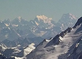
Nanda Devi is the second-highest mountain in India, after Kangchenjunga, and the highest located entirely within the country. Nanda Devi is the 23rd-highest peak in the world.

Kamet is the second-highest mountain in the Garhwal region of Uttarakhand, India, after Nanda Devi. It is the 29th highest mountain in the world. It lies in the Chamoli District of Uttarakhand. Its appearance resembles a giant pyramid topped by a flat summit area with two peaks.

Jengish Chokusu or Victory Peak is the highest mountain in the Tian Shan mountain system in Central Asia at 7,439 metres (24,406 ft). It lies on the China–Kyrgyzstan border between the Ak-Suu District in the Issyk-Kul Region of far Eastern Kyrgyzstan and Wensu County, Xinjiang, China. It is part of the Kakshaal Too, the highest part of the Tian Shan, and is southeast of lake Issyk-Kul. Jengish Chokusu is the 16th most topographically prominent peak on Earth.
K12 is the second highest peak in the Saltoro Mountains, a subrange of the Karakoram range in the Siachen region and is administered as a part of Ladakh territory. Its name comes from its designation given during the original survey of the Karakoram range. In 1984, an Indian army expedition under Colonel Prem Chand took hold of this peak, from the side of Siachen glacier by traversing from the west.
Joydeep Sircar is a mountaineer and mountain historian. In 1979, he published his Himalayan Handbook, an index of all the-then named peaks of 6096 meters (20000 feet) and above in Afghanistan and the Indian subcontinent, giving chronological entries of expeditions up to 1975 to each peak with a brief summary of results and references to expedition reports, after a decade of solitary research. He was inspired in this formidable undertaking by the pronouncement of the late Soli S. Mehta, Hony. Local Secretary of The Himalayan Club, that the task had never been attempted before and was well-nigh impossible. This book, introduced by the famous British mountaineer-explorer J. O. M. Roberts, one of Sircar's idols, was the first one of its kind. Printed in 500 copies only, it received excellent international notices and became a basic reference resource.

Nanda Kot is a mountain peak of the Himalaya range located in the Pithoragarh district of Uttarakhand state in India. It lies in the Kumaon Himalaya, just outside the ring of peaks enclosing the Nanda Devi Sanctuary, 15 kilometres (9 mi) southeast of Nanda Devi itself. The name Nanda Kot literally means "Nanda's Fortress" and refers to the abode of one of the sacred forms of the Hindu Goddess Parvati who in legend has made her sanctuary amongst the ring of lofty mountains in the region.

Changuch is a Himalayan mountain peak situated at the boundary of Pithoragarh and Bageshwar district of the Uttarakhand state of India. This peak is situated above the Pindari Glacier. This peak offers a ridge leading to Nanda Kot. On its massif Traill's pass is situated, which connects Pindari valley to Goriganga valley. The first successful ascent to the peak was made by an Indo-British team on 9 June 2009 at 9 am.
The Nanda Devi National Park or Nanda Devi Biosphere Reserve, established in 1982 is a national park situated around the peak of Nanda Devi in Chamoli Garhwal district of Uttarakhand, in northern India. The entire park lies at an elevation of more than 3,500 m (11,500 ft) above mean sea level.
Saltoro Kangri, previously known as Peak 36, stands as the highest peak within the Saltoro Mountains subrange, which is part of the larger Karakoram range. This subrange is also referred to as the Saltoro Range and is situated within the Karakoram region. The term "Saltoro Kangri" typically encompasses both of its twin peaks, Saltoro Kangri I and Saltoro Kangri II, which are connected by a saddle. When comparing heights, the generic term "Saltoro Kangri" is used for the taller of the two peaks, Saltoro Kangri I. This peak ranks as the 31st highest mountain globally and is located in the remote reaches of the Karakoram. It lies on the Actual Ground Position Line, dividing Indian-controlled territory in the Siachen region from Pakistani-controlled territory to the west of the Saltoro Range.

Operation Meghdoot was the codename for the Indian Armed Forces operation to take full control of the Siachen Glacier in Ladakh. Executed on the morning of 13 April 1984 in the highest battlefield in the world, Meghdoot was the first military offensive of its kind. This operation preempted Pakistan's Operation Ababeel and was a success, resulting in Indian forces gaining control of the Siachen Glacier in its entirety.
The Rimo massif lies in the northern part of the remote Rimo Muztagh, a subrange of the Karakoram range. It is located about 20 km northeast of the snout of the Siachen Glacier and its main summit, Rimo I is the world's 71st highest mountain with an elevation of 7,385 metres (24,229 ft). The massif heads the large Central Rimo Glacier and South Rimo Glacier, as well as the smaller North Terong Glacier.
Mamostong Kangri or Mamostang Kangri, surveyed as K35, is the highest peak in the remote Rimo Muztagh, a subrange of the Karakoram range in Ladakh union territory of India. It is located about 30 km east-southeast of the snout of the Siachen Glacier. It is the 48th-highest independent peak in the world.
The Teram Kangri group is a mountain massif in the remote Siachen Muztagh, a subrange of the Karakoram range. The high point of the group, and of the Siachen Muztagh, is Teram Kangri I. The peak lies on the boundary between disputed China controlled Trans-Karakoram Tract and the disputed Siachen Glacier section controlled by India. The northeast side of the peak is in Chinese-controlled territory, the southwest side is controlled by India.

The Siachen conflict, sometimes referred to as the Siachen Glacier conflict or the Siachen War, was a military conflict between India and Pakistan over the disputed 1,000-square-mile (2,600 km2) Siachen Glacier region in Kashmir. The conflict was started in 1984 by India's successful capture of the Siachen Glacier as part of Operation Meghdoot, and continued with Operation Rajiv in 1987. India took control of the 70-kilometre-long (43 mi) Siachen Glacier and its tributary glaciers, as well as all the main passes and heights of the Saltoro Ridge immediately west of the glacier, including Sia La, Bilafond La, and Gyong La. Pakistan controls the glacial valleys immediately west of the Saltoro Ridge. A cease-fire went into effect in 2003, but both sides maintain a heavy military presence in the area. The conflict has resulted in thousands of deaths, mostly due to natural hazards. External commentators have characterized it as pointless, given the perceived uselessness of the territory, and indicative of bitter stubbornness on both sides.

Captain Mohan Singh Kohli, is an Indian Navy officer and mountaineer, who led the 1965 Indian Everest Expedition, which saw nine men reach the summit of Everest, a world record for 17 years.

The Actual Ground Position Line (AGPL) divides current positions of Indian and Pakistani military posts and troops along the entire 110 kilometres (68 mi) long frontline in the disputed region of Siachen Glacier. AGPL generally runs along the Saltoro Mountains range, beginning from the northernmost point of the (LOC) at Point NJ 9842 and ending in the north on the Indira Ridge at the India-China-Pakistan LAC tripoint near Sia Kangri about 4 km (2.5 mi) northwest of Indira Col West, with peaks in excess of 7,000 m (23,000 ft) and temperatures ranging to around −55 °C (−67 °F). India gained control of 1,000 square miles (2,600 km2) of disputed territory in 1984 because of its military operations in Siachen. A cease-fire was announced in 2003.
Colonel Narendra Kumar, PVSM, KC, AVSM, FRGS was an Indian soldier and mountaineer. He is known for his expeditions across various mountain ranges such as the Himalayas and Karakorams, and respective subranges such as the Pir Panjals and Saltoro Mountains. His reconnaissance efforts on the Siachen glacier were key to the Indian Army's reclamation of the forward posts of the glacier in Operation Meghdoot in 1984. He was the deputy leader of the first successful Indian Mount Everest expedition in 1965.
Apsarasas Kangri is a mountain in the Siachen subrange of the Karakoram mountain range. With an elevation of 7,245 m (23,770 ft) it is the 96th highest mountain in the world. Apsarasas Kangri is located within the broader Kashmir region disputed between India, Pakistan and China. It is situated on the border between the areas controlled by China as part of the Xinjiang autonomous region, and the Siachen Glacier controlled by India as part of Ladakh.
The Nanda Devi Plutonium Mission was a joint operation by the United States Central Intelligence Agency (CIA) and the Indian Intelligence Bureau (IB) to spy on the nuclear developments being conducted in the Xinjiang Province of China. The agencies cooperated in October 1965 to install a nuclear-powered remote sensing station on the peak of Nanda Devi in the Uttarakhand Garhwal Himalayas.
References
- ↑ The Telegraph - Calcutta : Nation
- ↑ Joydeep Sircar, "Oropolitics: A dissertation on the political overtones of mountaineering in the East-Central Karakoram, 1975-82", Alpine Journal (1984), p. 74-79. Reprinted from Himalaya Sameeksha.
- ↑ SummitPost - Pik Pobeda/Tomur Feng - Climbing, Hiking & Mountaineering
- ↑ M.S. Kohli and K. Conboy, "Spies in the Himalayas", 2003.
- ↑ Articles in The Himalayan Journal, 1996, Mumbai.
- ↑ Jawad Raza Khan, "The Myth of Siachien :An extreme case of Oro-politics", Pakpotpourri. On line.