The Xiang River is the chief river of the Lake Dongting drainage system of the middle Yangtze, the largest river in Hunan Province, China. It is the second-largest tributary in terms of surface runoff, the fifth-largest tributary by drainage area of the Yangtze tributaries. The river flows generally northeast through the provinces of Guangxi and Hunan, its tributaries reaching into Jiangxi and Guangdong.

The Miluo River is located on the eastern bank of Dongting Lake, the largest tributary of the Xiang River in the northern Hunan Province. It is an important river in the Dongting Lake watershed, known as the location of the ritual suicide in 278 BC of Qu Yuan, a poet of Chu state during the Warring States period, in protest against the corruption of the era.

Xiangtan County is a county in Hunan Province, China; it is under the administration of Xiangtan City. Located on the east central Hunan, the county is bordered to the north by Yuhu, Yuetang Districts and Xiangtan City, to the west by Xiangxiang City and Shuangfeng County, to the south by Hengshan and Hengdong Counties, to the east by Zhuzhou County and Tianyuan District of Zhuzhou City. Xiangtan County covers 2,132.80 km2 (823.48 sq mi), as of 2015, it had a registered population of 979,600 and a resident population of 857,200. The county has 14 towns and 3 townships under its jurisdiction, the county seat is at Yisuhe Town (易俗河镇).

The Xiao River is the Main Stream of the upper Xiang River located in Yongzhou, Hunan. As of 2011 Water Census of China, it has a length of 365 kilometres (227 mi) from the headwaters to the confluence in the Ping Island of Yongzhou with the Xiang River West Branch originating from Guangxi. With the tributaries, its drainage basin area is 12,094 square kilometres (4,670 sq mi). Night rain on the Xiaoxiang, one of the Eight Views of Xiaoxiang, is located in this river.
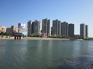
Yisuhe Town is an urban town and the seat of Xiangtan County in Hunan, China. As of the 2000 census it had a population of 60,283 and an area of 73.24 square kilometres (28.28 sq mi).
The Wei or Weishui River, begins in Weishan Township, is 117.2 kilometres (72.8 mi) long, and has a drainage basin of 2,125 square kilometres (820 sq mi). It is the largest river in Ningxiang City and one of the largest tributaries of the Xiang River.

The Liuyang River, also known as Liu River or Liuwei River, is a right-bank tributary of Xiang River, the largest tributary of Xiang River in Changsha, Hunan Province, China. The river has a length of 234.8 kilometres (145.9 mi) with its drainage area of 4,665 square kilometres (1,801 sq mi), accounting for 39.47% of the total area of Changsha, with surface water resources of 4,506 million cubic meters, accounting for 41.08% of that. It flows through Liuyang City, Changsha County, Yuhua, Furong and Kaifu Districts, and merges into Xiang River at Xinhe Delta Mouth of Kaifu District.

The Laodao River, also known as the Laotang River or Liaoxu River, is a right-bank tributary of the Xiang River, the 2nd largest tributary of Xiang River in Changsha, Hunan Province, China. The river has a length of 149.35 kilometres (92.80 mi) with its drainage area of 2,543 square kilometres (982 sq mi), accounting for 21.52% of the total area of Changsha, with surface water resources of 2,262 million cubic meters, accounting for 20.62% of that. It flows through Liuyang City, Changsha County, Furong and Kaifu Districts, and merges into Xiang River at Jiangwan (江湾) of Xiufeng Subdistrict, Kaifu District.
Shahe River, also known as Xianing River, is a right-bank tributary of Xiang River in Hunan, China. It rises in Fenshui'ao, Chuanshanping Town, southwest of Miluo City, The river runs Qiaoyi Town and Dingziwan Subdistrict of Wangcheng District and Qingzhuhu Subdistrict of Kaifu District through Changsha before linking up with the Xiang River.
Huanglong River, historically known as Zengzigang River, is a right-bank tributary of Xiang River in Wangcheng District and the northernmost one of right-bank tributaries in Changsha section of Xiang River in Hunan, China. It has a length of 10 kilometres (6.2 mi) with a rough drainage basin area of 50 square kilometres (19 sq mi). Huanglong River rises in Shiziling of Chating Town, flows through Shiziling, Yangjiaping, Dongcheng and Dalong four villages of Chating Town and Huashi Village of Tongguan Subdistrict, merging into Xiang River at Zengzigang Mouth located between Dalong and Huashi villages.
Shizhu River is a right-bank tributary of Xiang River in Wangcheng District of Changsha, Hunan Province, China. The river has three sources merging into the trunk stream at Daigongqiao. The right branch is its main stream which rises in the Jiufeng Mountain, the headwaters are a group of reservoirs including Chating Reservoir, Sichong Reservoir and Nanchong Reservoir located in Chating Town. The main river runs through Chating and Qiaoyi 2 towns and Tongguan Subdistrict before linking up with the Xiang River. It has a length of 25 kilometres (16 mi) with a drainage basin area of rough 60 square kilometres (23 sq mi). Its drainage basin covers Shizhu, Caitaoyuan, Heqiao, Gguoliang villages of Tongguan Subdistrict, Baishi of Qiaoyi Town, Xihusi, Shiziling, Daigongqiao, Wangqun, Meihualing, Tanjiayuan and Jiufengshan villages of Chating Town.

The Lianshui River, also known as Luoma River or Ganxi River, is a left-bank tributary in the middle reaches of the Xiang River in Hunan. The river rises in Pingshang Town of Xinshao County. Its main stream runs generally west to east through Xinshao, Lianyuan, Louxing, Shuangfeng, Xiangxiang, Yuhu and Xiangtan counties and joins the Xiang at Hekou of Xiangtan. The Lianshui River has a length of 224 kilometres (139 mi); its drainage basin covers an area of 7,150 square kilometres (2,760 sq mi).

The Mi River is one of three largest tributaries of the Xiang River and a right-bank tributary in the middle reaches of the Xiang in Hunan, China. The river rises in Tianxin Village of Xiacun Township, Yanling County. Its main stream runs generally southeast to northwest through Yanling, Chaling, You and Hengdong counties, and it joins the Xiang in Xintang Town of Hengdong. The Mi River has a length of 296 kilometres (184 mi); its drainage basin covers an area of 10,305 square kilometres (3,979 sq mi).

The Mochuan River is a right-bank tributary of the upper Xiang River in Xin'an County, Guangxi, China. The river rises in the west of Panhuang Temple in Mochuan Township and flows south to north, joining the Xiang at Qukou of Yujiang Village, Xiangli Town. The Mochuan River has a length of 60 kilometres (37 mi); its drainage basin covers an area of 416 square kilometres (161 sq mi).

The Chongling River, also known as Jiao River and Lingyuan River, is a right-bank tributary and one of the largest tributaries of the middle Xiang River in Hunan, China. The river rises in the Renxingling Mountains of Lanshan County. Its main stream runs generally south to north through Lansghan, Jiahe, Xintian, Xintian, Leiyang, Changning and Hengnan counties, and it joins the Xiang at Jiaohekou of Hengnan. The Chongling River has a length of 223 kilometres (139 mi), with its tributaries, and the drainage basin covers an area of 6,623 square kilometres (2,557 sq mi). The middle reaches of the river have been designated as a protected Ramsar site since 2022.

The Lei River is a right-bank tributary of the middle Xiang River in Hunan, China. It is also the longest tributary and has the second largest drainage system of the Xiang tributaries after the Xiao River. The Lei River has two sources: the Zhejiang River, which rises in the Leishan Mountains in the south of Rucheng County, and the Ou River, which rises in the Wanyang Mountains in the north of Guidong County. The two rivers join at Huangcaoping, Zixing City. The main stream of the Lei River runs generally south to northwest through Rucheng, Zixing, Suxian, Yongxing, Leiyang, Hengnan and Zhuhui counties and joins the Xiang at Leihekou of Zhuhui District of Hengyang. The main stream of the Lei River has a length of 453 kilometres (281 mi), with its tributaries, and the drainage basin covers an area of 11,783 square kilometres (4,549 sq mi).

The Guan River, also known as Guanyang River, is a right-bank tributary of the upper Xiang River in Guilin, Guangxi, China. The river rises in Liziping of Dazhuyuan Village, Dongjing Township, Guanyang County. Its main stream runs generally southwest to northeast through Guanyang and Jiahe counties, and it joins the Xiang at Xiaonan Village of Quanzhou Town, Quanzhou. The Guan River has a length of 176.63 kilometres (109.75 mi), with its tributaries, and the drainage basin covers an area of 2,285.7 square kilometres (882.5 sq mi).

The Qi River is a left-bank tributary of the middle Xiang River, one of main tributaries of the Xiang in Hunan Province. It rises in the Simin Mountains of Qidong County. Its main stream runs generally northwest to southeast through Shaoyang, Qidong and Qiyang counties, and it joins the Xiang in the west of Shuifumiao of Qiyang. The Qi River has a length of 114 kilometres (71 mi), with its tributaries, and has an drainage-basin area of 1,685 square kilometres (651 sq mi).

The Bai River, also known as Baisui River, is a right-bank tributary of the middle Xiang River and one of main tributaries of the Xiang in Hunan Province. It rises in Baishui Township of Guiyang County, Hunan. Its main stream runs generally southeast to northwest through Guiyang, Changning and Qiyang counties, and it joins the Xiang in Guanzikou of Baishui Town of Qiyang. The Bai River has a length of 117 kilometres (73 mi), with its tributaries, and has a drainage-basin area of 1,810 square kilometres (700 sq mi).

The Yishui River, also known as Yi River, is a right-bank tributary of the middle Xiang River in Hunan, China. It is the largest and longest river in Changning City. The Yi River rises in Xiaoyangquan of Baishui Township of Guiyang County. Its main stream runs generally south to north and joins the Xiang at Jiangkoutang of Xinhe Town. The Yi River has a length of 86 kilometres (53 mi), with its tributaries, and its drainage basin covers an area of 1,056 square kilometres (408 sq mi).