
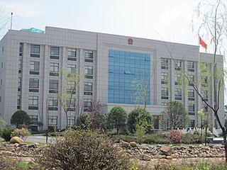
Wangcheng District is one of six urban districts of Changsha, the capital of Hunan province, China. the district is bordered to the north by Miluo City and Xiangyin County of Yueyang, to the west by Heshan District of Yiyang and Ningxiang County, to the south by Yuelu and Kaifu Districts, to the east by Changsha County. Located in the northsouth of the City proper in Changsha, Wangcheng covers 951.06 km2 (367.21 sq mi) with registered population of 560,567 and resident population of 562,100. The district has 10 subdistricts and 5 towns under its jurisdiction, the government seat is at Gaotangling Subdistrict.
Tongguan is a subdistrict of Wangcheng district, Changsha, China. It is located on the eastern bank of Xiang river, the subdistrict is bordered by Dingziwan subdistrict to the south, Qiaoyi and Chating towns to the east and north, Jinggang town and Gaotangling subdistrict across the Xiang river to the west. Tongguan has an area of 90.3 km2 (34.9 sq mi) with a population of 50 thousand, its administrative centre is at Huacheng village. the subdistrict has 5 residential communities and 9 villages under its jurisdiction. Tongguan is located on the eastern bank of Xiangjiang River in the northern part of Wangcheng District. It has one provincial-level cultural relic protection unit, one municipal-level cultural relic protection unit, four county-level cultural relic protection unit and two county-level cultural relic site. Tongguan has been known as "Town of Ceramics" and "Ancient Tongguan Town".
Dongcheng is a community of Chating town, Wangcheng District, Changsha. It is located on the northern margin of Wangcheng District, and the west of Chating town. the community was formed by merging the Shenjiaqiao Community (慎家桥社区) and Jingshen Village (静慎村) on March 23, 2016. there is about a population of 4,880.
Hengshi Town is a rural town in Ningxiang City, Hunan Province, China. It is surrounded by Huangcai Town on the west, Huishangang Town on the north, Yujia'ao Township and Shuangfupu Town on the east, and Laoliangcang Town on the south. As of the 2000 census it had a population of 47,491 and an area of 123 square kilometres (47 sq mi).
Yujia'ao Township is a rural township in Ningxiang City, Hunan Province, China. It is surrounded by Hengshi Town on the west, Huishangang Town and Yuejiaqiao Town on the north, Meitanba Town on the east, and Shuangfupu Town and Dachengqiao Town on the south. As of the 2000 census, it had a population of 35,670 and an area of 96.85 square kilometres (37.39 sq mi).
Fenshui Township is an rural township in Xiangtan County, Xiangtan City, Hunan Province, People's Republic of China. It's surrounded by Shigu Town on the west, Xiangxiang City on the north, Paitou Township on the east, and Shigu Town on the south. As of the 2000 census it had a population of 39,898 and an area of 85.33 square kilometres (32.95 sq mi).
Huashi Town is an urban town in Xiangtan County, Xiangtan City, Hunan Province, People's Republic of China. It's surrounded by Paitou Township on the west, Shebu Town on the north, Zijingshan Town on the east, and Cha'ensi Town on the south. As of the 2000 census it had a population of 54,941 and an area of 133.4 square kilometres (51.5 sq mi).
Shigu Town is an urban town in Xiangtan County, Xiangtan City, Hunan Province, People's Republic of China. As of the 2000 census it had a population of 49,645 and an area of 96.5 square kilometres (37.3 sq mi)
Yangjiaqiao Town is an urban town in Xiangtan County, Xiangtan City, Hunan Province, People's Republic of China. As of the 2006 census it had a population of 60,929.
Jingang Town is a rural town in Liuyang City, Hunan Province, People's Republic of China. As of the 2015 census it had a population of 64,000 and an area of 79.88-square-kilometre (30.84 sq mi). The town is bordered to the north and west by Dayao Town, to the east by Jinshan Town of Shangli County, to the south by Litian Town of Liling, and to the northeast by Chengtanjiang Town.
Zhangfang Town is a rural town in Liuyang City, Hunan Province, People's Republic of China. As of the 2015 census it had a population of 31,800 and an area of 319.3-square-kilometre (123.3 sq mi) . It borders Daweishan Town in the north, Paibu Town in the east, the towns of Yonghe, Guandu and Dahu in the west, and Xiaohe Township in the south.
Zhentou Town is a rural town in Liuyang City, Hunan Province, People's Republic of China. As of the 2015 census it had a population of 57,100 and an area of 158.8-square-kilometre (61.3 sq mi). It is bordered to the north by Jiangbei Town, to the east by towns of Puji, Gejia and Guanqiao, to the south by Lusong District and Hetang District of Zhuzhou, and to the west by Baijia Town.
Dingziwan is a subdistrict of the Wangcheng district, Changsha in China, located on the eastern bank of the Xiang River. The subdistrict is bordered by the Tongguan Subdistrict to the north; the town of Qiaoyi to the east; the Qingzhuhu subdistrict of the Kaifu district to the south; and the Gaotangling, Baishazhou, and Dazehu subdistricts across the Xiang River to the west.
Qiaoyi is a town of Wangcheng district, Changsha, China. the town is bordered by Chuanshanping town of Miluo and Chating to the north, Beishan town of Changsha county to the east, Shaping and Qingzhuhu subdistricts of Kaifu district to the south, Tongguan Subdistrict to the west. It covers 103.0 km2 (39.8 sq mi) with 38.4 thousand of population. the town contains 9 villages and residential communities, its administrative center is at Qiaotouyi.
Chating is a town of Wangcheng district, Changsha, China. the town is located on the northeast of the district, and bordered by Zhangshu and Jinlong towns of Xiangyin county to the north, Gaojiafang town of Miluo city to the east, Qiaoyi town to the south, Dingziwan and Tongguan Subdistricts to the west. It covers 135 km2 (52 sq mi) with 54 thousand of population. the town contains 11 villages and 2 residential communities, its administrative center is at Meihualing (梅花岭).
Dazehu is a subdistrict of Wangcheng District, Changsha, China. It is located on the western bank of the Xiang River. The subdistrict is bordered by the Yueliangdao Subdistrict to the South, Huangjinyuan to the West, Baishazhou, the Gaotangling Subdistricts to the North, and Dingziwan across the Xiang River to the East. Dazehu has an area of 25.33 km2 (9.78 sq mi) and has a population of 26,400. The subdistrict has one residential community and three villages under its jurisdiction.
Yueliangdao is a subdistrict of Wangcheng district, Changsha, China. It is located on the western bank of Xiang river, the subdistrict is bordered by Dazehu subdistrict to the north, Huangjinyuan to the west, Wangyue and Guanshaling subdistricts of Yuelu district to the south, Xiufeng subdistrict across the Xiang river to the east. Yueliangdao has an area of 22.77 km2 (8.79 sq mi) with a population of 30,061. the subdistrict has 4 residential communities and 3 villages under its jurisdiction.
Huanglong River, historically known as Zengzigang River, is a right-bank tributary of Xiang River in Wangcheng District and the northernmost one of right-bank tributaries in Changsha section of Xiang River in Hunan, China. It has a length of 10 kilometres (6.2 mi) with a rough drainage basin area of 50 square kilometres (19 sq mi). Huanglong River rises in Shiziling of Chating Town, flows through Shiziling, Yangjiaping, Dongcheng and Dalong four villages of Chating Town and Huashi Village of Tongguan Subdistrict, merging into Xiang River at Zengzigang Mouth located between Dalong and Huashi villages.
Guanshaling Subdistrict is a subdistrict of Yuelu District in Changsha, Hunan, China. The subdistrict has an area of about 14.17 km2 (5.47 sq mi) with a population of 51,324. The subdistrict of Guanshaling has 3 villages and 13 communities under its jurisdiction, its administrative office is at Juzhou Xinyuan Community.


