Judds Falls

Last updated
Judds Falls
JuddsFalls2019.jpg
Judds Falls in May 2019
USA New York relief location map.svg
Red pog.svg
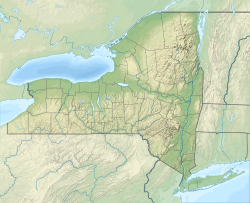
Location of Judds Falls within New York
Judds Falls
Coordinates 42°49′21″N74°41′12″W / 42.82250°N 74.68667°W / 42.82250; -74.68667
Elevation1,207 ft (368 m) [1]
Watercourse Canajoharie Creek

Judds Falls, also known as Tekaharawa Falls, is a waterfall located northeast of the Village of Cherry Valley, New York on the Canajoharie Creek. [1] [2]
Related Research Articles

<span class="mw-page-title-main">Cherry Valley, California</span> Census-designated place in California, United States

Cherry Valley is a census-designated place (CDP) in Riverside County, California, United States. The population was 6,362 at the 2010 census, up from 5,891 at the 2000 census. It is situated at the most northwestern point of the San Gorgonio Pass.

Cherry Valley is a village in Otsego County, New York, United States. The population was 520 at the 2010 census.

<span class="mw-page-title-main">Cherry Valley, New York</span> Town in New York, United States

Cherry Valley is a town in Otsego County, New York, United States. According to the 2020 US census, the village of Cherry Valley had a population of 487. However, the town has a much higher population.

<span class="mw-page-title-main">Tuolumne River</span> River from Yosemite to the San Joaquin Valley, California

The Tuolumne River flows for 149 miles (240 km) through Central California, from the high Sierra Nevada to join the San Joaquin River in the Central Valley. Originating at over 8,000 feet (2,400 m) above sea level in Yosemite National Park, the Tuolumne drains a rugged watershed of 1,958 square miles (5,070 km2), carving a series of canyons through the western slope of the Sierra. While the upper Tuolumne is a fast-flowing mountain stream, the lower river crosses a broad, fertile and extensively cultivated alluvial plain. Like most other central California rivers, the Tuolumne is dammed multiple times for irrigation and the generation of hydroelectricity.

<span class="mw-page-title-main">Tualatin River</span> River in Oregon, United States

The Tualatin River is a tributary of the Willamette River in Oregon in the United States. The river is about 83 miles (134 km) long, and it drains a fertile farming region called the Tualatin Valley southwest and west of Portland at the northwest corner of the Willamette Valley. There are approximately 500,000 people residing on 15 percent of the land in the river's watershed.

<i>Cherry Falls</i> 2000 American slasher film by Geoffrey Wright

Cherry Falls is a 2000 American slasher film directed by Geoffrey Wright, and starring Brittany Murphy, Jay Mohr, and Michael Biehn. The plot focuses on a small Virginia town where a serial killer is targeting teenaged virgins. After being submitted to and rejected by the MPAA numerous times, the film was never picked up for theatrical distribution and was purchased by USA Films, who telecast it in the fall of 2000.

<span class="mw-page-title-main">Walter Judd (politician)</span> American politician and physician

Walter Henry Judd or I-te Chou, was an American politician and physician, best known for his battle in Congress (1943–63) to define the conservative position on China as all-out support for the Nationalists under Chiang Kai-shek and opposition to the Communists under Mao Zedong. After the Nationalists fled to Formosa (Taiwan) in 1949, Judd redoubled his support.

"Love Can Build a Bridge" is a song written by Naomi Judd, Paul Overstreet, and John Barlow Jarvis, and recorded by American country music duo the Judds. It was released in 1990 as the second single and title track from their album of the same name. It was a top-five country hit in mid-1991. The song has inspired several cover versions, including one by Cher, Chrissie Hynde, Neneh Cherry, and Eric Clapton that topped the UK Singles Chart in 1995.

<span class="mw-page-title-main">Cherry Creek (Tuolumne River tributary)</span> River in California, United States

Cherry Creek is a large, swift-flowing stream in the Sierra Nevada mountain range, and is the largest tributary of the Tuolumne River. The creek is 40 miles (64 km) long measured to its farthest headwaters; the main stem itself is 26 miles (42 km) long, draining a watershed of 234 square miles (610 km2) in the Stanislaus National Forest. Part of the drainage also extends into the northwest corner of Yosemite National Park.

<span class="mw-page-title-main">Cherry Hill station (NJ Transit)</span> NJ Transit rail station

Cherry Hill station is a NJ Transit train station in Cherry Hill, New Jersey, United States, on the Atlantic City Line. Eastbound service is offered to Atlantic City and Westbound service is offered to Philadelphia. The station runs through the former Garden State Racetrack property, currently occupied by two separate shopping centers. The station is accessible directly from Route 70. There is also an NJT 450 bus connection at the station, and the 406 bus on Route 70.

<span class="mw-page-title-main">Cherry Grove, Oregon</span> Unincorporated community in the state of Oregon, United States

Cherry Grove is an unincorporated community in Washington County, Oregon, United States. Cherry Grove is situated on the north bank of the Tualatin River near where it exits the Northern Oregon Coast Range and enters Patton Valley.

<span class="mw-page-title-main">Norman J. Gould</span> American politician

Norman Judd Gould was a Republican member of the United States House of Representatives from New York.

<span class="mw-page-title-main">Huon Valley</span> Valley in Tasmania, Australia

The Huon Valley, or simply the Huon, is a valley and geographic area located in southern Tasmania, Australia. The largest town is Huonville, with other smaller towns spread across the area. It includes Australia's most southern permanent settlement at Southport. The Huon Valley Council area had a population of 15,140 in 2011. Famed for its apple growing, the Valley was first settled by British colonists in the 1820s; prior to settlement the Huon Valley area was inhabited by the Mouheneenner, Nuenonne, Mellukerdee and Lyluequonny people.

<span class="mw-page-title-main">Cherry Valley Township, Ashtabula County, Ohio</span> Township in Ohio, United States

Cherry Valley Township is one of the twenty-seven townships of Ashtabula County, Ohio, United States. The 2020 census found 913 people in the township.

<span class="mw-page-title-main">Norman B. Judd</span> American politician (1815–1878)

Norman Buel Judd was a U.S. Representative from Illinois, and the grandfather of U.S. Representative Norman Judd Gould of New York.

<span class="mw-page-title-main">Cherry Valley Creek (New York)</span> River in New York, United States

Cherry Valley Creek is a 34.1-mile-long (54.9 km) headwater tributary of the Susquehanna River in central New York, United States.

<span class="mw-page-title-main">Cherry Valley National Wildlife Refuge</span>

The Cherry Valley National Wildlife Refuge is a National Wildlife Refuge in Monroe County, Pennsylvania.

<span class="mw-page-title-main">Canajoharie Creek</span> Watercourse in the United States of America

The Canajoharie Creek is a river that flows into the Mohawk River in the Village of Canajoharie in the U.S. State of New York. The name "Canajoharie" is a Mohawk language term meaning "the pot that washes itself", referring to the "Canajoharie Boiling Pot", a 20-foot (6.1 m) wide and 10-foot (3.0 m) deep pothole in the Canajoharie Creek, just south of the village of Canajoharie. Bowmans Creek is one main tributary that enters the creek east of the Hamlet of Sprout Brook. The other main tributary is Brimstone Creek which enters the creek north-northwest of the Village of Ames.

Shankley Mountain is a mountain in the Central New York region of New York. It is located northwest of Cherry Valley, New York.

<span class="mw-page-title-main">Apple Fire</span> 2020 wildfire in Riverside, California

The Apple Fire was a wildfire that burned during the 2020 California wildfire season in Cherry Valley south of Oak Glen and north of Beaumont and Banning in Riverside County, California in the United States. The fire ignited on Friday, July 31, 2020 as three separate smaller blazes within the rural canyons along Oak Glen Road before merging and rapidly expanded to 1,900 acres (769 ha) and destroyed at least one home and two outbuildings in the Cherry Valley area. It now covers at least 33,424 acres (13,526 ha) and created "a plume of smoke so massive that it generated its own winds." The fire was sparked by a diesel-burning vehicle that emitted burning carbon.

References

  1. 1 2 "Judds Falls". Geographic Names Information System . United States Geological Survey, United States Department of the Interior . Retrieved 2017-10-12.
  2. "Town of Cherry Valley map". historicmapworks.com. 1868. Retrieved 30 May 2019. data