Junctions (software)

Last updated

Junctions is a software package by Transport Research Laboratory. It incorporates the previously separate programs ARCADY, PICADY and OSCADY. The latest version, Junctions 10, was launched on 3 February 2021. [1]

Contents

Junctions
Developer(s) Transport Research Laboratory
Stable release
10.1.0 / August 2, 2023;16 months ago (2023-08-02)
Operating system Windows
Type Traffic software
License Proprietary software
Website https://trlsoftware.com/

ARCADY

ARCADY is used to assess roundabout designs. Circulating traffic has priority over traffic entering from the approach roads. Key Street Roundabout - geograph.org.uk - 11850.jpg
ARCADY is used to assess roundabout designs. Circulating traffic has priority over traffic entering from the approach roads.

ARCADY (Assessment of Roundabout Capacity And DelaY) models traffic capacity, queues, and delays at roundabouts. [2] The software is largely based on empirical relationships between roundabout geometry and capacity, which were established as the result of extensive research carried out on existing roundabouts on the UK road network, as well as controlled test track facilities. [3]

The program is used by traffic engineers when assessing existing layouts or when analysing the impacts of proposed design changes. Estimates of annual accident frequencies can also be obtained. [4] The key outputs are the Ratio of Flow to Capacity, the queue length, and delay time.

The capacity and safety relationships that ARCADY utilizes are discussed in the UK's Design Manual for Roads and Bridges. [5]

RODEL is similar to ARCADY. [6]

Recent developments

From ARCADY 7 onwards, the software has been capable of communicating with certain CAD software, aiding real-time design analysis. ARCADY 7 introduced the ability to model simple networks of linked roundabouts.

In ARCADY 8, [7] the Highway Capacity Manual 2010 methodology for roundabout analysis was made available. ARCADY 8 also introduced a simulation technique to deal with the modelling of certain configurations, such as lane usage at roundabouts.

'ARCADY Lite' is a simplified version of ARCADY 8 that provides basic analysis of roundabouts.

ARCADY 9 includes built-in tools for graphically measuring roundabout geometries and for assisting with the transfer of traffic flow data from other sources (typically spreadsheets).

ARCADY 10 is now fully integrated and available as a module within Junctions. Updates include a number of new modelling scenarios to be evaluated, such as priority chicanes and one-ways. North American users also have the option of using the HCM 2010 model (using HCM 2016 roundabout coefficients) to analyse roundabout designs.

PICADY

PICADY is used to assess priority junction designs such as this T-junction. There are no signals here so right of way is determined by the road markings. The double-dashed line indicates that the grey car should give way to any oncoming traffic. T-junction in Strood.jpg
PICADY is used to assess priority junction designs such as this T-junction. There are no signals here so right of way is determined by the road markings. The double-dashed line indicates that the grey car should give way to any oncoming traffic.

PICADY (Priority Intersection Capacity and Delay) is a program for modelling three and four arm priority junctions in a similar manner to ARCADY. It is based on empirical relationships which link capacity and safety with road geometric parameters such as carriageway widths and visibilities. [8] These relationships are discussed in the UK Design Manual for Roads and Bridges. [9] As for ARCADY, the key outputs are the Ratio of Flow to Capacity, the queue length and delay time.

PICADY can also model pedestrian crossings on the approaches to priority junctions. [10]

PICADY 5 can model the following junction forms:

PICADY 9 includes Highway Capacity Manual 2010 models for Two-Way Stop-Controlled and All-Way Stop-Controlled intersections.

PICADY 10 offers the ability to calibrate models in all circumstances, by applying adjustments to the model’s individual traffic movement raw capacities. Models applicable to North America allow users to set up and model Two-Way Stop Controlled (TWSC) and All-Way Stop Controlled (AWSC) intersections.

OSCADY

OSCADY (Optimized Signal Capacity and Delay) [11] calculates and simulates capacities, queues and delays for isolated (uncoordinated), traffic signal-controlled junctions. It can evaluate a set of known signal timings, and optionally it can optimize stage lengths and/or cycle time to minimize delay. These functions are similar to LinSig.  More recently, an extension to the simulation mode allows the performance of simple adaptive signal control to be estimated.

OSCADY is intended to be used at relatively simple signalized junctions (or temporary signals at road works) where the emphasis is on setting up model runs quickly and easily, but can model junctions that include flared approaches and opposed right turns. Its integration with ARCADY and PICADY means that users can switch a junction between priority and signalized options and compare the results within one package.

Optionally, signalized junctions can be evaluated in Lane Simulation mode which offers additional functionality, such as the ability to model intermittent stages and partially signalized junctions, including signalized roundabouts. In Junctions 10 the simulation mode capability has been extended to allow the performance of simple adaptive signal control to be estimated. This model can be applied to temporary signals (such as at roadworks) and some control over the controller logic is provided in order to mimic behaviour whenever there is no demand at any point within the modelled time period.

Related Research Articles

<span class="mw-page-title-main">Roundabout</span> Traffic intersection

A roundabout, a rotary and a traffic circle are types of circular intersection or junction in which road traffic is permitted to flow in one direction around a central island, and priority is typically given to traffic already in the junction.

<span class="mw-page-title-main">Intersection (road)</span> Road junction where two or more roads either meet or cross at grade

An intersection or an at-grade junction is a junction where two or more roads converge, diverge, meet or cross at the same height, as opposed to an interchange, which uses bridges or tunnels to separate different roads. Major intersections are often delineated by gores and may be classified by road segments, traffic controls and lane design.

<span class="mw-page-title-main">Traffic light</span> Signaling device to control competing flows of traffic

Traffic lights, traffic signals, or stoplights – also known as robots in South Africa, Zambia, and Namibia – are signaling devices positioned at road intersections, pedestrian crossings, and other locations in order to control the flow of traffic.

Level of service (LOS) is a qualitative measure used to relate the quality of motor vehicle traffic service. LOS is used to analyze roadways and intersections by categorizing traffic flow and assigning quality levels of traffic based on performance measure like vehicle speed, density, congestion, etc. In a more general sense, levels of service can apply to all services in asset management domain.

<span class="mw-page-title-main">Diamond interchange</span> Common type of road junction

A diamond interchange is a common type of road junction, used where a controlled-access highway crosses a minor road.

<span class="mw-page-title-main">Traffic island</span> Object in the middle of a road designed to channel traffic

A traffic island is a solid or painted object in a road that channels traffic. It can also be a narrow strip of island between roads that intersect at an acute angle. If the island uses road markings only, without raised curbs or other physical obstructions, it is called a painted island or ghost island. Traffic islands can be used to reduce the speed of cars driving through, or to provide a central refuge to pedestrians crossing the road.

<span class="mw-page-title-main">Interchange (road)</span> Road junction that uses grade separation

In the field of road transport, an interchange or a grade-separated junction is a road junction that uses grade separations to allow for the movement of traffic between two or more roadways or highways, using a system of interconnecting roadways to permit traffic on at least one of the routes to pass through the junction without interruption from crossing traffic streams. It differs from a standard intersection, where roads cross at grade. Interchanges are almost always used when at least one road is a controlled-access highway (freeway) or a limited-access highway (expressway), though they are sometimes used at junctions between surface streets.

In transportation engineering, traffic flow is the study of interactions between travellers and infrastructure, with the aim of understanding and developing an optimal transport network with efficient movement of traffic and minimal traffic congestion problems.

<span class="mw-page-title-main">Road junction</span> Location where two or more roads meet

A junction is where two or more roads meet.

Intersection Capacity Utilization (ICU) method is a tool for measuring a roadway intersection's capacity. It is ideal for transportation planning applications such as roadway design, congestion management programs and traffic impact studies. It is not intended for traffic operations or signal timing design. ICU is also defined as "the sum of the ratios of approach volume divided by approach capacity for each leg of intersection which controls overall traffic signal timing plus an allowance for clearance times." The ICU tells how much reserve capacity is available or how much the intersection is overcapacity. The ICU does not predict delay, but it can be used to predict how often an intersection will experience congestion.

<span class="mw-page-title-main">Bowtie (road)</span> Type of road intersection

The bowtie is a type of road intersection which replaces left turns or right turns, with roundabouts on the cross street. It is an alternative to the Michigan left intersection.

In traffic engineering, saturation describes the maximum traffic flow which can be handled by a junction. The saturation flow is the rate at which a continuous flow of vehicles can pass through a constant green signal, typically expressed in vehicles per hour or PCUs per hour.

<span class="mw-page-title-main">Traffic light control and coordination</span>

The normal function of traffic lights requires more than sight control and coordination to ensure that traffic and pedestrians move as smoothly, and safely as possible. A variety of different control systems are used to accomplish this, ranging from simple clockwork mechanisms to sophisticated computerized control and coordination systems that self-adjust to minimize delay to people using the junction.
<span class="mw-page-title-main">LinSig</span>

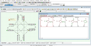
LinSig is software by JCT Consultancy which allows traffic engineers to model traffic signals and their effect on traffic capacities and queuing. As well as modelling the effects of traffic signals LinSig also optimises signal timings to reduce delay or increase capacity at a junction or group of interlinked junctions.
<span class="mw-page-title-main">Canadian Capacity Guide For Signalized Intersections</span> Publication on traffic signal controlled roadway intersections

The Canadian Capacity Guide for Signalized Intersections (CCG) is a publication of the Canadian Institute of Transportation Engineers (CITE). It provides a methodology that allows Traffic Engineers to plan, design, and evaluate traffic signal controlled roadway intersections.

<span class="mw-page-title-main">Traffic simulation</span>

Traffic simulation or the simulation of transportation systems is the mathematical modeling of transportation systems through the application of computer software to better help plan, design, and operate transportation systems. Simulation of transportation systems started in the 1950s, and is an important area of discipline in traffic engineering and transportation planning today. Various national and local transportation agencies, academic institutions and consulting firms use simulation to aid in their management of transportation networks.

TRANSYT-7F is a traffic simulation and signal timing optimization program. The primary application of TRANSYT-7F is signal timing design and optimization. TRANSYT-7F features genetic algorithm optimization of cycle length, phasing sequence, splits, and offsets. TRANSYT-7F combines a detailed optimization process with a detailed macroscopic simulation model.

<span class="mw-page-title-main">Cycling infrastructure</span> Facilities for use by cyclists

Cycling infrastructure is all infrastructure cyclists are allowed to use. Bikeways include bike paths, bike lanes, cycle tracks, rail trails and, where permitted, sidewalks. Roads used by motorists are also cycling infrastructure, except where cyclists are barred such as many freeways/motorways. It includes amenities such as bike racks for parking, shelters, service centers and specialized traffic signs and signals. The more cycling infrastructure, the more people get about by bicycle.

Sidra Intersection is a software package used for intersection (junction), interchange and network capacity, level of service and performance analysis, and signalised intersection, interchange and network timing calculations by traffic design, operations and planning professionals.

<span class="mw-page-title-main">Protected intersection</span> At-grade road junction in which cyclists and pedestrians are separated from cars

A protected intersection or protected junction, also known as a Dutch-style junction, is a type of at-grade road junction in which cyclists and pedestrians are separated from cars. The primary aim of junction protection is to help pedestrians and cyclists be and feel safer at road junctions.

References

  1. "Junctions 10 Features". TRL Software. Retrieved 2 February 2021.
  2. Kimber, R.M., The Traffic Capacity of Roundabouts, TRL Laboratory Report LR942, 1980.
  3. "Roundabout Design for Capacity and Safety: the UK Empirical Methodology" (PDF). Archived from the original (PDF) on 26 July 2014. Retrieved 12 May 2015.
  4. Maycock, G. and R.D. Hall, Accidents at 4-Arm Roundabouts, TRL Laboratory Report LR1120, 1984.
  5. DMRB TD 16/07: Geometric Design of Roundabouts
  6. Nikolic et al http://conf.tac-atc.ca/english/resourcecentre/readingroom/conference/conf2010/docs/j4/nikolic.pdf
  7. Georgia Department of Transportation http://www.dot.ga.gov/PartnerSmart/DesignSoftware/TrafficSoftware/Getting%20Started%20ARCADY8.pdf
  8. Kimber, R.M. and R.D. Coombe, The Traffic Capacity of Major/Minor Priority Junctions, TRL Laboratory Report SR582, 1980.
  9. DMRB TD 42/95: Geometric Design of Major/Minor Priority Junctions
  10. Transport for London, Traffic Modelling Guidelines v3.0, http://content.tfl.gov.uk/traffic-modelling-guidelines.pdf
  11. TAL 1/06 https://tsrgd.co.uk/pdf/tal/2006/tal-1-06_1.pdf

See also