
Apchaur is a popular VDC in Gulmi District in the Lumbini Zone of centralNepal. At the time of the 1991 Nepal census it had a population of 3910 persons living in 743 individual households.
Arbani is a village and municipality in Gulmi District in the Lumbini Zone of central Nepal. At the time of the 1991 Nepal census it had a population of 3116 persons living in 565 individual households.
Arkhawang is a village and municipality in Gulmi District in the Lumbini Zone of central Nepal. At the time of the 1991 Nepal census it had a population of 1282 persons living in 237 individual households.
Aslewa is a village development committee (VDC) in Gulmi District in the Lumbini Zone of central Nepal. At the time of the 1991 Nepal census it had a population of 8088 persons living in 992 individual households. The village has a temple called Rudra Beni Dhaam and a school for higher level study, the Shree Janata Higher Secondary School.
Dalamchaur is a village and municipality in Gulmi District in the Lumbini Zone of central Nepal. At the time of the 1991 Nepal census it had a population of 2597 persons living in 524 individual households.
Darbar Devisthan is a town and municipality in Gulmi District in the Lumbini Zone of central Nepal. At the time of the 1991 Nepal census it had a population of 5152 persons living in 957 individual households.
Ghamir is a village in Gulmi District in the Lumbini Zone of Western Nepal. It is located at latitude 28°12′7.81″ N and longitude 83°9′32.66″ E. It lies 1143 meters above sea level. According to 2011 Nepal census, the total population of this village is 3,588 individuals living in 768 households. The census also noted some absent people; most are foreign employees employed overseas and in the Middle East. The male population is 1,563 and the female population is 2,025, causing a sex ratio of 77.19.
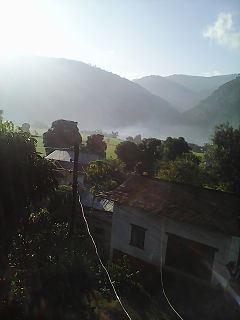
Dhurkot Nayagaun is a town and municipality in Gulmi District in the Lumbini Zone of central Nepal. At the time of the 1991 Nepal census it had a population of 4692. This VDC is one of the most beautiful VDC of Gulmi and famous for Oranges. Literacy rate of this VDC is above 90℅. Politically above 75% people support CPM UML in this village. This VDC is touched by Arghakhanchi district.
Gwadi is a village and municipality in Gulmi District in the Lumbini Zone of central Nepal. At the time of the 1991 Nepal census it had a population of 2997 persons living in 546 individual households.
Johang is a Village Development Committee VDC in Gulmi District in the Lumbini Zone of Western Nepal. At the time of the 2011 Nepal census it had a population of about 10000 living in 1509 individual households.
Situated on the bank of Kaligandaki river, Khadgakot is a town and Village Development Committee, in Gulmi District in the Lumbini Zone of central Nepal. At the time of the 1991 Nepal census it had a population of 4297 persons living in 808 individual households.
Kurgha is a village and municipality in Gulmi District in the Lumbini Zone of central Nepal. At the time of the 1991 Nepal census it had a population of 2988 persons residing in 556 individual households.
Limgha is a rural municipality ward no 4 and (सत्यवती) village council ward no 4 in Gulmi District in the Lumbini Zone of central Nepal. At the time of the 1991 Nepal census it had a population of 3285 persons living in 665 individual households.
Malagiri is a village and municipality in Gulmi District in the Lumbini Zone of central Nepal. At the time of the 1991 Nepal census it had a population of 2024.
Pipaldhara is a village and municipality in Gulmi District in the Lumbini Zone of central Nepal. At the time of the 1991 Nepal census it had a population of 2876 persons living in 593 individual households.
Rupakot is a Village Development Committee (VDC) in Gulmi District in the Lumbini Zone of central Nepal. Its headquarters is in Myal pokhara. It is located in about the center of Gulmi District. It is surrounded by hills. Its main religion is Hinduism. There are many temples like Chhatra Thaan, Shiddababa temple, Shiva Temple, Ram Temple,Debi deurali temple etc. The main sources of revenue for the village are agriculture and foreign employment. At the time of the 2001 Nepal census, it had a population of 3521 persons residing in 704 individual households. 76.48% of students attend school. The most populated parts of this VDC is Damuka, Sota & Ekle Pipal.
Simichaur is a town in Resunga Municipality in Gulmi District in the Lumbini Zone of central Nepal. At the time of the 1991 Nepal census it had a population of 4811 persons living in 942 individual households. Almost 99% of the people are Hindus.
Wagla is a village and VDC in Gulmi District in the Lumbini Zone of Western Nepal. At the time of the 1991 Nepal census it had a population of 2736 persons living in 510 individual households.
Kaligandaki is a Village council in Syangja District in Gandaki Pradesh, central Nepal. In 12 March 2017, the government of Nepal implemented a new local administrative structure consisting of 744 local units. With the implementation of the new local administrative structure, VDCs have been replaced with municipal & village councils. Kaligandaki is one of these 744 local units. Kaligandaki is created by merging Alamdevi, Birgha Archale, Chandibhanjyang & Shreekrishna Gandaki.

Gulmi Darbar is a Rural municipality located within the Gulmi District of the Lumbini Province of Nepal. The rural municipality spans 79.99 square kilometres (30.88 sq mi) of area, with a total population of 22,037 according to a 2011 Nepal census.

