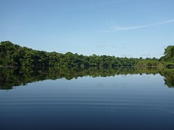
The Juruá River is a southern affluent river of the Amazon River west of the Purus River, sharing with this the bottom of the immense inland Amazon depression, and having all the characteristics of the Purus as regards curvature, sluggishness and general features of the low, half-flooded forest country it traverses.

The Purus River is a tributary of the Amazon River in South America. Its drainage basin is 371,042 km2 (143,260 sq mi), and the mean annual discharge is 11,207 m3/s (395,800 cu ft/s). The river shares its name with the Alto Purús National Park and the Purús Province, one of the four provinces of Peru in the Ucayali Region.

The Juruena River is a 1,240 km (770 mi) long river in west-central Brazil, in the state of Mato Grosso.

Coari (Choary) is a municipality located in the Brazilian state of Amazonas.

Apuí is a municipality located in the Brazilian state of Amazonas. Its population was 22,359 (2020) and its area is 54,240 km2.

Carauari is a municipality located in the Brazilian state of Amazonas. Its population was 28,508 (2020) and its area is 25,767 km².

Jutaí is a municipality located in the Brazilian state of Amazonas. Its population is 13,886 (2020) and its area is 69,552 km2, making it the fifth largest municipality in Amazonas by area and the ninth largest in Brazil.

Novo Aripuanã is a municipality located in the Brazilian state of Amazonas.
The Jutaí-Solimões Ecological Station is an ecological station in the state of Amazonas, Brazil. It protects an area of flooded and terra firme forest in the Amazon biome.
The Mamirauá Sustainable Development Reserve in the Brazilian state of Amazonas, near the city of Tefé, is a 4,300-square-mile (11,000 km2) reserve near the village of Boca do Mamirauá. It includes mostly Amazonian flooded forest and wetlands. The ribeirinhos are native to the area.

Aripuanã River is a river in the Mato Grosso and Amazonas states in north-western Brazil. It is a tributary of the Madeira River in the Amazon Basin. The town of Novo Aripuanã is located on its banks where it merges into the Madeira River. The town of Aripuanã is also on its banks, but on the upper (southern) section of the river.
The Biá River is a river of Amazonas state in north-western Brazil. It is a tributary of the Jutaí River.
The Mutum River is a river of Amazonas state in north-western Brazil. It is a tributary of the Jutaí River.
The Riozinho River is a river of Amazonas state in north-western Brazil. It is a tributary of the Jutaí River.
Amanã Sustainable Development Reserve is a sustainable development reserve in the state of Amazonas, Brazil.
The Cujubim Sustainable Development Reserve is a sustainable development reserve in the state of Amazonas, Brazil.
The Rio Gregório Extractive Reserve is an extractive reserve in the state of Amazonas, Brazil. It supports about 200 families engaged in extraction of forest products, small-scale farming and animal husbandry.

The Catuá-Ipixuna Extractive Reserve is an extractive reserve in the state of Amazonas, Brazil. It takes its name from two lakes that drain into the Solimões River, or Upper Amazon, and is covered in Amazon rainforest.
The Rio Jutaí Extractive Reserve is an extractive reserve in the state of Amazonas, Brazil.
The Baixo Juruá Extractive Reserve is an extractive reserve in the state of Amazonas, Brazil. It contains an area of almost untouched Amazon rainforest inhabited by communities that rely on manioc farming, small-scale animal husbandry, fishing, hunting and gathering.


