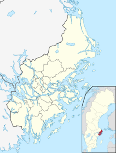
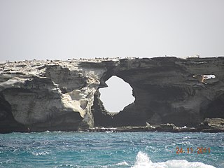
Cape Peron is a headland at Rockingham, at the southern end of Cockburn Sound in Western Australia. It contains the suburb of Peron. Locally known as Point Peron, the cape is noted for its protected beaches, limestone cliffs, reefs and panoramic views. Officially, "Point Peron" is the designation of a minor promontory on the south side of the cape's extremity.
UNESCO Biosphere Reserves are environment-protected scientific-research institutions of international status that are created with the intent for conservation in a natural state the most typical natural complexes of biosphere, conducting background ecological monitoring, studying of the surrounding natural environment, its changes under the activity of anthropogenic factors.

Fort Monroe is a decommissioned military installation in Hampton, Virginia at Old Point Comfort, the southern tip of the Virginia Peninsula, United States. Along with Fort Wool, Fort Monroe originally guarded the navigation channel between the Chesapeake Bay and Hampton Roads—the natural roadstead at the confluence of the Elizabeth, the Nansemond and the James rivers. Until disarmament in 1946, the areas protected by the fort were the entire Chesapeake Bay and Potomac River regions, including the water approaches to the cities of Washington, D.C. and Baltimore, Maryland, along with important shipyards and naval bases in the Hampton Roads area. Surrounded by a moat, the six-sided bastion fort is the largest fort by area ever built in the United States.

Fort Worden and accompanying Fort Worden Historical State Park are located in Port Townsend, along Admiralty Inlet in Washington state. It is on 433 acres that originally was a United States Army installation to protect Puget Sound. Fort Worden was named after U.S. Navy Rear Admiral John Lorimer Worden, commander of USS Monitor during its famous battle during the American Civil War.

Camp Hero State Park is a 754-acre (3.05 km2) state park located on Montauk Point, New York. The park occupies a portion of the former Montauk Air Force Station.

Beavertail State Park is a public recreation area encompassing 153 acres (62 ha) at the southern end of Conanicut Island in Narragansett Bay, Rhode Island. The state park's main attraction is the active Beavertail Lighthouse, the current tower of which dates from 1856. During World War II, the park area was part of Fort Burnside, one of several coastal fortifications designed to protect Narragansett Bay. The park's scenic shoreline offers hiking, picnicking, and saltwater fishing.
Fort Tilden, also known as Fort Tilden Historic District, is a former United States Army installation on the coast in the New York City borough of Queens. Fort Tilden now forms part of the Gateway National Recreation Area, and is administered by the National Park Service.
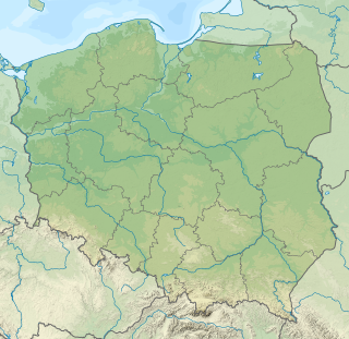
Coastal fortifications were constructed in New Zealand in two main waves: around 1885 as a response to fears of an attack by Russia, and in World War II due to fears of invasion by the Japanese.

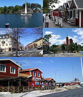
Arholma is an island in the north eastern part of the Stockholm archipelago in Norrtälje Municipality. It is 5 kilometres (3.1 mi) long by 2 kilometres (1.2 mi) wide. It is the northernmost island in the archipelago before the Sea of Åland. The island is characterised by a picturesque combination of traditional wooden buildings, farmland, forests and rocky shorelines.

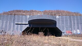
The Krepost Sveaborg was an Imperial Russian system of land and coastal fortifications constructed around Helsinki during the First World War. The purpose of the fortress was to provide a secure naval base for the Russian Baltic fleet and to protect Helsinki and block routes to Saint Petersburg from a possible German invasion. Krepost Sveaborg was part of Peter the Great's Naval Fortress, a coastal fortification system protecting access to Saint Petersburg by sea. The central part of Krepost Sveaborg was the old fortress of Suomenlinna where the fortress headquarters were located. Due to technological advances in artillery the old fortress was no longer capable of providing a sufficient protection, and a new main defensive line was built well beyond the old fortress boundaries. New coastal artillery guns built on outlying islands protected Krepost Sveaborg from the sea, while fortified lines constructed around Helsinki were intended to stop any attacks on land. The primary coastal guns were 10 in (254 mm) model 1891 guns and 6 in (152 mm) model 1892 Canet guns. Older 11 in (279 mm) model 1877 guns were also used. In summer 1917 the fortress had two hundred coastal or anti-landing guns, of which 24 were 10-inch guns in six batteries, 16 were 6-inch Canet guns in four batteries and twelve were 11-inch guns in three batteries. The artillery used in land fortifications included older coastal guns, old fixed carriage guns and newer light field guns. In March 1917, Krepost Sveaborg had a total of 463 guns, although many of them were obsolescent. Krepost Sveaborg was still partly incomplete in 1917 when the February Revolution halted most of the construction work. Some further construction work was carried out during the remaining year, but all work halted during the October Revolution. Following the Finnish Declaration of Independence, parts of the land fortifications were used in the Finnish Civil War. The coastal fortifications were later taken over by Finland to protect Helsinki, while the land fortifications were mostly abandoned and disarmed.

Battery Steele is a United States military fortification on Peaks Island, Portland, Maine in Casco Bay. Completed in 1942 as part of World War II, it is located on 14 acres (5.7 ha) on the oceanside area of the island, formerly part of the Peaks Island Military Reservation. It is named for Harry Lee Steele, who was a Coast Artillery officer during World War I. It was armed with two 16-inch MkIIMI guns and, with a 12-inch gun battery at Fort Levett on Cushing Island, replaced all previous heavy guns in the Harbor Defenses of Portland. It was built to protect Casco Bay, particularly Portland harbor, from Kennebunk to Popham Beach in Phippsburg. According to Kim MacIsaac and historian Joel Eastman in An Island at War, “Battery Steele is not only the largest gun battery built on Peaks Island, but also an example of the largest battery ever built anywhere in the United States.” In 1995, after decades of non-use, the Peaks Island Land Preserve, a community land preservation group, formed to purchase the area and forever preserve it as a public space. On October 20, 2005, the property was listed on the National Register of Historic Places. Other coast defense structures on the island include fire control towers and the counterweight for a disappearing searchlight tower.

The North Norfolk Coast Site of Special Scientific Interest (SSSI) is an area of European importance for wildlife in Norfolk, England. It comprises 7,700 ha (19,027 acres) of the county's north coast from just west of Holme-next-the-Sea to Kelling, and is additionally protected through Natura 2000, Special Protection Area (SPA) listings; it is also part of the Norfolk Coast Area of Outstanding Natural Beauty (AONB). The North Norfolk Coast is also designated as a wetland of international importance on the Ramsar list and most of it is a Biosphere Reserve.

St. David's Battery, also known during wartime as the "Examination Battery", was a fixed battery of rifled breech-loader (RBL) artillery guns, built and manned by the Royal Garrison Artillery and the Royal Engineers, and their part-time reserves, the Bermuda Militia Artillery and the Bermuda Volunteer Engineers, part of the Bermuda Garrison of the British Army.
The Ilhéu de Curral Velho and adjacent coast Important Bird Area lies in the southeastern part of the island of Boa Vista in the Cape Verde archipelago off the coast of north-west Africa in the Atlantic Ocean. It is a 986 ha site consisting of the Ilhéu de Curral Velho, as well as the area opposite it on Boa Vista centred on the deserted village of Curral Velho. It was designated as a Ramsar wetland of international importance on July 18, 2005.

Saint Mary's Battery, also known as Comino Battery, is an artillery battery on the island of Comino in Malta. It was built by the Order of Saint John between 1715 and 1716 as one of a series of coastal fortifications around the coasts of the Maltese Islands.

Teiči Nature Reserve is a nature reserve situated in eastern Latvia, spread across Madona, Varakļāni and Krustpils municipalities.

Sandemar Nature Reserve is a nature reserve in Stockholm County in Sweden.

Wied Musa Battery, also known as Swatar Battery, is a former artillery battery in Marfa, limits of Mellieħa, Malta. It was built by the Order of Saint John in 1714–1716 as one of a series of coastal fortifications around the Maltese Islands.

Riħama Battery is an artillery battery in Marsaskala, Malta. It was built by the Order of Saint John in 1714–1716 as one of a series of coastal fortifications around the coasts of the Maltese Islands. The battery still exists, although it is in a dilapidated state with part of it having collapsed.