Königsberg (Brocken)

Last updated
Königsberg
Koenigsberg.jpg
Highest point
Elevation 1,034 m above  sea level (NN) (3,392 ft) [1]
Prominence 39 m Brocken
Isolation 1.1 km  Brocken
Coordinates 51°47′20″N10°35′58″E / 51.78889°N 10.59944°E / 51.78889; 10.59944 Coordinates: 51°47′20″N10°35′58″E / 51.78889°N 10.59944°E / 51.78889; 10.59944
Geography
Saxony-Anhalt relief location map.jpg
Red triangle with thick white border.svg
Königsberg
Parent range Harz Mountains

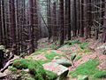
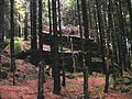
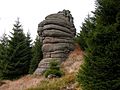
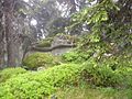
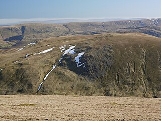
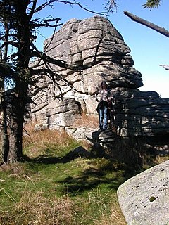
The Königsberg is a neighbouring peak of the Brocken and, at 1033.5 m above sea level [1] the third highest elevation in the Harz mountains. It lies on a long ridge that runs from southeast to northwest about 1.5 km south of the Brocken's summit. Near its summit on the northwest side is the rock formation of Hirschhörner (max. 1,023.2 m). [1] To the east the land descends to the Schwarze Schluftwasser, a small tributary of the Kalte Bode which flows south of the mountain. To the east on the far side of the Schwarzer Schluftwasser is the Heinrichshöhe (1,039.5 m), another subpeak of the Brocken.

Brocken Harz mountain in Germany

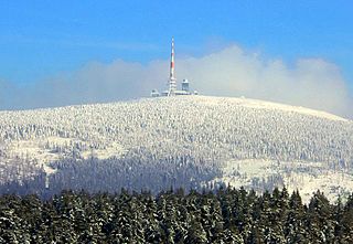
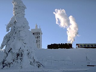
The Brocken, also sometimes referred to as the Blocksberg, is the highest peak of the Harz mountain range and also the highest peak of Northern Germany; it is located near Schierke in the German state of Saxony-Anhalt between the rivers Weser and Elbe. Although its elevation of 1,141 metres (3,743 ft) is below alpine dimensions, its microclimate resembles that of mountains of about 2,000 m (6,600 ft). The peak above the tree line tends to have a snow cover from September to May, and mists and fogs shroud it up to 300 days of the year. The mean annual temperature is only 2.9 °C (37.2 °F). It is the easternmost mountain in northern Germany; travelling east in a straight line, the next prominent elevation would be in the Ural Mountains in Russia.

Normalnull

Normalnull or Normal-Null is an outdated official vertical datum used in Germany. Elevations using this reference system were to be marked "Meter über Normal-Null". Normalnull has been replaced by Normalhöhennull.

Kalte Bode river in Germany

The Kalte Bode is the left-hand headstream of the Bode in the High Harz Mountains in the German state of Saxony-Anhalt. It is 17 kilometres (11 mi) long.

Contents

Geography and former access

The mountain is located in the heart of the national park and is out-of-bounds to walkers. Formerly two paths ran to the top:

Harz National Park national park of Germany

Harz National Park is a nature reserve in the German federal states of Lower Saxony and Saxony-Anhalt. It comprises portions of the western Harz mountain range, extending from Herzberg and Bad Lauterberg at the southern edge to Bad Harzburg and Ilsenburg on the northern slopes. 95 % of the area is covered with forests, mainly with spruce and beech woods, including several bogs, granite rocks and creeks. The park is part of the Natura 2000 network of the European Union.

The Eckerloch is a forested mountain valley, 845 metres above sea level near the village of Schierke in the Harz Mountains of central Germany.

Goethe Way is the name given to a number of footpaths or trails that run through various regions in Germany and the Alps as well as a railway station on the Brocken Railway. They are all named after the German poet, Johann Wolfgang von Goethe.

Goetheweg station railway station in Wernigerode, Germany

Goetheweg station is located between the stations of Schierke and Brocken on the Brocken Railway in the Harz Mountains of Central Germany at a height of 956 m above sea level. The track layout today consists, as in the past, of a horizontal reversing track (Rückdrückgleis) and just one turnout, whilst the running line maintains its continuous gradient of 33 permille.

Map of the Konigsberg ridge Brockenbahn Karte 1912.JPG
Map of the Königsberg ridge

Crags

There are several prominent granite crags on the ridge. From east to west they are the:

Granite A common type of intrusive, felsic, igneous rock with granular structure

Granite is a common type of felsic intrusive igneous rock that is granular and phaneritic in texture. Granites can be predominantly white, pink, or gray in color, depending on their mineralogy. The word "granite" comes from the Latin granum, a grain, in reference to the coarse-grained structure of such a holocrystalline rock. Strictly speaking, granite is an igneous rock with between 20% and 60% quartz by volume, and at least 35% of the total feldspar consisting of alkali feldspar, although commonly the term "granite" is used to refer to a wider range of coarse-grained igneous rocks containing quartz and feldspar.

The Stangenklippe and the pillar-shaped Schluftkopf used to be popular destinations and lie between the Brocken road and Brocken Railway (Brockenbahn). The Kanzelklippen consists of a group of several granite crags, some of which are over 20 m high. On the Rabenklippe is a fireplace about 70 cm in diameter, that has been hewn out of the granite. Its age is unknown. The Gipfelklippe is only about 1.5 m high.

Brocken Railway railway line

The Brocken Railway is one of three tourist metre gauge railways which together with the Harz Railway and Selke Valley Railway form the Harz Narrow Gauge Railways railway network in the Harz mountain range of Germany.

Related Research Articles

Helvellyn mountain in the English Lake District

Helvellyn is a mountain in the English Lake District, the highest point of the Helvellyn range, a north-south line of mountains to the north of Ambleside, between the lakes of Thirlmere and Ullswater.

Mount Monroe mountain in United States of America

Mount Monroe is a 5,372-foot-high (1,637 m) mountain peak southwest of Mount Washington in the Presidential Range of the White Mountains in New Hampshire, United States. It is named for American President James Monroe and is the fourth highest mountain on the 4000 footers list for New Hampshire. The Appalachian Trail skirts its summit, which is the next highest peak on or near the trail north of Mount Rogers in Virginia. The Lakes of the Clouds, and its AMC hut, lie nestled at the col between Mount Monroe and neighboring Mount Washington.

Schierke Stadtteil of Wernigerode in Saxony-Anhalt, Germany

Schierke is a village and a former municipality in the Harz district, in the German state of Saxony-Anhalt. Since 1 July 2009, it is part of the town Wernigerode. Situated within the Harz mountain range in the valley of the Bode River, at the rim of the Harz National Park, it is mainly a tourist resort, especially for hiking and all kinds of winter sport.

Gowbarrow Fell mountain in United Kingdom

Gowbarrow Fell is a low fell in the English Lake District. It is an outlier of the Eastern Fells, standing to the north of Ullswater, bounded on one side by Aira Beck with its waterfall Aira Force, a popular attraction for visitors to the area.

Hart Side mountain in United Kingdom

Hart Side is a subsidiary top on one of the east ridges of Stybarrow Dodd, which is a mountain in the English Lake District, west of Ullswater on the main Helvellyn ridge in the Eastern Fells. With a height of 2,480 feet (756 m) Hart Side rises above the col separating it from Green Side by 75 feet (23 m).

Caw Fell mountain in United Kingdom

Caw Fell is a fell in the English Lake District, standing between Haycock the Lank Rigg group. It occupies a wide upland area with Ennerdale to the north and Blengdale to the south. Caw Fell is distant from any point of access by Lakeland standards, but can be climbed from Blengdale or Bowness Knott car-parks.

North Palatine Uplands Mountains in Germany

The North Palatine Uplands, sometimes incorrectly shortened to Palatine Uplands, is a low mountain range and landscape unit in the German state of Rhineland-Palatinate and belongs mainly to the Palatinate region. It is part of the Saar-Nahe Uplands.

Heinrichshöhe mountain

The Heinrichshöhe is a subsidiary peak of the highest mountain in the Harz, the Brocken, and, at 1,040 m above NN, it is the second summit in the Harz Mountains.

Wolfsklippen mountain

The Wolfsklippen, also called the Wolfsklippe, is a granite mountain in the Harz mountains in Central Germany with an observation platform on the summit. Its height is frequently given as about 723 m above sea level (NN), but occasionally also as only around 710 m above NN.

Hirschhorn Crags

The Hirschhorn Rocks are a natural monument in the Harz National Park in central Germany.

Renneckenberg mountain in Germany

The Renneckenberg is a mountain, roughly 933 metres (3,061 ft) high, in the High Harz part of the Harz mountain range of central Germany within the borough of Wernigerode in the state of Saxony-Anhalt.

Trudenstein

The Trudenstein is a rock formation and popular hiker's destination in the Harz Mountains of central Germany. It is located in the federal state of Saxony-Anhalt.

Scharfenstein (Ilsenburg) mountain

The Scharfenstein is a mountain, 697.6 m above sea level (NN) high, in the Harz Mountains of Germany, near Ilsenburg in the district of Harz in Saxony-Anhalt. It is part of the Harz National Park.

Barenberg (Schierke) mountain in the Harz, Germany

The Barenberg, also called the Bärenberg or Bärenkopf, is a mountain, 695.5 m above sea level (NN), in the Harz Mountains of Germany near the village of Schierke, Harz county, in the state of Saxony-Anhalt.

References

  1. 1 2 3 Saxony-Anhalt viewer of the State Office for Survey and Geoinformation (Landesamt für Vermessung und Geoinformation)