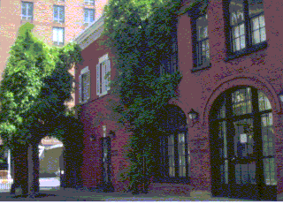
La Maison Française NYU is one of New York University's International Houses, located on its Washington Square campus. Since 1957, La Maison Française has served as a forum for French-American cultural and intellectual exchange, offering contemporary perspectives on French and Francophone issues. Its lectures, symposia, concerts, screenings, exhibitions, and special events provides a resource to the university community, as well as the general public.

Úhřetická Lhota is a village in the Pardubice Region of the Czech Republic. It has around 220 inhabitants.

The Mülheim Bridge in Cologne is a suspension bridge on the river Rhine in western Germany. It has a main span of 315 metres. The bridge was originally completed in 1929. On October 14-15, 1944, an American bomb struck the chamber containing the demolition charges, destroying the bridge. The bridge was rebuilt between 1949 and 1951. It connects the city district Riehl on the west side of the river with Mülheim on the east side, after which the bridge is named.

Rzywno is a village in the administrative district of Gmina Łabiszyn, within Żnin County, Kuyavian-Pomeranian Voivodeship, in north-central Poland. It lies approximately 5 kilometres (3 mi) north of Łabiszyn, 23 km (14 mi) north-east of Żnin, and 15 km (9 mi) south of Bydgoszcz.

Olszanka is a village in the administrative district of Gmina Turobin, within Biłgoraj County, Lublin Voivodeship, in eastern Poland. It lies approximately 3 kilometres (2 mi) west of Turobin, 31 km (19 mi) north of Biłgoraj, and 49 km (30 mi) south of the regional capital Lublin.
Rakołupy Małe is a village in the administrative district of Gmina Leśniowice, within Chełm County, Lublin Voivodeship, in eastern Poland.
Majdan is a village in the administrative district of Gmina Michałowo, within Białystok County, Podlaskie Voivodeship, in north-eastern Poland, close to the border with Belarus.
Nowogród is a village in the administrative district of Gmina Zbójna, within Łomża County, Podlaskie Voivodeship, in north-eastern Poland.

Kraszew is a village in the administrative district of Gmina Andrespol, within Łódź East County, Łódź Voivodeship, in central Poland. It lies approximately 2 kilometres (1 mi) south-east of Andrespol and 15 km (9 mi) south-east of the regional capital Łódź.

Dağ Maşanlı is a village in the Jabrayil Rayon of Azerbaijan.

Czarny Las is a village in the administrative district of Gmina Szadek, within Zduńska Wola County, Łódź Voivodeship, in central Poland. It lies approximately 7 kilometres (4 mi) west of Szadek, 14 km (9 mi) north of Zduńska Wola, and 40 km (25 mi) west of the regional capital Łódź.

Szarów is a village in the administrative district of Gmina Kłaj, within Wieliczka County, Lesser Poland Voivodeship, in southern Poland. It lies approximately 15 kilometres (9 mi) east of Wieliczka and 25 km (16 mi) east of the regional capital Kraków.

Szczeglin is a village in the administrative district of Gmina Stopnica, within Busko County, Świętokrzyskie Voivodeship, in south-central Poland. It lies approximately 5 kilometres (3 mi) south-east of Stopnica, 21 km (13 mi) east of Busko-Zdrój, and 59 km (37 mi) south-east of the regional capital Kielce.

Mikówiec is a village in the administrative district of Gmina Góra Kalwaria, within Piaseczno County, Masovian Voivodeship, in east-central Poland. It lies approximately 4 kilometres (2 mi) north-west of Góra Kalwaria, 14 km (9 mi) south-east of Piaseczno, and 28 km (17 mi) south-east of Warsaw.
Radziejowice-Parcel is a village in the administrative district of Gmina Radziejowice, within Żyrardów County, Masovian Voivodeship, in east-central Poland.
Dziubielewo is a settlement in the administrative district of Gmina Przytoczna, within Międzyrzecz County, Lubusz Voivodeship, in western Poland.
Łosiniec is a village in the administrative district of Gmina Lipiany, within Pyrzyce County, West Pomeranian Voivodeship, in north-western Poland.

Nghiên Loan is a rural commune (xã) of Pác Nặm District, Bắc Kạn Province, in Vietnam.

Tulliby Lake is a hamlet in central Alberta, Canada within the County of Vermilion River. It is located approximately 23 kilometres (14 mi) north of Highway 45 and 50 kilometres (31 mi) northwest of Lloydminster.
Linnamäe is a village in Lääne-Nigula Parish, Lääne County, in western Estonia.


