Skrzypnik is a village in the administrative district of Gmina Domaniów, within Oława County, Lower Silesian Voivodeship, in south-western Poland. Prior to 1945 it was in Germany.

Popowice is a village in the administrative district of Gmina Jordanów Śląski, within Wrocław County, Lower Silesian Voivodeship, in south-western Poland. Prior to 1945 it was in Germany. Erich Fellgiebel was born in the village. It lies approximately 3 kilometres (2 mi) north-east of Jordanów Śląski and 30 km (19 mi) south of the regional capital Wrocław.
Kasjany is a village in the administrative district of Gmina Narewka, within Hajnówka County, Podlaskie Voivodeship, in north-eastern Poland, close to the border with Belarus.

Osowe is a village in the administrative district of Gmina Narewka, within Hajnówka County, Podlaskie Voivodeship, in north-eastern Poland, close to the border with Belarus. It lies approximately 7 kilometres (4 mi) north-east of Narewka, 24 km (15 mi) north-east of Hajnówka, and 50 km (31 mi) south-east of the regional capital Białystok.

Porosłe is a village in the administrative district of Gmina Narewka, within Hajnówka County, Podlaskie Voivodeship, in north-eastern Poland, close to the border with Belarus. It lies approximately 7 kilometres (4 mi) north-east of Narewka, 24 km (15 mi) north-east of Hajnówka, and 50 km (31 mi) south-east of the regional capital Białystok.
Stare Bogusze is a village in the administrative district of Gmina Grodzisk, within Siemiatycze County, Podlaskie Voivodeship, in north-eastern Poland.

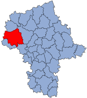
Jeziora is a village in the administrative district of Gmina Pniewy, within Grójec County, Masovian Voivodeship, in east-central Poland. It lies approximately 8 kilometres (5 mi) west of Grójec and 40 km (25 mi) south-west of Warsaw.
Zaręby is a village in the administrative district of Gmina Karniewo, within Maków County, Masovian Voivodeship, in east-central Poland.

Przedewsie is a village in the administrative district of Gmina Jakubów, within Mińsk County, Masovian Voivodeship, in east-central Poland. It lies approximately 8 km (5 mi) north-east of Mińsk Mazowiecki and 46 km (29 mi) east of Warsaw.
Henrykowo is a village in the administrative district of Gmina Nowe Miasto, within Płońsk County, Masovian Voivodeship, in east-central Poland.

Ćwiklinek is a village in the administrative district of Gmina Płońsk, within Płońsk County, Masovian Voivodeship, in east-central Poland. It lies approximately 5 kilometres (3 mi) north of Płońsk and 67 km (42 mi) north-west of Warsaw.
Gładczyn Rządowy is a village in the administrative district of Gmina Zatory, within Pułtusk County, Masovian Voivodeship, in east-central Poland.

Gościejewo Leśne is a settlement in the administrative district of Gmina Ryczywół, within Oborniki County, Greater Poland Voivodeship, in west-central Poland. It lies approximately 4 kilometres (2 mi) east of Ryczywół, 20 km (12 mi) north of Oborniki, and 47 km (29 mi) north of the regional capital Poznań.

Chiny is a village in the administrative district of Gmina Chojnice, within Chojnice County, Pomeranian Voivodeship, in northern Poland. It lies approximately 22 kilometres (14 mi) north of Chojnice and 94 km (58 mi) south-west of the regional capital Gdańsk.

Szczukowo is a settlement in the administrative district of Gmina Stężyca, within Kartuzy County, Pomeranian Voivodeship, in northern Poland. It lies approximately 4 kilometres (2 mi) west of Stężyca, 26 km (16 mi) south-west of Kartuzy, and 52 km (32 mi) west of the regional capital Gdańsk.

Słajkowo is a village in the administrative district of Gmina Choczewo, within Wejherowo County, Pomeranian Voivodeship, in northern Poland. It lies approximately 3 kilometres (2 mi) south of Choczewo, 27 km (17 mi) north-west of Wejherowo, and 63 km (39 mi) north-west of the regional capital Gdańsk.
Kolonia Myśliborzyce is a village in the administrative district of Gmina Myślibórz, within Myślibórz County, West Pomeranian Voivodeship, in north-western Poland.
Niedźwiady is a settlement in the administrative district of Gmina Szczecinek, within Szczecinek County, West Pomeranian Voivodeship, in north-western Poland.
Litu is a village in Ridala Parish, Lääne County, in western Estonia.

Odžak is a village in the municipality of Višegrad, Bosnia and Herzegovina.


