Related Research Articles

Palo Cedro is a census-designated place (CDP) in Shasta County, California, United States. It is 8 miles (13 km) east of Redding. Its population is 2,931 as of the 2020 census, up from 1,269 from the 2010 census.

The Wintu are Native Americans who live in what is now Northern California. They are part of a loose association of peoples known collectively as the Wintun. There are three major groups that make up the Wintu speaking people: the Wintu, Nomlaki, and Patwin. The Wintu language is part of the Penutian language family.

Shasta Dam is a concrete arch-gravity dam across the Sacramento River in Northern California in the United States. At 602 feet (183 m) high, it is the eighth-tallest dam in the United States. Located at the north end of the Sacramento Valley, Shasta Dam creates Shasta Lake for long-term water storage, flood control, hydroelectricity and protection against the intrusion of saline water. The largest reservoir in the state, Shasta Lake can hold about 4,500,000 acre-feet (5,600 GL).

The Pit River is a major river draining from northeastern California into the state's Central Valley. The Pit, the Klamath and the Columbia are the only three rivers in the U.S. that cross the Cascade Range.

The McCloud River is a 77.1-mile (124.1 km) long river that flows east of and parallel to the upper Sacramento River, in Siskiyou County and Shasta County in northern California in the United States. Protected under California's Wild and Scenic Rivers Act (1972), it drains a scenic mountainous area of the Cascade Range, including part of Mount Shasta. It is a tributary of the Pit River, which in turn flows into the Sacramento River. The three rivers join in Shasta Lake, formed by Shasta Dam north of Redding.

The Trinity River is a major river in northwestern California in the United States and is the principal tributary of the Klamath River. The Trinity flows for 165 miles (266 km) through the Klamath Mountains and Coast Ranges, with a watershed area of nearly 3,000 square miles (7,800 km2) in Trinity and Humboldt Counties. Designated a National Wild and Scenic River, along most of its course the Trinity flows swiftly through tight canyons and mountain meadows.

The Winnemem Wintu are a Native American band of the Wintu tribe originally located along the lower McCloud River, above Shasta Dam near Redding, California.

Upper Soda Springs is on the banks of the Sacramento River in Dunsmuir, California, USA. It consists of approximately 15 acres of level ground on both sides of the River, the surrounding hillsides, and continues north along the eastern bank of the Sacramento River to the Dunsmuir City Park. The State of California and the City of Dunsmuir oversee a public park on this historic site. The Upper Soda Springs site contains a riparian ecosystem and includes its namesake mineral water springs. In large part because of its location on the Siskiyou Trail, the site mirrors the history of the state and of the American West.
The Okwanuchu were one of a number of small Shastan-speaking tribes of Native Americans in Northern California, who were closely related to the adjacent larger Shasta tribe.

In 1942, the Coleman National Fish Hatchery was established under an act of the U.S. Congress to mitigate the loss of historic spawning habitat caused by the construction of dams. The fish hatchery is located in Shasta County, California, near the town of Anderson on the north bank of Battle Creek approximately 6 river miles (9.7 km) east of the Sacramento River. Coleman NFH covers approximately 75 acres (300,000 m2) of land owned by the U.S. Fish and Wildlife Service (USFWS), with an additional 63 acres (250,000 m2) of land in perpetual easements for pipelines and access. It is the largest salmon hatchery in the continental United States.
The Shastan peoples are a group of linguistically related Indigenous peoples from the Klamath Mountains. They traditionally inhabited portions of several regional waterways, including the Klamath, Salmon, Sacramento and McCloud rivers. Shastan lands presently form portions of the Siskiyou, Klamath and Jackson counties. Scholars have generally divided the Shastan peoples into four languages, although arguments in favor of more or fewer existing have been made. Speakers of Shasta proper-Kahosadi, Konomihu, Okwanuchu, and Tlohomtah’hoi "New River" Shasta resided in settlements typically near a water source. Their villages often had only either one or two families. Larger villages had more families and additional buildings used by the community.

Clear Creek is a tributary of the upper Sacramento River in northern California.

The Redding Rancheria is a federally recognized tribe with a reservation in Shasta County, Northern California. The 31-acre site (13 ha) of the Redding Rancheria was purchased in 1922 by the Bureau of Indian Affairs in order to provide Indigenous peoples with a place to camp and live. They had been made landless by European-American settlers in the area. Three groups of Native Americans in the area organized as a tribe and were recognized in 1979.
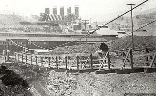
Kennett was an important copper mining town in northern California, United States until it was flooded by Shasta Lake while Shasta Dam was being constructed. Kennett is submerged under approximately 400 ft. of water. It was the largest, most important mining town in the area outside of Redding and Shasta.
Kabyai Creek or Kaibai Creek is a tributary of the McCloud River in Shasta County, California. It flows into the river opposite the McCloud Bridge Campground in the Shasta–Trinity National Forest.

Cottonwood Creek is a major stream and tributary of the Sacramento River in Northern California. About 68 miles (109 km) long measured to its uppermost tributaries, the creek drains a large rural area bounded by the crest of the Coast Ranges, traversing the northwestern Sacramento Valley before emptying into the Sacramento River near the town of Cottonwood. It defines the boundary of Shasta and Tehama counties for its entire length. Because Cottonwood Creek is the largest undammed tributary of the Sacramento River, it is known for its Chinook salmon and steelhead runs.
The Sacramento River massacre refers to the killing of many Wintu people on the banks of the Sacramento River on 5 April 1846 by an expedition band led by Captain John C. Frémont of Virginia. Estimates range from 125 to 900.
The Sutter Buttes massacre refers to the murder of a group of Californian Indians on the Sacramento River near Sutter Buttes in June 1846 by a militarized expeditionary band led by Captain John C. Frémont of Virginia. At least 14 California Indians were killed in the massacre.
The Wintu Shasta salamander is a species of salamander in the family Plethodontidae. It is endemic to Shasta County in California.

Niria Alicia Garcia is a Xicana environmental activist, human rights advocate, and educator. She is an organizer involved with indigenous-led species restoration efforts in California's Sacramento River watershed.
References
- ↑ Kabyai Creek, USGS Map Name: Bollibokka Mountain, CA, from topoquest.com accessed June 6, 2013
- ↑ Brian Melley, Tribe dances to protest Shasta Dam expansion, Wednesday, Seattle Times, September 15, 2004, from seattletimes.com accessed June 6, 2013
- ↑ Peter Fimrite, Winnemem Wintu tribe stages war dance as protest, San Francisco Chronicle, Saturday, May 26, 2012, from sfgate.com accessed June 7, 2013
40°56′2″N122°15′0″W / 40.93389°N 122.25000°W
| | This article relating to the Indigenous peoples of North America is a stub. You can help Wikipedia by expanding it. |
| | This United States military history article is a stub. You can help Wikipedia by expanding it. |
| | This California-related article is a stub. You can help Wikipedia by expanding it. |
| | This American Old West-related article is a stub. You can help Wikipedia by expanding it. |
| | This massacre-related article is a stub. You can help Wikipedia by expanding it. |